Blog

The Murals of Sorrow in Ping Yeung

The Murals of Sorrow in Ping Yeung

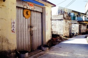
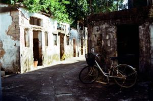
I have previously visited the Murals of Love in Kam Tin.  There is another mural village in Hong Kong.  The Ping Yeung New Village in Ping Che, Fanling is another mural village.  Yet the reasons for these murals were markedly different from the ones in 

Kayaking at Hoi Ha

Kayaking at Hoi Ha

This was probably the first time that I have kayaked in Hong Kong.  We went to Hoi Ha in Sai Kung for an exciting day in kayaking. About Hoi Ha Wan Hoi Ha, in Chinese, means “beneath the sea.”  The beaches in this area, some 

Curvy Hill – MacLehose Trail Section 4 From Shui Long Wo to Ma On Shan Country Park

Curvy Hill – MacLehose Trail Section 4 From Shui Long Wo to Ma On Shan Country Park

There is no official English name to this hill known locally as “Curvy Hill.”  It has acquired its name from the meandering path that leads downward from the top of neighboring mountains.  I saw photographs online and became very drawn to the scenery there.  On this early autumn day I took up the journey in search of Curvy Hill with a friend.

The itinerary is quite simple.  At Shui Long Wo in Sai Kung, embark upon the MacLehose Trail Section 4 toward the Shui Long Wo Campsite.  Be vigilant throughout the trail and watch the signs pointing to MacLehose Trail Section 4.  We did miss one and had to turn back to find the right way.  The signs are all clear, however, just make sure you do not get so deep in your conversations that you miss the signs.

The first part of the trail was a gentle but continuously upward incline on paved slopes.  We passed by a beautiful bamboo grove on the way:

Otherwise, the scenery on the first part of the trail is of standard mountain views.  I do warn readers that, once you find your way to the stony stairs, it is a continuous upward climb on both stairs and mountainous paths until you see the peak of Ma On Shan.  There are some nice views on the way.

Photos above: Views on the way, including the peak of Ma On Shan

From the beginning of the trail to the point of beautiful aerial views at Curvy Hill, it took 2-2.5 hours of a continuous climb.  Be prepared, the rigor does demand physical fitness.

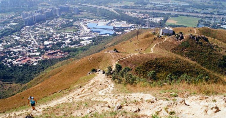
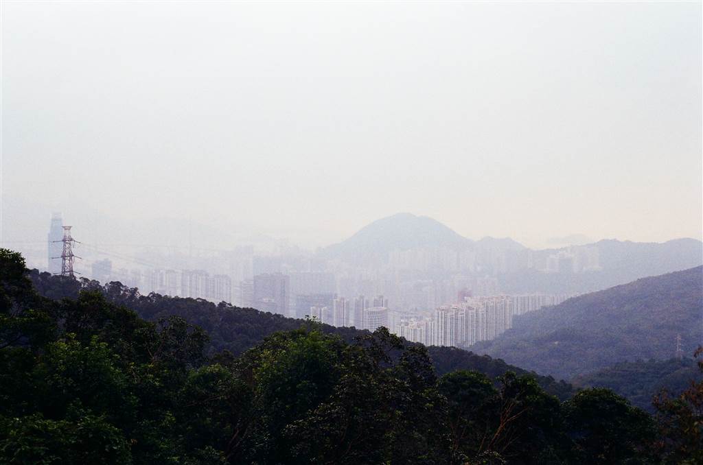
The hard work was well-rewarded.  When we approached the meandering path on Curvy Hill, we could see the wide-open sceneries of Tai Po and Sai Kung.  I swear we could have touched the sky there.

From then on, follow the path to descend the mountain.  You will then come to this sign.

We headed toward the Hang On Estate direction.  This section of our hike is on Ma On Shan Country Trail, until we reach Ma On Shan Village.  From the village back to civilization, it took another half hour to 40 minutes, with no views whatsoever.  Therefore my suggestion is to haul a taxi back to Ma On Shan proper, if you do see one.

Reminders

We went on an early autumn day and the heat has already dropped a few degrees from the summer prime.  The early sections of the trail, where there are lots of upward climb, were full of shades.  The climb was rigorous, however, and so I kept drinking my water to rehydrate.  The section of Curvy Hill has no shades, but that is already at the point of descent.  I do think that 2 litres of water is necessary for this hike at the current weather.

Also, the trail is quite demanding, and it will be wise to bring snacks and a hiking pole with you.

How to Get There

Bus 299X goes from Shatin or Sai Kung to Shui Long Wo.  From Shatin, get off at the Shui Long Wo stop and keep going toward the Sai Kung direction.  You will arrive at the entrance to MacLehose Trail Section 4 in 5-8 minutes.  From Sai Kung, get off at the Shui Long Wo Stop and walk backwards to reach the entrance.

The Mini Great Wall of Cheung Chau

The Mini Great Wall of Cheung Chau

The Mini Great Wall Trail of Cheung Chau is an easy walk on the southeastern coast of Cheung Chau for under two hours.  It has acquired this name because of the trail’s stone-paved and stone-fenced features.  Another popular island trail is in Cheung Chau north, 

A Yacht Trip to To Tei Wan (Deity Beach) and Tai Tam Bay

A Yacht Trip to To Tei Wan (Deity Beach) and Tai Tam Bay

It is at the tail of our summer and I joined a group of friends on the last yacht trip that they were organizing for the year.  The itinerary is Tai Tam Bay and Deity Beach in the southeastern waters of Hong Kong.  On this 

Canyoning at the Ping Nam Stream

Canyoning at the Ping Nam Stream

I went canyoning with a group of friends at the Ping Nam Stream.  This trip came just in time to catch the last stretch of the summer heat.  We met at the Nam Chung parking lot at the foot of MacLehose Trail Section 10 for our professional guides to begin this exceedingly adventurous day.
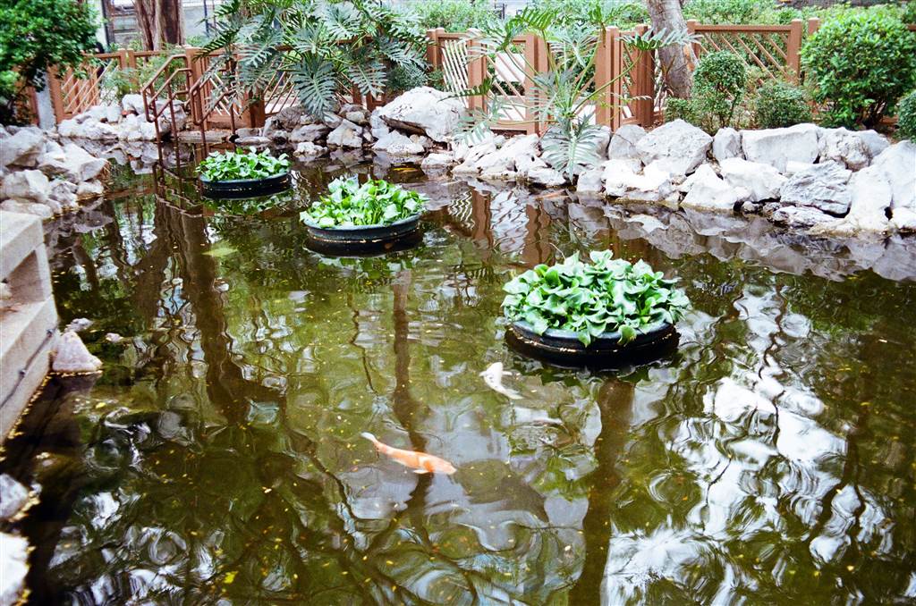
The Ping Nam Stream originates in Ping Fung Shan and flows through the Nam Chung area to exit at Nam Chung River.  Located in the Nam Chung area in Fanling, the stream is part of the scenery at Pat Sin Leng’s northern ridges, and it lies within the Pat Sin Leng Country Park.  There are nine major streams in Hong Kong and Ping Nam Stream is one of them.

Like the Ping Ka Stream in the vicinity, the Ping Nam Stream shows the similar feature of the potholes.  Although there were no potholes as significant as the one at Shek Pan Tam, I saw quite a few small ones as I rested in the stream.

The Gear and the Preparation

It was my first time hearing the term canyoning, and even when I arrived at the waiting spot, I kept thinking we were doing canoeing.  But canyoning is a notably different activity, as it requires a whole lot more physical strength and willpower, especially for abseiling.  As a result, I was under-prepared for this day.  I was so glad that I survived the activities without injury.

Before meeting with the group, I had a proper breakfast.  This is the type of breakfast that would typically last me a whole day with regular hiking.  I could survive on this amount of food for six hours of hiking.  But abseiling, and other adventurous activities on this trip, required a lot of physical strength.  A full stomach for regular hiking would not do.  I brought a small bun with me for lunch and it turned out to be not enough food for the day.  Therefore my advice is a full breakfast plus a proper sandwich.

When we gathered for instructions, we took the harness and fixed it on our laps.  There were quite a few large carabiners on the belt, and we would learn how we fix our rope when we abseil. We would keep the harness on throughout the trip.  Then came our safety helmets and the stream-trekking shoes.  Finally, we reorganized our belongings, and stuffed them into dry bags.  The normal hiking bags that are “waterproof” will not protect your belongings, for we would be soaking in the stream throughout this trip.  Even with the watersport dry bags, my belongings were all wet in my hiking bag by the end of the day.

The tour operator has advised us that we should wear long pants.  I did not fully understand the activity, and thinking that it was such a hot day, I wore beach shorts.  My beach shorts were of a sturdy material.  But indeed, the uncovered parts of my legs suffered from some scrapes as we hiked upstream.  There were a lot of rough surfaced rocks on the way and we had to use our knees as anchors throughout the hike.  Therefore, listen to your guides and wear long pants.

The Trail

We probably spent a couple hours hiking up stream.  We passed by all the pools, of which we would eventually descend by abseiling, diving and sliding.  The scenery was beautiful under the sun rays of the late morning.  The trail was difficult, however.  We trekked both the rocks and the streams.  Some of these rocks required strong upper body strength as we had to pull ourselves up with the aid of tree branches.  The whole group made it and no one fell on the way.

On our way, we also did a bit of diving in a couple pools.  The water was flowing, but our guides said that it was not considered strong currents.  Although it felt clean, it was not really pristine and in fact a little muddy.  We were glad that we could be in the water though, as the sun was approaching its noon prime.

These were the beautiful waterfalls that we saw on our way.

We were at upstream finally and sat by the pool to rest.  Then our guide did a trial with abseiling.  She showed us how to fix our rope properly.  For right-handers, you would be holding onto the rope with your right hand.  The key is to never let go of your right hand.  Your left hand will provide balance.  If you slip on the rocks as you descend, you can use your left hand to push the body back to position.   The abseil is done facing the cliff.  When your right hand releases the grip slowly, you would descend as your body weighs down.  Keep your legs in a half-squatting position (in the air, yes).  The waist remain straight throughout as well.

We conducted this trial abseil on relatively dry rocks.  At the real abseiling sessions, we would be coming down on rocks that are consistently washed by the stream.  We did abseil down a few waterfalls, in fact.

It was lunch hour and so we sat around with our buns and sandwiches.  The abseiling would begin.

Abseiling, Sliding and Diving

We would not be trekking the rocks downstream.  Instead, we abseiled, slid and dived down quite a number of waterfalls and pools.  As shown above, the abseiling was a true test of both physical and mental strength.

The standard itinerary would require three sessions of abseiling on waterfalls and cliffs. At some point in this tour, we heard our guide exclaiming, “I love this Ping Nam Stream.”  We asked her why, and she said because it is the easiest stream.  I could see that, as the three abseiling sessions increased in difficulty.  As such it was probably suitable for beginners.  We had some practice before the last difficult one.

Abseiling is dangerous.  The first session was doable for me, because the stream was not washing so rapidly.  The difficulty is, when your body is hung on a rope and your right hand is the key to your survival, your attention is very much drawn only to your right hand.  But abseiling is more than the right hand.  Your feet are supposed to be on the cliff as you descend, it is not about being roped down in air.

With the rapids washing your whole body (and the beautiful sound of water splashing all around you), there is almost no mind power left to watch your feet.  So I kind of felt my way with my feet, without knowing what the next step might be.  Needless to say, you can easily lose balance on a single rope and slippery cliff surfaces.  When I did, it took first the left hand to prevent my body from banging on the cliff and sustaining bruises.  Then I told myself to seriously calm down before the next move, at the same time reminding my right hand that it must not let go.  Then I exercised strength in the waist and the knees to get my feet back on the cliff, and facing the cliff in a half-squat to continue the descent properly.

And this is what I meant by serious willpower.  The act itself is intuitive, it is what it looks like.  While I was at it, however, all the motor skills that I have developed and exercised so automatically over the years required determination.  Move this first, hold on there, step on this—yes, I had to make conscious decisions, remaining absolutely calm (deep breathing helps) throughout the process.

Perhaps after two intense session in abseiling, I came across a problem.  The next descent is to slide down a 4-meter, smooth-surfaced cliff.  There was no choice in this.  The guides must watch over the safety of the whole group and I could not say “can I trek down the rocky path instead.”  Once you are there, you must do what the whole group does.  And I felt quite frightened here.  But I did it, it was not so bad, and maybe it was fun.

Then came an even more difficult task.  The next descent was to jump off a 5-6 meter cliff.  It turned out to present a serious problem for me, by then a very scared soul.  When I dived, I felt my heart popping out before I just entered the water.  As a result, when I went into the water, I could not coordinate my breathing.  Also, the shoes that I was wearing did not help with the swimming.  It was nothing like swimming in a swimming pool, and no matter how much I used my legs I was not heading forward in the water.  I could not get myself to swim back to the edge of this pool, and I could not coordinate breathing.

I had to call for help, and my friend came to my rescue.  Again, there was no choice in this dive.  And I rested for a long time at the pool before the next task.

At round 2-3pm in the afternoon, the third abseiling session became perhaps a little too strenuous for me.  When I descended, I felt this pang of hunger and light-headedness.  Also, by that time the heat has really tapered and the water was becoming quite chilly.  Yet I must not lose my willpower.  I was hoping that it would be the last abseiling I had to do.

The final descent of water came with two options.  I either slide down eight meters, or abseil down the same 8-meter cliff.  I decided that, despite the near-exhaustion from the day, I would abseil down.  An 8-metre slide down the cliff is simply too frightening.

Some Concluding Thoughts

The most enjoyable part of this day was the natural spa in the streams.  Although the guides said this could not be considered an abundance of water, it did flow rapidly.  When we were waiting for the others to abseil, we could sit at the flowing streams and enjoy a natural spa.  I am pretty sure that has eased some of my fatigue.

When I showed the pictures to family and friends, they came back with mixed reactions.  The young ones tend to say, “how fun!”  While the older generation said, “how dangerous.”  Perhaps they are both right in that the fun comes from the risks, and that combination is known as adventure.  I think I am at an age where I prefer not doing this type of activity.  Upon reflection, it was a lot of fun, but if I were to get hurt, I did not think the thrill would have justified the injury.  This is a kind of thing that doing once in life just for the experience is perhaps enough.

Dangers

Due to a number of fatal accidents, including hikers slipping or getting washed away by unexpected currents, the Ping Nam Stream has also acquired the name “God of Death.”  Having spent one adventurous day there, I can say that this is a kind of activity that requires professional guidance.  Even with all our safety gears and two professional guides I thought it was very dangerous.  Certainly, do not go alone; and certainly, get a group together with professional guides.  And even then, you must pay full attention when you do abseiling.  Your life is literally in your right hand.

Finally, one member in our group lost his wedding band after diving one of the cliffs.  Both jewelry and contact lens should be avoided in this activity.  Believe it or not, our guide dived 6 times into the pool and found his wedding band.  What a lucky man.

The Shui Yuet Palace (Kwun Yam Temple) of Mong Kok

The Shui Yuet Palace (Kwun Yam Temple) of Mong Kok

I paid a visit to the Shui Yuet Palace of Mong Kok.  Seated besdies the Tung Wah College Mong Kok Campus, the Shui Yuet Palace has a distinctive appearance with its red colored walls and green roof tiles.  You cannot miss it when you pass 

The Island of Ma Shi Chau

The Island of Ma Shi Chau

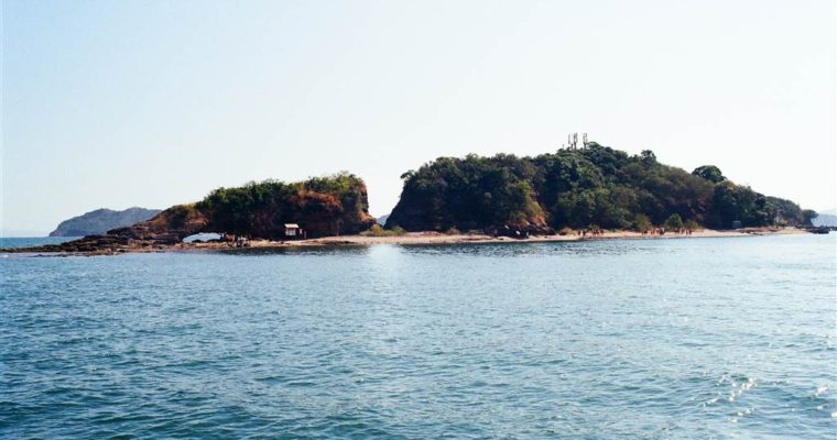
A Brief Introduction of Ma Shi Chau Ma Shi Chau is the largest island in Tolo Habour.  Together with Centre Island, Yeung Chau and an unnamed island off of the Sam Mun Tsai New Village, Ma Shi Chau was designated a Special Area pursuant to 

The Sam Mun Tsai New Village

The Sam Mun Tsai New Village

I have lived in Tai Po before.  The one thing that I had heard about Sam Mun Tsai was its fame for seafood.  The only other time that I visited the area was related to food as well.  I ate at a Chinese restaurant there for really good and pricy dim sum.

When I learned about Ma Shi Chau, I decided that I must visit Sam Mun Tsai for the proper reason.  That is, to see its roots as a fishing village amidst beautiful ocean surroundings.  For the only way to reach Ma Shi Chau on foot is by hiking through the Sam Mun Tsai New Village and up the hilly area following in Yim Tin Tsai of Tai Po.

The Sam Mun Tsai New Village

The minibus (details below) dropped me off right at the entrance to Sam Mun Tsai New Village.  I then walked through the village in order to find my way to the hilly area.  To my surprise, the village has put in quite a bit of effort to tell its story.

Photo: a beautiful introduction of Sam Mun Tsai New Village’s history on its village walkway.

According to displays on site, the earliest settlement by fishermen in the old Sam Mun Tsai area dated as early as 1898.  This was before the British took over the New Territories.  Now the Plover Cove Reservoir and Tolo Harbour, the old Sam Mun Tsai area was a good shelter for fishing boats because of its surrounding hills and islands.

The name “sam mun” means “the three gates.”  The village acquired this name from the geography of the old Sam Mun Tsai area.  There were three water channels situated between the Sam Mun Tong Chau and Tong Tau Chau islands, which lied parallel to each other in Tolo Harbour before the Plover Cove Reservoir was built.  Thus the name Sam Mun Tsai.

Some of these fishermen did eventually settle down on land, and the Hong Kong Government offered to move them to the current location in Tai Po’s Yim Tin Tsai in order to make way for the construction of the Plover Cove Reservoir in the 1960s.  This became the Sam Mun Tsai New Village.  At the time of relocation, the Hong Kong Government moved the whole old Sam Mun Tsai Village to Yim Tin Tsai.  It built two-storey buildings to house some 40 family homes.

Later on, the fishermen of Tap Mun and Ko Lau Wan joined this new fishermen’s community in Sam Mun Tsai New Village.  They have been here to this day.  Besides the fishermen’s home, the government later also provided a school and a harbour shelter for the fishermen’s families.  The community lived in this setting for 40 years.  Then there were calls to renovate the structures of the village, replacing the old floors and the roofs, and with water-proof materials as well as new paint on the walls and staircases.  This renovation project completed in 2007.  Then Chief Executive Donald Tsang officiated the opening ceremony of the revamped Sam Mun Tsai New Village when it reopened.

As shown in the pictures below, there is that sense of the idyllic in this fishing village even today.  The villagers surely take pride in their heritage, calling this village a “heaven of tranquility.”  Fishing now has certainly moved on to meet the change of times.  There are still fish-catching in the traditional way, but villagers also do fish farming in rafts with the latest technology.

The Visit at Sam Mun Tsai New Village

Plentiful sunshine blessed this summer day and I was very excited when I saw the scenes of a fishing village.  Boats docked over jade-blue waters.  There were different types of sun-dried food on the way.  This was a very refreshing scene for me, even as compared with the many New Territories villages that I visited before.

Photos above and below: scenes at the Sam Mun Tsai New Village

About ten minutes into the walk in the village, I came across the signs pointing to the hilly area that would lead me to Ma Shi Chau, but I was in search of the Tai Po GeoHeritage Center, as I would like to learn more about the geological formations on the island before I went.

The Tai Po GeoHeritage Center

The Tai Po GeoHeritage Center would have provided an air-conditioned space for introduction of the geological features of Ma Shi Chau in greater detail.  But they have remained closed since the pandemic began.  The address is 120 Sam Mun Tsai, Tai Po.  It is the first community-initiated geo-educational center in Hong Kong.

According to the group’s introduction on Facebook, it still accepts bookings for guided group tours.  Please refer to their Facebook page for more.  I think that this would be a good idea for families with children.  I also think that for those who are serious about the geology of the island, it is worthwhile to take a guided tour.  On my own exploring, I ran into wild dogs that chased me and it was a very frightening experience.  See the next entry on Ma Shi Chau.

Photo: the Tai Po GeoHeritage Center, closed due to the pandemic.

Photo: sign of a vibrant community

How to Get there

From the minibus terminal at the Tai Po Market Station, take green top minibus 20K to the final stop.  Bus 74K also has a final stop in Sam Mun Tsai, but it would take longer than the minibus.

Sources

Historical descriptions on-site at Sam Mun Tsai New Village.

The Wikipedia on Ma Shi Chau.

Ma Shi Chau, the Hong Kong Geo Park.

The Tai Po GeoHeritage Center’s Facebook Page.

A Californian Good Time at the Lower Cheung Sha Beach

A Californian Good Time at the Lower Cheung Sha Beach

The Cheung Sha Beach is the longest beach in Hong Kong.  At three km in length, the beach provides ample space for visitors to do all sorts of fun activities, including surfing, camping, canoeing and simply beach bathing. The Cheung Sha Beach is located in