The Island of Ma Shi Chau
A Brief Introduction of Ma Shi Chau
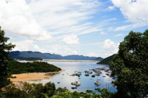
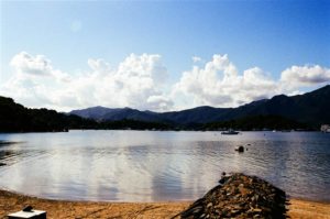
Ma Shi Chau is the largest island in Tolo Habour. Together with Centre Island, Yeung Chau and an unnamed island off of the Sam Mun Tsai New Village, Ma Shi Chau was designated a Special Area pursuant to the Country Parks Ordinance (Cap. 208) in 1999. As such, it came under the management of the Director of Agriculture and Fisheries, like other country parks in Hong Kong. Its location in Tolo Harbour enables hikers the views of Ma On Shan at its east, the Plover Cove Dam at its north and Pat Sin Leng at its west.
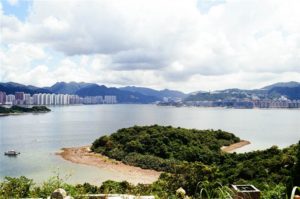
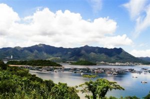
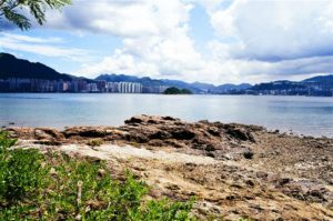
Photo: looking eastward, the housing estates of Ma On Shan and along the Tolo Harbour; looking westward, the boats of Tai Mei Tuk and the ridge of Pat Sin Leng
Ma Shi Chau’s Chinese name is somewhat unseemly as it means “horse dung island.” But the island certainly offers much more valuable insights into Hong Kong’s geology than its name suggests.
According to the website of GeoPark Hong Kong and the introduction on-site, there are 8-9 points of interest along the Ma Shi Chau Nature Trail. Namely, they are: the tombolo, siltstone, shell beach, colorful mudstone, quartz vein, differential erosion, sandstone, fault, and fold. I was overjoyed. Because besides the tombolo, I don’t think I found any of these features along the trail (and please do read the section below on Unexpected Dangers).
Geological Formations at Ma Shi Chau
The geology of Ma Shi Chau consists of the oldest sedimentary rocks in Hong Kong. There are three distinct phases of importance. The oldest rocks in Hong Kong are in the Bluff Head Formation. “It extends northeastwards from Ma Shi Chau and forms the hills to the north of the Tolo Channel.” (Owen & Shaw at 39). Evidence of the Bluff Head Formation lies on the northern coast of Ma Shi Chau. From the rare fossils found in this area, the age of this part of land is the Devonian age, that is 410-360 million years old.
The next stage of land formation was the Permian age, a time when the island “was in the turbulent delta neritic environment with un-ending transformation of land and sea 290 to 250 million years ago.” (Chan Wai-chung at 8) The characteristic rock formation of this period “are tightly folded, broken by faults, and display a range of interesting weathering patterns that reflect the varied structures within the rocks.” (Owen & Shaw at 40). This is the Tolo Harbour Formation, which is “confined to the area around Tolo Habour, occurring on Ma Shi Chau, Center Island, possibly to the northeast of the Chinese University, and on the southwest side of Three Fathoms Cove.” (Id.)
The western coast south of the island shows evidence of rock formation of the Jurassic Period. It comes many ages after the Permian age (Chan Wai-chung at 8-9). The rock formation of this period was named the Tolo Channel Formation. Rock formations show “pinkish brown, micaceous, laminated siltstones that are inclined steeply towards the west.” Again, discovery of fossils of the Jurassic Age, such as the one ammonite fossil discovered, confirms the date of these rocks. The animals were marine animals, meaning that the land forming had oceanic origins.
Yim Tin Tsai, lying west of Ma Shi Chau, was once the earliest location of active volcanic activity in Hong Kong. Volcanic rocks of the Yim Tin Tsai Formation, the oldest of which is the basal sedimentary breccia about 5 metres thick, and covered with a volcanic ash, confirms the role of the volcanos during the Middle Jurassic period (Owen & Shaw at 42).
One very special feature about the geology of Ma Shi Chau is the abundance of fossils on the island. Some are observable on the rocks, well, supposedly. With untrained eyes I simply was not able to locate them during my visit. These creatures were mostly shellfish, the proper names are brachiopod and bivalves.
The Hike on the Hill of Tai Po’s Yim Tin Tsai
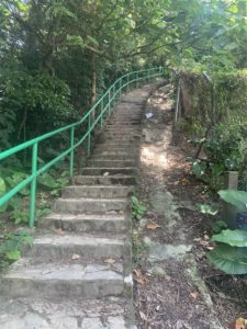
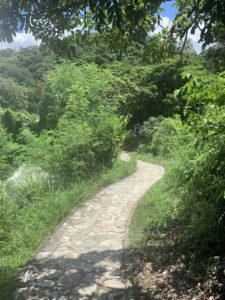
After returning from the now-closed Hong Kong GeoHeritage Center, I headed back to the signs pointing to the direction of Ma Shi Chau in the Sam Mun Tsai New Village. The hike was a gentle incline, with a bit of stairs, for about 15 minutes.
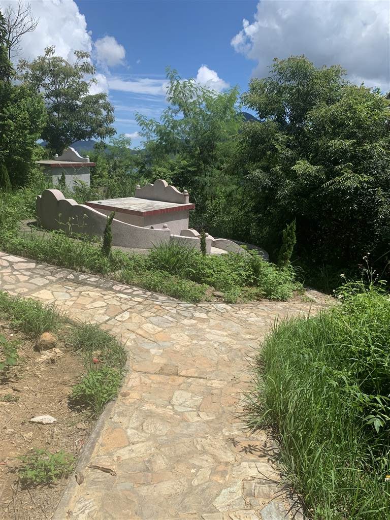
And what a pleasant surprise. This hill is actually the ancestral graveyard for the villagers. The numerosity of well-kept burials enabled many good photo opportunities on the way. As you know, the Chinese people believe in the feng-shui of their ancestors’ burials, and these graves are the typical propitious sites “backed by mountains and facing the water.”
I have a practice of saying, “excuse me, I am here only for a photo” at these ancestral graves. I did not want to disturb the spirits in their peace when I take my photographs. And I did stop at many of these spots to appreciate the aerial views of New Territories East.
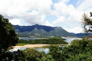

Photos: Aerial views up on the hill of Yim Tin Tsai. They show Ma On Shan on the East, Pat Sin Leng on the West, and the Plover Cove Reservoir Dam on its north
An Exploration of Ma Shi Chau
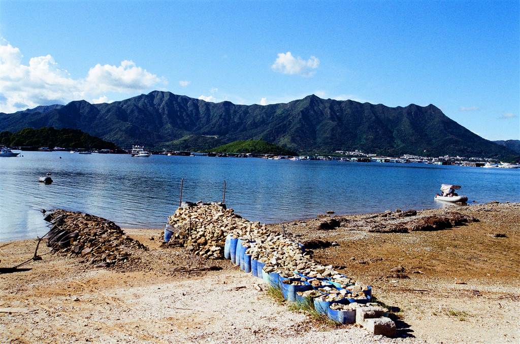
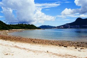
I marveled at the beautiful tombolo. As the connection between Ma Shi Chau and the neighboring Yim Tin Tsai, the tombolo is a sandy isthmus. This sandy sediments and stones formed a pathway in the shape of a crescent. Walking on both shores of the tombolo, one can view Pat Sin Leng on the west and Ma On Shan on the east. The tombolo formed by “the deposition of fine particles transported by sea wave motion between 2 lands. Ma Shi Chau is fairly close to the coast of Yim Tin Tsai, the sea wave was being slowed down there and therefore the shadow area of the wave formed between Ma Shi Chau and Yim Tin Tsai. The sea wave transports the sand drift to deposit in Ma Shi Chau for a long time forming the tombolo at last.” (Chan Wai-chung at 79.)
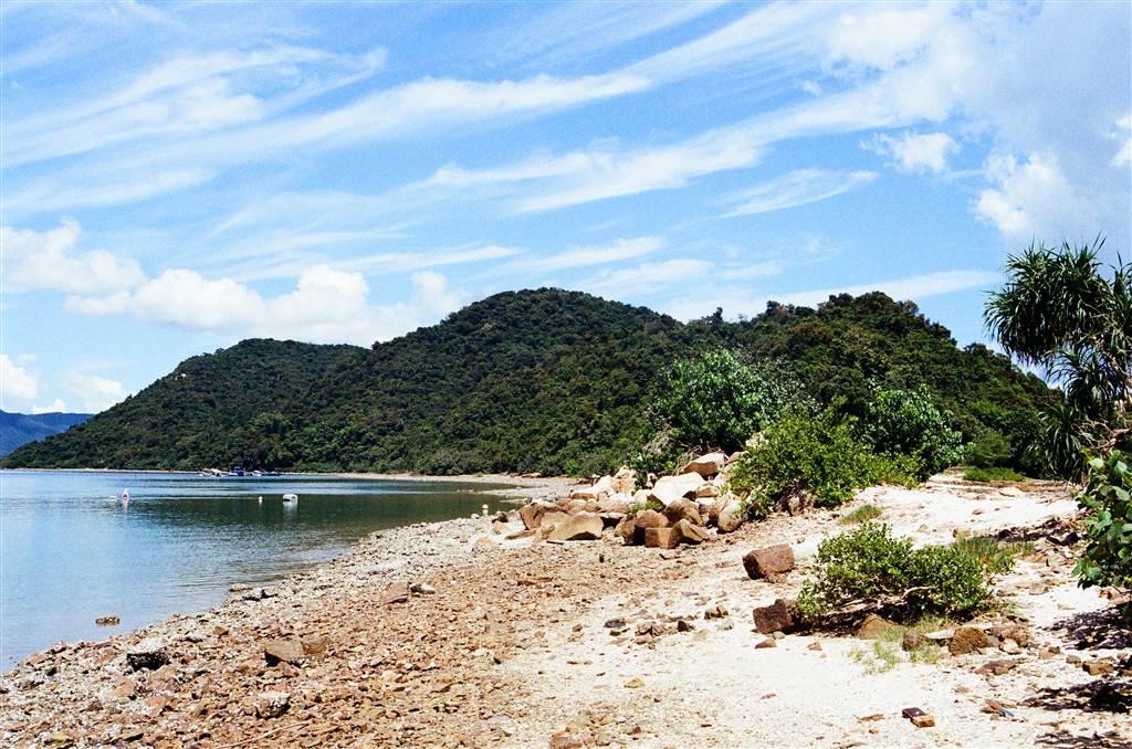
Photo above: The tombolo connecting Yim Tin Tsai and Ma Shi Chau
Photos below: Western view on the Tombolo
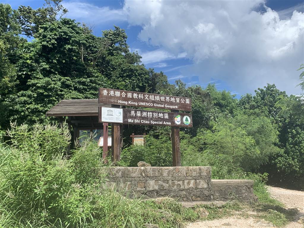
There is a clear sign welcoming visitors to Ma Shi Chau. From this point on, it is just a walk along the southeastern coast of the island on the Ma Shi Chau Nature Trail.
I researched on the government websites before visiting Ma Shi Chau, and I was very excited about the ancient rock formations on the Island. I therefore detoured from the standard inland hiking path and walked on the coast instead. My original goal was to walk all the way to the northern coast of Ma Shi Chau. This following was what happened when I almost reached the northern coast of Ma Shi Chau.
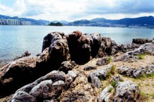
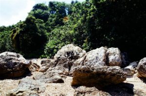
Photos: Maybe I did see something worthile. I believe the photo on the left shows the colored mudstones. The one in the middle is what people call “lung chut shui,” meaning a dragon goes into the water. It is a phenomenon of folds in rocks. On the right there should be signs of quartz vein.
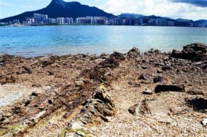
Photos below: a panoramic vew on the eastern coast of Ma Shi Chau.
Unexpected Dangers
Dogs, wild dogs and a lot of them!
Well, I ended up walking into a pack of wild dogs. Two of them chased me and actually went into an attack-ready mode.
I did see them from afar. I was careful not to intrude into their territory by trekking on the shallow water. They were mostly staying at the beach. But these two wild dogs chased me all the way from their near-inland position to the shore. I did not move when they came near and barked, but it did seem like they would attack me soon, so I quickly moved into the water at a knee-deep level. They did stop at the shore when I trekked in the knee-deep water. I therefore trekked the ocean at knee-deep level before I got back to safety.
I met a fellow hiker and told him what happened. He said the thing to do with dogs is to squat. They would interpret that as you getting in an attack position. But if I squat and they attack, then they would go directly at my face. So I was sure I would never squat in that circumstance. He also said that wherever I go hiking I should bring a hiking pole. That advice I will heed. I did have an umbrella on me that day, but I was simply too frightened to think of that.
After this dog-scare, I had not hiked for two, three weeks. And in the end, I did not even manage to find any of the special rock formation that the Hong Kong Government claimed there was. If I had stayed on the inland hiking trail, I would not have run into these dogs.
How to Get there
From the minibus terminal at the Tai Po Market Station, take green top minibus 20K to the final stop. Bus 74K also has a final stop in Sam Mun Tsai, but it would take longer than the minibus.
After getting off, go into the Sam Mun Tsai New Village, keep going until you see this following sign.

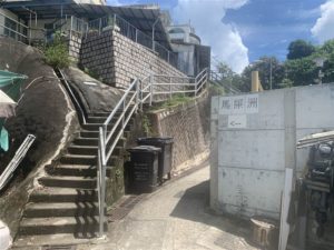
This indicates the way up the hilly area that you must climb for about half an hour before descending onto the tombolo. Be sure to go during low tide (usually the afternoon hours), because at high tide the tombolo would be under water.
At this crossroads, follow the path on the left. The path on the right just leads you to more ancestral graves.
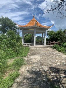
The walk from the Sam Mun Tsai bus stop to the island should take about 40 to 50 minutes. I spent 15 minutes hiking up the hill to come upon the pavilion (photo above).
The pavilion is roughly on the highest point of this hill. From then on the way descends to the waterfront areas for fifteen more minutes. Soon enough, I came upon the tombolo at low tide.
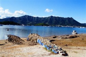
Allow for 1-2 hours to trek the southeastern coast of the Island, which is a proper trail, the Ma Shi Chau Nature Trail.
The western coast is not yet open for regular hiking yet. However, some hikers do scale the shores and there is danger involved.
Sources
Historical descriptions on-site at Sam Mun Tsai New Village
The Wikipedia on Ma Shi Chau at https://en.wikipedia.org/wiki/Ma_Shi_Chau.
Ma Shi Chau, Hong Kong Geo Park at https://www.geopark.gov.hk/en/en_s2p01g.htm.
Chan Wai-chung (ed.), Ma Shi Chau, Hong Kong GeoPark (2009).
Bernie Owen & Raynor Shaw, Hong Kong Geopark All in One (2011).
The Tai Po GeoHeritage Center’s Facebook Page at https://www.facebook.com/TaiPoGeoheritageCentre.