Blog

An Easy Stroll at the Checkerboard Hill

An Easy Stroll at the Checkerboard Hill

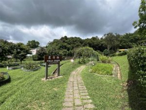
Checkerboard Hill is an easy stroll in Kowloon with wonderful city views.  Like the stairs at Mei Ho House in Sham Shui Po, the Checkerboard Hill presents the skyline of Kowloon without requiring a strenuous climb.  Perhaps it offers something more than the walk at 

Beautiful Sha Tau Kok – From the Lead Mine of Lin Ma Hang to Shan Tsui Tsuen Village

Beautiful Sha Tau Kok – From the Lead Mine of Lin Ma Hang to Shan Tsui Tsuen Village

I have long yearned to visit the lead mine pits of Lin Ma Hang.  Due to the trail being somewhat challenging, I shelved the plan for a year until I found some companions to go with.  The opportunity finally came last week. The Way to 

The Kai Shan of Yuen Long

The Kai Shan of Yuen Long

Kai Shan is a small hill in Yuen Long with a 360 view of the cities and hilly terrain of both Hong Kong and China.  At a height of 120 metres, the walk is suitable for beginners.   The temperature has been rising in this late spring in Hong Kong.  Therefore even a climb of 120 metres proved to be a bit difficult for me.  It was nonetheless a short and manageable hike.

The Trail

The most accessible entrance to this trail is perhaps on Long Ping Road.  From the Long Ping MTR Station, I headed toward Exit B and walked through Long Ping Estate to arrive at Long Ping Road.  I crossed the road, and soon after passing the construction site I saw the entrance to the trail on my left.

Photos: the way to Kai Shan.  At Exit B, turn right on the overpass, then go straight to walk through the Long Ping Estate.

Second photo from the left: The path to Wang Chau on Long Ping Road.  The two photos on the right shows views on the way.

There is a construction site on Long Ping Road (below photo).  The path to Wang Chau is next to the construction site.


Head up the stairs, and keep on going.  You will first climb a bit, then descend onto a village road.  Then you will ascend again to arrive at Wang Chau.

Wang Chau’s name suggests an island scenery, for “Chau” in Cantonese means island.  Some reports suggest that Wang Chau acquired its name due to its geography a few hundred years ago.  The hill was surrounded by swamps then.  As such it looked like an island amidst surrounding waters.  The small hill is at 80 metres high.

Photo: View of Yuen Long at Wang Chau

I breathed in the fresh air and the wonderful views there at Wang Chau.  On the way, I saw some pretty interesting human footprints, especially people who planted colorful flowers at various spots.

Photo: At Wang Chau, you will see Kai Shan on your right, follow the path through the nice flowers, the path to Kai Shan is clear from that point.

Kai Shan is in view throughout this first part of the trail at Wang Chau.  Once you have reached the peak at Wang Chau, Kai Shan is on your right (northward) and you can follow the path that will clearly lead your way up to the peak.

The View

The peak of Kai Shan presents some exceptional views of both Yuen Long and Shenzhen.  Looking on the north, there are the fish ponds of Yuen Long set against the skyline of Shenzhen.  It is an interesting view, rivaling that of Ma Tso Lung.

The trail becomes wide open, with very little shade, between Wang Chau and Kai Shan.  However, once you are at the peak of Kai Shan, there are shaded areas with chairs for you to rest.

Kai Shan is also a perfect location for viewing sunset.

To return, I took the same path as I came.

A Pleasant Human Touch

At the peak of Kai Shan lies a very unusual feature.  An artist has put up quite a few rock paintings there.  Please look out for those as you tour the peak.

On this trail I met a man who showed me around.  He lives in Yuen Long and comes to this hill very often.  Given that someone cared to paint the rocks here, I have a feeling that it is a neighborhood trail, where nearby residents do their morning exercise.  The Wu Tip Shan of Fanling is similar in this sense.

Reminder

The weather has been sunny for a good few weeks in April, as a result it has become notably hot.  Be prepared with plenty of water with you on this hike.  The section between Wang Chau and Kai Shan have little shade, although it is a short section.  Once up the top of Kai Shan there are a few shaded spots with chairs for resting.

Photo: the sign post at the peak of Kai Shan.

How to Get There

The closest MTR station to the trail is Long Ping Station.

Sources

From the Long Ping Station to Kai Shan, A View of the Fishponds of Nam Sang Wai (Chin), hongkong01.com, republished entry from timhiking.com with permission.

Old-Time Vietnam – The DMZ and the Rockpile

Old-Time Vietnam – The DMZ and the Rockpile

I guess people in Asia tend to think that those who speak fair English are from Singapore.  Despite my initial introduction, Mr. T mistook me for a Singaporean a few times in our conversation.  Although I did not insist on this point, I said that 

Old-Time Vietnam – The DMZ, Mr. T and the Highway of Horror

Old-Time Vietnam – The DMZ, Mr. T and the Highway of Horror

Bright and early at 8am I was ready for the day.  I would be meeting Mr. T, an ARVN veteran of Vietnam War that will be leading me on a one-day tour at the DMZ (the Demilitarized Zone). The trip to the DMZ was the 

Gorgeous Views of Double Haven at Sai Lau Kong

Gorgeous Views of Double Haven at Sai Lau Kong

Sai Lau Kong lies on the northeastern coast of Hong Kong.  At that location, one has perhaps one of the best views of Double Haven.

About Sai Lau Kong

Sai Lau Kong was once a thriving fishing village in the northeastern coast of the New Territories.  The village once had a population of over 100 people.  There was also a village school, but due to insufficient enrollment, the school was merged with the Sha Tau Kok Central Primary School in 1988.

In 2018, super typhoon Mangkhut destroyed the original fishing huts in the village.  There was effort to rebuild the village, although there are perhaps just a few old people living there now.  I did not get to see this rebuilt village because the guarding dogs chased me (see more below).

Originally, Sai Lau Kong was known as the Rhinoceros, “Sai Ngau.”  That explains the name of the nearby lake and hill, named “Ngau Shi Wu” (the Lake of Cow Dung) and “Ngau Shi Wu Shan” (The Lake of Cow Dung Hill).

The Trail

This is a pretty long trail, a distance of at least 16 kilometers return and it is somewhat demanding.  However, the path is a standard and official trail.  As such, it is a pretty safe route throughout.

I started at the Double Haven Country Trail and walked the upper path to Sam A Tsuen via Lai Tau Shek.  The way to Sai Lau Kong can be divided into two sections.  The first section is from Wu Kau Tang to Sam A Tsuen.

Photo: About 20 minutes after embarking on the Double Haven Country Trail from Wu Kau Tang, you will come across this crossroads.  Choose the upper path on the left, as it is a quicker way to Sam A Tsuen.

Once you are in Sam A Tsuen, you will pass by the restaurant.  I was there at 9:30am and they were already open.  I went on a public holiday, so the owners probably expected quite a huge crowd to dine there.  This restaurant is well-known for its good Hakka cuisine.  However, I always prefer doing picnics at the destination.  I packed a little sandwich instead and did not stop at the restaurant.

The second section then begins at Sam A Tsuen Village.  Keep on going from the restaurant and you will come across an intersection with a clear signpost.  Choose the way of Lai Chi Wo.

At this point, you will come to the Public Toilet of Sam A Tsuen Village.  Right next to the public toilet, you will see the sign pointing the way to Sai Lau Kong.  From this point on, there are clear signs pointing you to Sai Lau Kong, follow them.

Begin on the ascent.  There are two hilly sections on this path.  The first one is Ngau Shi Wu Shan.

Photo: Beautiful views on ascent on Ngau Shi Wu Shan

Then you will pass by Ngau Shi Wu, with views on the coast.

The second hilly section will lead you to the viewing point.  This is where you will gather the most exceptional views of Double Haven.

The Views

At the viewing point, you can see afar the ports of Shenzhen in the north.  On the east lies Double Haven, a body of water with small uninhabited islands, and the inhabited island of Kat O (Crooked Island).  The mountainous terrain in the south, of Kwun Yam Tung and Luk Wu Tung afar, envelopes Double Haven.

Photos: Panoramic view of Double Haven at the Viewing Point

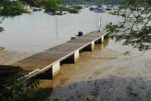
Then descend on another flight of stairs and you will arrive at the village of Sai Lau Kong.  There is a pier.  The scenery is rustic, beautiful and serene.  I took out my sando and had a very nice picnic, with my phone off.  There was plenty of sunshine.  I started the hike at 8am in Wu Kau Tang.  At a little past 11am, I reached Sai Lau Kong.  When I left a little after noon, throngs of hikers started coming in.  I had just enough time to enjoy a quiet lunch there.

Photos Above: Views at Sai Lau Kong.  Photos Below: Views at the Pier, where I picnicked.


The Six Treasures of Double Heaven

The scenic features of Double Haven has inspired the imagination of the literati.  What the Hong Kong people refer to as the “Six Treasures of Double Haven” are references to the tools and treasures of the ancient scholar.  These are the descriptions I have found when I visited Kat O:

A pointed sand spit (Pak Sha Tau Tsui) resembles the tip of a Chinese brush.

Pak Ka Chau at the foot of Wong Fong Shan is shaped like a brush stand.

A rock outcrop near Pak Ka Chau is shaped like an ink slab.

The conical Wong Fong Shan resembles a parasol.

The placid water of Double Haven is as smooth as a piece of paper.

Yan Chau, with its central crack, looks like a seal.

As far as I could tell, at Sai Lau Kong the best view is that of Yan Chau, the treasure that “looks like a seal.”

And of course, the placid water of Double Heaven spread as wide and far as the azure sky this day.

Photo: A Close View of Yan Chau (The Island of the Seal)

Reminders

There are dogs in the village.  They ran out toward me and barked fiercely when I came close to the village settlement area.  As a result, I did not see much of the coastal views on the southern waters of Sai Lau Kong.

Some people do trek the coastline in the southern parts of Sai Lau Kong.  Again, do not do this alone.  You also must watch the time for low tides, otherwise you could be stranded.  It is dangerous and you should only do so if you are experienced and with other experienced hikers.

Be sure to bring quite a bit of water with you.  I suggest no less than 2 litres.  Although there is a restaurant at mid-point in Sam A Tsuen, you do need to keep yourself hydrated throughout the walk.

Overall, it took me a total of 7.5 hours between my start time and when I reached my car again in Wu Kau Tang.  I did take a leisurely break in Sai Lau Kong.  It is a long and demanding walk.  A good part of the trail is shaded, but a hat would be necessary.

Photos: Another Panorama View of Double Haven at the Viewing Point

How to Get There

For how to get to Wu Kau Tang and the Double Haven Country Trail, please see my prior entry here.  Be very good with time, because if you rely on public transportation, the last minibus leaves Wu Kau Tang at 8:15pm.  If you miss that minibus, chances are it will be hard to even call a cab willing to take you back to civilisation.

On Sundays and public holidays, Bus Route 275R stops you off between the Tai Po Market Bus Terminus and Wu Kau Tang.  Again, please consult its schedule to plan your journey better.  This hike does take a whole day.

By private car, there is a parking lot right at the proper entrance of the Double Haven Country Trail, at the end of Wu Kau Tang Road.  There is also a parking lot, usually with more spots, along the Wu Kau Tang Road.  It is about an eight to ten minute walk to the proper entrance of the Double Haven Country Trail.

Sources

The Wikipedia on Sai Lau Kong (Chin).
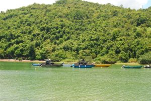
Oasis Trek on Sai Lau Kong (Chin).
The Descriptions On-site at Kat O.

The “Skyward Crocodile” of Tsuen Wan on MacLehose Trail Section 9

The “Skyward Crocodile” of Tsuen Wan on MacLehose Trail Section 9

This location along the MacLehose Trail Section 9 has the somewhat unusual name of “the Crocodile.”  The locals call it the “Skyward Crocodile” and I am not able to find its English name.  Nor is there an explanation for why it is named as such. 

The Wu Tip Shan Path of Fanling

The Wu Tip Shan Path of Fanling

The weather has not been too good lately so I opted for a short hike in my neighborhood.  The Wu Tip Shan Path of Fanling serves a good purpose.  I clocked in some pretty good exercise and saw some decent views on the way. Entrances 

The Jubilee Battery

The Jubilee Battery

It took me a while, with many confusing turns, before I found the Jubilee Battery.  For there is only one ruins of the battery that is accessible by proper roadways.  The Jubilee Battery’s Gun Emplacement 2 lies within the University of Chicago Francis and Rose Yuen Campus in Hong Kong on Victoria Road.

The Jubilee Battery’s Role in WWII

During the latter half of the 1930s, the British determined that “if the defence on the mainland were overcome, and retirement to the Island of Hong Kong took place,” there was such need to build a battery on the northwestern coast of Hong Kong Island.  The British then built the Jubilee Battery to serve this purpose.  It replaced the former Mount Davis Practice Battery of the 1900s.  Together with the long range Mount Davis Battery up on nearby Mount Davis, the Jubilee Battery was part of the Western Fire Command.  Its specific role was for counter bombardment.

The Jubilee Battery had engaged in a battle in the defence of Hong Kong against the Japanese invasion of 1941.  The 26th Coast Battery, 12th Coast Regiment, Royal Artillery was in command here.  On 11th December, 1941, both the Jubilee Battery and Aberdeen Battery directed fire against the Japanese attempting to land on Lamma Island.  As a result of this battle, this battery and the Mount Davis Battery sustained multiple bombing from the Japanese forces.  Before Hong Kong’s surrender on 25th December, 1941, the officers blew up this facility,   This would prevent its use by the enemy after.

The Jubilee Battery acquired its name from the main road above, as it used to be Jubilee Road.  The main road is now Victoria Road, but the name of the battery remains.

Layout of the Gun Emplacements

The Jubilee Battery consists of three 6-inch gun emplacements.  Two of the guns came from the nearby Belcher’s Battery.  The other one came from the Pak Sha Wan Battery.

According to historical descriptions on-site,

Each emplacement consists of a circular reinforced concrete structure for mounting the coastal gun, and adjacent Above-ground Magazine and Underground Magazine for the protected storage of shells and cartridges. 

The layout of the three Gun Emplacements takes advantage of the terrain in order to achieve the widest possible arc-of-fire from right to left.  The guns were positioned in such a way that the blast of a firing gun at one Emplacement would not endanger the crews at the other Emplacements. 

It is of some importance that the outer curved wall of Gun Emplacement 2 was demolished due to a mistaken assessment of its role.  According to descriptions on-site, “an initial site investigation in 2013-2015 led to the conclusion that the outer curved wall of the No.2 Gun Emplacement was part of a later-added servants’ quarters.”  As a result, this outer curved wall was demolished during the construction of the University.  Together with the inner curved wall, the outer curved wall was meant to form a protected corridor for the gunners that carried, stored, and delivered ammunitions.  It served an important role in the defence of Hong Kong during WWII.  The best that can be done now is to just conserve the footprint of the wall.

Photos:  These ten rectangular storage recesses were “expense lockers,” for separate storage of shells and cartridges.

Photos: Left – The boundary marker for a military structure; Right – Above-ground Magazine with 3 compartments, for separate storage of fuzes, shells and cartridges.  Mental ventilators above maintain a stable environment in Hong Kong’s humid and hot weather.

Gun Emplacements 1 and 3

The layout of Gun Emplacements 1 and 3 are very similar to Gun Emplacement 2 as described above.

Despite my best efforts, I was not able to find my way to Gun Emplacements 1 and 3, which, together, take up a much larger area of the defence system of the Jubilee Battery. They lie further west and southwest of the restored Gun Emplacement 2, just about 20 to 30 metres above sea level.  Besides the gun emplacements and the magazines, the system also consisted of tunnels and a searchlight shelter.

According to Ko Tim Keung & Jason Wordie, “some areas of the battery lie within a restricted area, and the extant ruins outside the restricted area are very heavily overgrown.  This location should only be visited by the very keen and adventurous.”  At 143.

Early sources (dating the 1990s and early 2000s) suggest that there is a path that connects to Victoria Road.  However, the government has closed the road access to Gun Emplacements 1 and 3.  That explains why I could not find my way.

In terms of heritage conservation, neither has the government given the Jubilee Battery a grading as historic buildings.

A Walk in the Vicinity

Besides the Jubilee Battery, part of the structures of Block C are also publicly accessible nearby.  Block B and Block C are both part of the Jubilee Battery.  Block B lies within the University structure.  During the turbulent times of 1960s, the Hong Kong Police used them for group confinement.  They kept the leftist elements of Hong Kong here to prevent spying against the British administration.  For some time in the 1990s the police used it for the protection of witnesses.  The metal grille enclosure remains a testament to the stark reality of police practices even during the British times.

 Finally, I also took a further walk to visit the Sai Wan Swimming Shed nearby.  Another suggestion is to walk up Mount Davis to see the Mount Davis Battery.

Photo: Across the street from the University of Chicago Campus, this is the road leading to the Mount Davis Battery.

How to Get There

Bus Routes 1, 43M, 47P, and 971 stop at the Mount Davis Path stop.  Once off the bus, enter the public areas of the University of Chicago campus.  Access to Gun Emplacement 2 is open to the public year-round, perhaps subject to Covid restrictions, if there is any.  Walk through the open area, and head toward the direction of the ocean.  You will have a bird’s eye view over the Jubilee Battery Gun Emplacement 2 there.

The university does offer a tour of the other areas of historic interests within its building.  That includes the infamous detention center with its cells, that is Block B.  Visitors can sign up for it normally, but I am very sure that has ceased due to the pandemic.

Sources

Historical Descriptions on-site.

The best and most thorough discussion I managed to find online of Gun Emplacements 1 and 3 are gwulo.com on the Jubilee Battery, here.  However, the government has closed access to the entry path that this entry shows.

Ko Tim-keung & Jason Wordie, Ruins of War: A Guide to Hong Kong’s Battlefields and Wartime Sites (1996) at 143 – 147.

The University of Hong Kong, Finding a Partly Forgotten Urban Gem, Decoding Some Enigmas of the Jubilee Battery, 25 April 2001.

The Siu Lo of Yuen Long

The Siu Lo of Yuen Long

Update as of August 2023: The area of the heritage site has been blocked off from visits. It is likely due to the revitalization and construction work that was approved. The old trees with their aerial roots that hovered over the building have been removed.