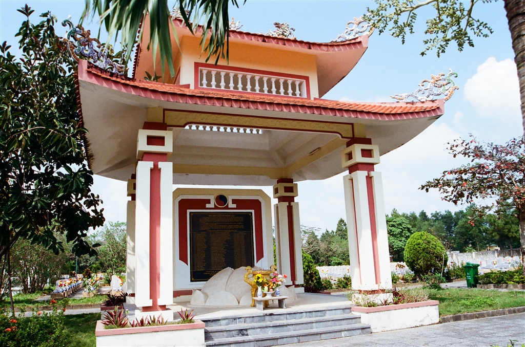
I first encountered the MacIntosh Cathedrals at the Police Museum of Hong Kong. The name, the look and the history of these police forts captured my imagination right away. In this long entry, you will find information about how to reach the six currently accessible MacIntosh Cathedrals in Hong Kong’s former frontier closed area.
A Chanced Conversation with a Taxi Driver
“The Mac, Mac, Mac…” The taxi driver stumbled as he tried to name it. “MacIntosh Police Forts,” I named it for him.
“Yes, the MacIntosh Police Forts,” he said, perhaps with a sense of pride, but certainly with nostalgia, “I was there as a police officer.”
I was in a taxi telling my friends about my excursions on the border of Hong Kong. The self-initiated project is to find all the seven police forts that were built during the 1950s to stamp out illegal border crossings from China.
In English, these forts have acquired the somewhat unusual name of MacIntosh Cathedrals. Then Police Commissioner William Duncan MacIntosh initiated the construction of these sites, and they naturally acquired his name. As to the “cathedral” reference, it had to do with the forts’ “distinctive appearance and outline against the skyline.” (R.G. Horsnell, at 177)
“I used to camp out all along the border for my patrol shifts. The border outposts can detect movements, but we had to go and seek out the illegal immigrants. We very often found women. That is because they were not as swift and nimble as men.”
“Then what did you do with these people that you captured?” I was very surprised that I could have this chanced conversation with someone who had experience at the MacIntosh Cathedrals as an officer.
“They were all for deportation. And when they returned to China, they will be sent to reeducation camps.”
The First Time Learning about the MacIntosh Cathedrals
While this taxi driver had personal experience at the MacIntosh Cathedral as a former border patrol, I had to learn about the sites as a historical relic. I first saw photographs of the MacIntosh Cathedrals at the Police Museum of Hong Kong.
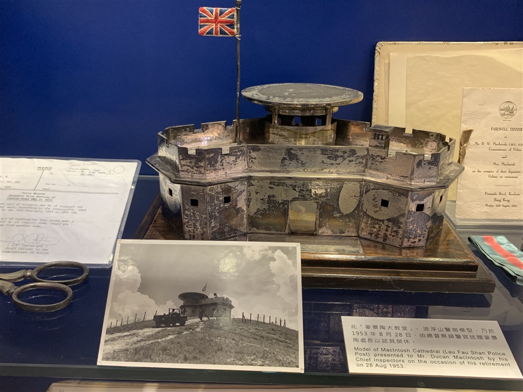
The museum shows this model of a MacIntosh Cathedral. The Chief Inspectors presented this model to Mr. William Duncan MacIntosh, then Commissioner of Police, as a gift upon his retirement.
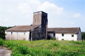
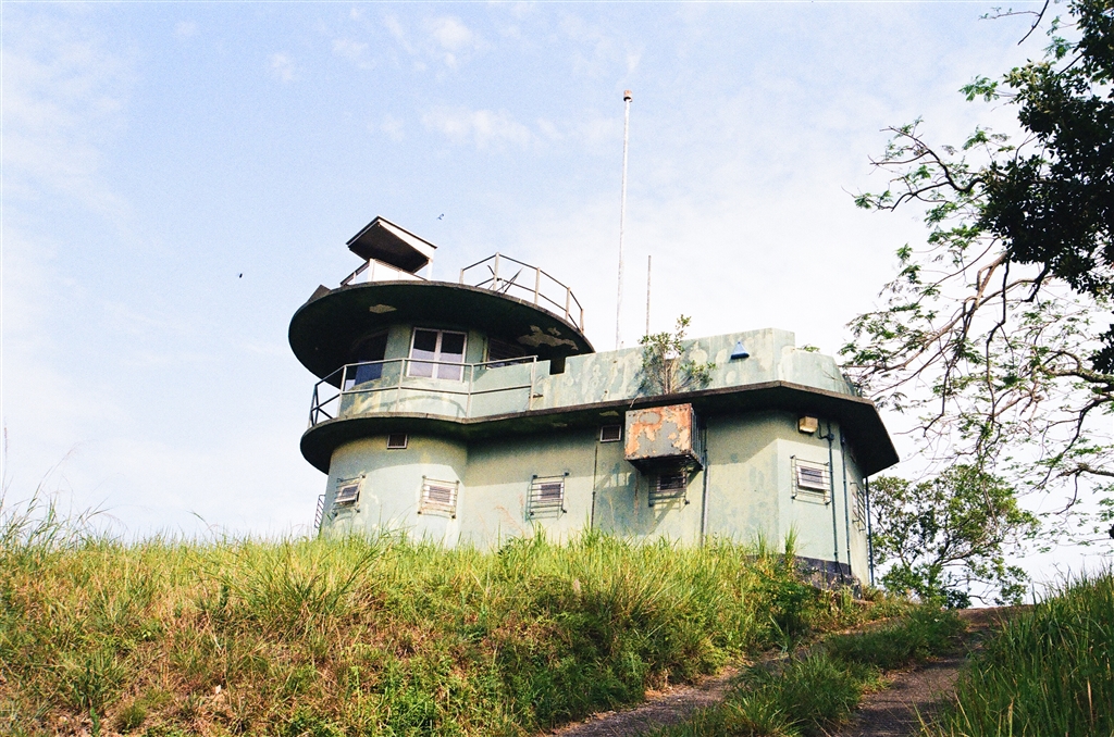
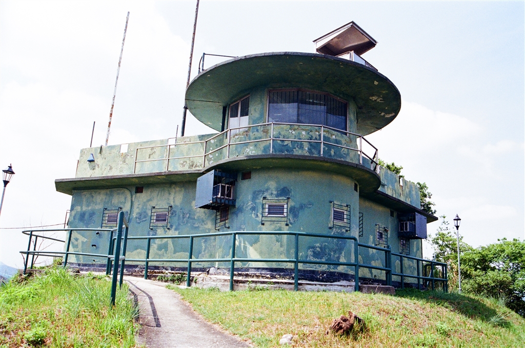
And indeed, all the MacIntosh Cathedrals have this similar architectural design. The name, the look and the history of these police forts captured my imagination right away.
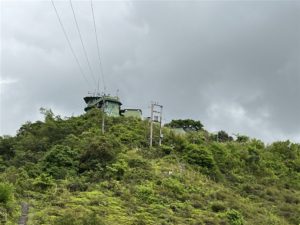
Are the MacIntosh Cathedrals historic relics? Perhaps the answer is yes in some ways, and no in others. They have enough history and significance behind them that earned them the status as Grade 2 Historic Buildings. However, they actually do continue to serve their intended functions in border patrol. The equipment in most of the MacIntosh Cathedrals are automated by now, with remote control capability. That is, except for the one at Kong Shan. And this MacIntosh Cathedral is still manned today.
The Story of the MacIntosh Cathedrals
After WWII, Hong Kong experienced an exponential growth in population. This was due to large numbers of refugees coming from the mainland in escape of both WWII and the civil war that followed. In late 1940s, with the Communists taking power in China, more refugees flooded into Hong Kong. The border became the “wild wild west.” Bandits and gangs roamed and menaced the police officers there. The results were frequent gun battles.
In 1949, the Hong Kong government closed the border with China. Police officers patrolled the border regularly, both to guard against illegal immigration as well as infiltration. Two incidents in 1949 resulted in then Commissioner of Police William Duncan MacIntosh’s decision to reinforce border security with the construction of MacIntosh Cathedrals. A same group of gangsters attacked the patrolling officers at or near the border outposts in two separate incidents. One constable was killed in each incident, and the gangsters seized the weapons of these officers.
The reinforced concrete structures of the MacIntosh Cathedrals provided significant protection to the officers as opposed to the former brick structures of the border outposts. Along with the equipment inside and the functions of the architectural design, the new outposts would provide more modern, efficient border patrol for decades to come.

Photo: All the MacIntosh Cathedrals are heavily-surrounded with tall fences and barbed wire reinforcements ontop.
Architectural Features of the MacIntosh Cathedrals
All seven of the MacIntosh Cathedrals are Grade 2 Historic Buildings. All of these border outposts had a similar and rather distinctive design.
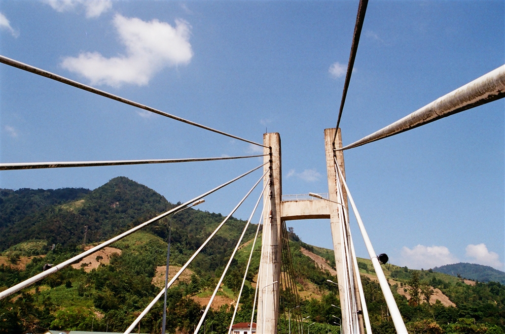
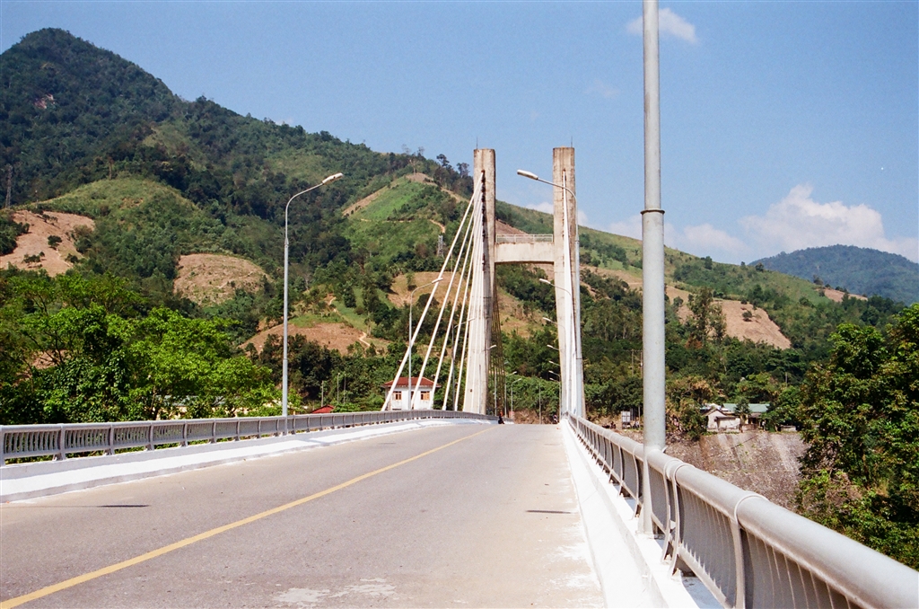
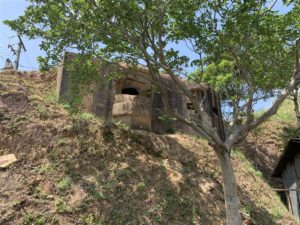
“Centrally there is a round, two storied, tower, and jutting from its sides are two long, one storied arms. The plan of the whole is roughly in the shape of a chevron.” R.G. Horsnell at 174.
R.G. Horsnell’s article, entitled The MacIntosh Cathedrals, gives a detailed account on the structure of these border outposts. This is valuable information, as all of the MacIntosh Cathedrals remain off-bounds to visitors. And again I quote from his article:
“The upper storey of the tower is the control room, equipped with radio and telephone, which is manned continuously. In the wall, at head height around the circumference, windows afford a 360 arc of vision to the duty constable…The roof has a low, castellated parapet, and forms the Observation Bridge. Here is located a petrol generator and a searchlight.” Id.
Construction of all of the MacIntosh Cathedrals completed in 1953.
The Search for the MacIntosh Cathedrals
Between the time I began research on the MacIntosh Cathedrals and finally seeing all the accessible ones, it took me one year. This is because, even for the Chinese sources online, few give detailed instructions on how to find them. Some of them are not even on Google Map. For those that are on Google Map, Google is not able to provide navigation. For one (Pak Kung Au), Google actually directed a way that is within the frontier closed area, and therefore you will not be able to follow its way. It is the same with the popular hiking apps.
In the end, it took a combination of grit and luck for me to be able to locate all of them.
To prepare for these visits, I also consulted the Plans of Frontier Closed Area, available at the website of the Hong Kong Police Force (see link under Sources). Until relatively recently (during the 2010’s), most of the MacIntosh Cathedrals lied within the frontier closed areas. Therefore I took the time to study the maps carefully.
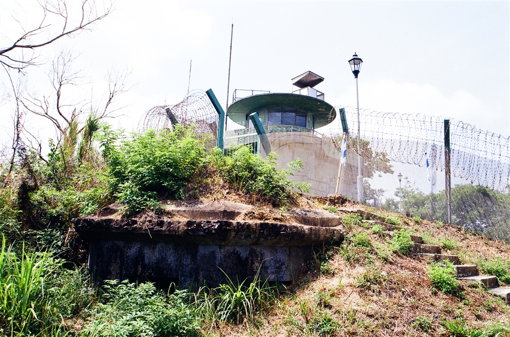
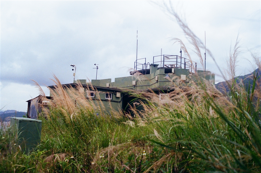
Photo: At the Pak Fu Shan MacIntosh Cathedral, there are WWII era military facilities on-site as well.
The Seven MacIntosh Cathedrals
I shall go through the seven MacIntosh Cathedrals in the order of their location along the northern border. Starting from the western-most one in Mai Po, then eastward to the last northeastern post at Sha Tau Kok. The names of the border outposts are the proper name, denoting the actual location. The names in parenthesis refers to the better-known, and the general larger areas that they are located.
The Pak Hok Chau MacIntosh Cathedral (Mai Po)
The Pak Hok Chau MacIntosh Cathedral stands apart from the rest of the border outposts in two ways. First of all, this is the only one that is colored in white, instead of the blue and green of the other six. Secondly, this is also the only one that does not require any climbing. It is laid on ground level in Mai Po.
The Way to the Pak Hok Chau MacIntosh Cathedral
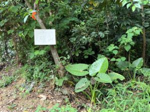
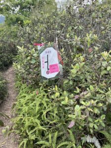
Bus Route 76K runs between the villages of Yuen Long and Sheung Shui, along Castle Peak Road. Get off at the Mai Po stop. Then walk on Tam Kon Chau Road for 1.5 km, for about 20 minutes. Keep an eye to your right. When you see this sign, you have arrived at the Pak Hok Chau MacIntosh Cathedral.
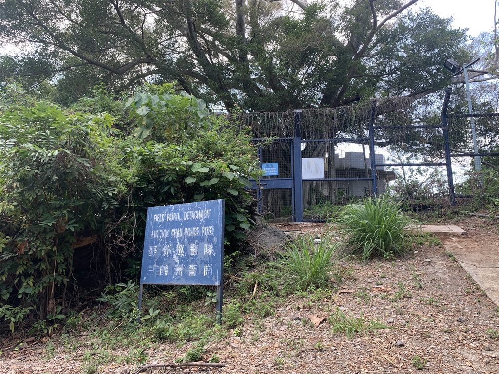
Photo above: The sign says Field Patrol Detachment Pak Hok Chau Police Post.
A gentle reminder that there is almost no shade all along Tam Kon Chau Road, therefore be prepared with a hat and enough water in the summer.
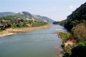
You may consider a visit to Mai Po along with the MacIntosh Cathedral. Suffice to say, the walk on Tam Kon Chau Road really was quite beautiful.
Finally, it is possible to drive to this location. There should be a free parking lot at Mai Po, but you should call the WWF-HK to confirm.
The Ma Tso Lung MacIntosh Cathedral (Lok Ma Chau)
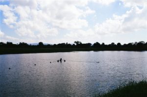
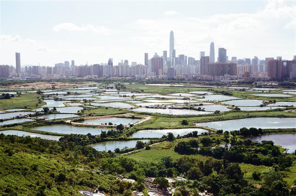
The Ma Tso Lung MacIntosh Cathedral is perhaps my favorite location out of all the six that I have visited. This area is actually better known for sunset viewing of the fish ponds of Yuen Long. See my separate entry for this. And of course, it is one stone two birds here for the MacIntosh Cathedral. See also below for Suggested Route 2.
The Way to the Ma Tso Lung MacIntosh Cathedral
Of all the MacIntosh Cathedrals, the one at Ma Tso Lung is the most friendly to private cars. From Ho Sheung Heung Road, turn left onto Ma Tso Lung Road. Keep on going, and you will pass by the Ma Tso Lung Village. You will come across a T section at the end, turn right onto Liu Pok Road. You will be heading up on a hill, watch out for the first road (you can easily miss it) on your left. Turn onto this road, and you will see spots up the hill where you can park. Then head up the stairs to see the Ma Tso Lung MacIntosh Cathedral.
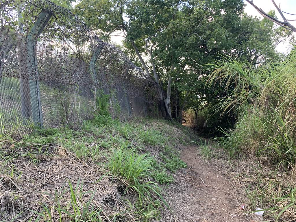
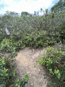
Photo: After seeing the Ma Tso Lung MacIntosh Cathedral, walk on this path to view the fish ponds of Ma Tso Lung. The view there really is breathtaking.
By public transportation, take green top minibus Route 51B at the Sheung Shui minibus station outside of the Sheung Shui MTR Station. Ask to get off at Ma Tso Lung Shun Yee San Tsuen. When you get off the minibus, go a bit backward from the way that the minibus came from, but do not turn right onto Ma Tso Lung Road. Instead, go straight onto Liu Pok Road. You will walk up a gentle incline, but watch closely on your left. At the first turn on the left that you see, make your way up that road. It leads you further up to the hill where the Ma Tso Lung MacIntosh Cathedral sits.
The Nam Hang MacIntosh Cathedral (Man Kam To)
Out of the seven MacIntosh Cathedrals, the one at Nam Hang (Man Kam To) is the only one that is not accessible. This is due to the current construction taking place there now. One cannot get in because the construction site blocks Sha Ling Road, which is the only access. The border outpost lies on the very end of Sha Ling Road.
I did consider getting the “green pass,” which enables anyone who has taken and passed a test on safety measures for construction sites to enter them. However, I decided that it would be too much effort.
If you are more keen than I am in seeing this border outpost, consider getting the green pass for construction sites, or wait till construction is over. As of the day of writing, however, they are still at it and it’s been a year. It is also unclear what the finished site will become. Chances are that it will be private property, to which access may remain restricted.
The Nga Yiu MacIntosh Cathedral (Ta Kwu Ling)
The Nga Yiu MacIntosh Cathedral is perhaps most noteworthy for its historic role in the construction of these police forts. One of the two gun battles with gangsters that prompted William Duncan MacIntosh to build these seven police forts took place at Nga Yiu. The positioning of the MacIntosh Cathedral here also enables a very good look at the architecture of the police forts.
The Way to the Nga Yiu MacIntosh Cathedral
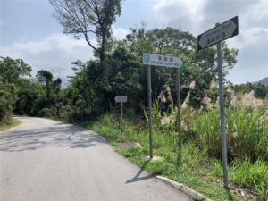
Take the green top minibus Route 59K from the minibus station outside of the Sheung Shui MTR Station. Note that 59K runs rather sparsely with only one shuttle every half hour. Ask the minibus driver to drop you off at Muk Wu Nga Yiu. Once getting off the minibus, look along Lin Ma Hang Road, the sign of the Nga Yiu Police Post is on the right side of Lin Ma Hang Road (across the street). See below photograph. Head up this somewhat steep but very short slope up, and you will see the Nga Yiu MacIntosh Cathedral at its end.
Photos: After getting off at Muk Wu Nga Yiu, watch out for the sign (it says Nga Yiu Police Post). This is the path up to see the Nga Yiu MacIntosh Cathedral.
Not surprisingly, this location also enables a pretty good view of Shenzhen’s city establishments.
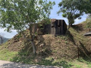
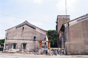
The Pak Fu Shan MacIntosh Cathedral (Heung Yuen Wai)
The Pak Fu Shan MacIntosh Cathedral is an interesting visit. Besides the police fort itself, there are also WWII relics there. There are sources suggesting that these were Japanese-built pillboxes.
In terms of views, I think the Pak Fu Shan MacIntosh Cathedral is the most photogenic of all the six that I found. Note that all of them are heavily fenced, with high barbed wires. You have few options in terms of the angles in which you take your photos.
The Way to the Pak Fu Shan MacIntosh Cathedral
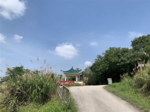
Take the green top minibus Route 59K from the minibus station outside of the Sheung Shui MTR Station. Note that 59K runs rather sparsely with only one shuttle every half hour. Ask the minibus driver to drop you off at Heung Yuen Wai. You may want to be dropped off at the pavilion on Lin Ma Hang Road, see photograph below.
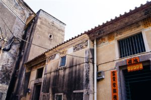
Photos: Left – The pavilion on Lin Ma Hang Road, at the entrance to Heung Yuen Wai Village. Right – Once off the minibus, follow Lin Ma Hang Road.
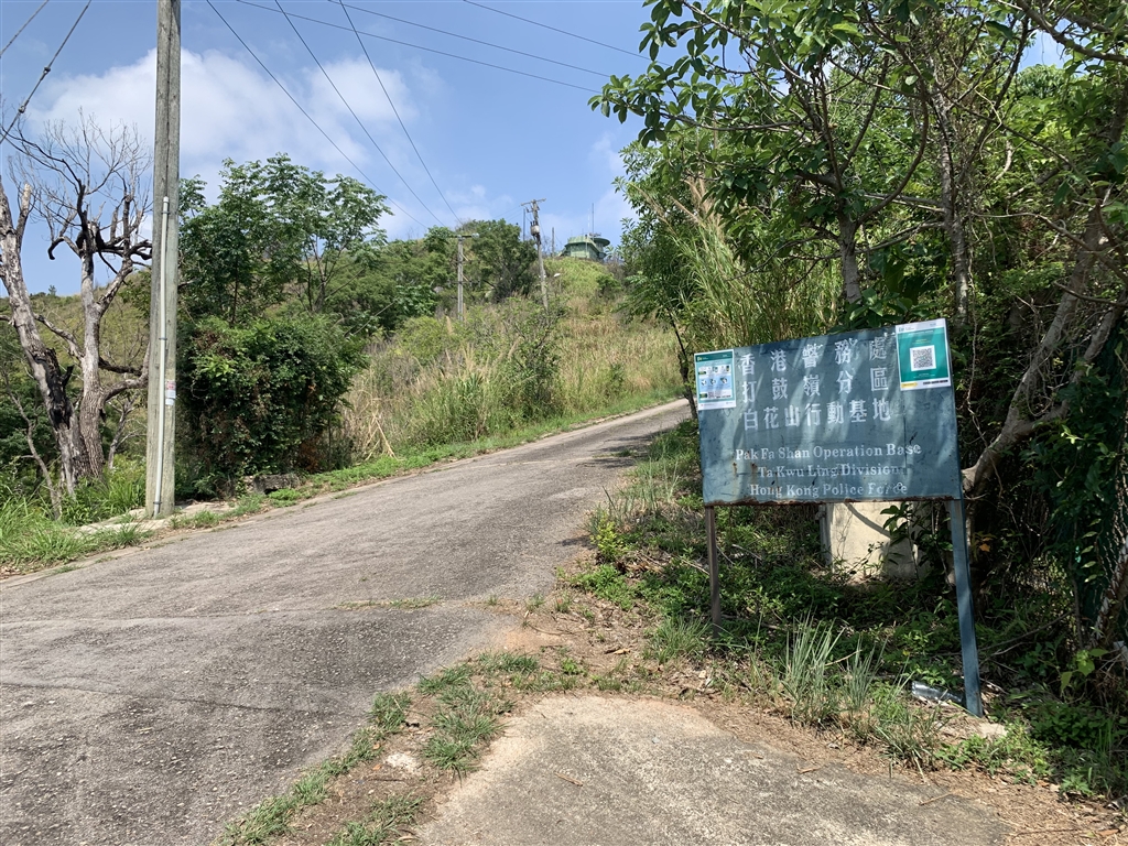
After getting off, walk on Lin Ma Hang Road. Be watchful on your left. See this way up a hill on your left with the sign saying Pak Fa Shan Operation Base Ta Kwu Ling Division Hong Kong Police Force. Head up the slope. In fact, you can already see the Pak Fu Shan MacIntosh Cathedral in this picture.
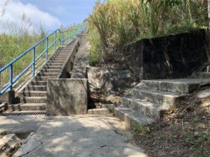
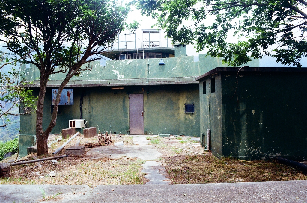
You will then notice the WWII era pillboxes. Then you can head up the stairs to reach the Pak Fu Shan MacIntosh Cathedral.
Photos: You will see the WWII era pillboxes on top of the hill. Then take the stairs (photo right) on the right, without the railing, to reach the Pak Fu Shan MacIntosh Cathedral.
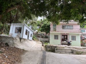
When I went, the minibus driver dropped me off inside the Heung Yuen Wai village, so I took a quick tour at the village as well. But be very sure not to disturb the residents there. They are very accustomed to, and also entitled to, the quiet enjoyment of their life there at the former frontier closed area.
The Kong Shan MacIntosh Cathedral (Lin Ma Hang)
As mentioned above, the Kong Shan MacIntosh Cathedral is the only one out of the seven that requires manned control because the equipment there is not automated. Even now, a policeman is deployed there every night.
The Way to the Kong Shan MacIntosh Cathedral
This location is not accessible by private car.
At the Sheung Shui minibus stop (outside of Sheung Shui MTR Station), take green top minibus Route 59K. The very last stop you can get off at is the No. 12 Police Post. Without a permit, you may not enter the Lin Ma Hang Village on this minibus. Do note that Minibus 59K comes only every half hour.
Once at the Police Post, expect to exchange a few words with the policeman guarding the area. Simply tell the policeman that you are here for hiking. Walk on for about ten, fifteen minutes or so. You will arrive at the gatepost for the border. At that point you may not go forward without a permit. The trail up to Kong Shan (via Lin Ma Hang Village) is on your right. See the sign.
Photos: The entrance to Lin Ma Hang Tsuen Village via a mountainous path, on your right when you arrive at the border gate post.
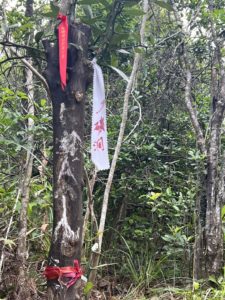
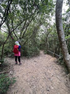
This path is relatively simple. Do follow both your hiking app and the hiking ribbons. There is one section that requires roping, and another section that requires a little hop to get past a stream on a metal frame. If you remain watchful, it presents little danger.
As soon as arriving at the village, look to your left to see a little green village home (left photo below). The stairs next to this green village home is the way up the MacIntosh Cathedral of Kong Shan and also the way to the Lead Mine of Lin Ma Hang. The rest is just about climbing 917 steps and at the end of these stairs you will see the MacIntosh Cathedral of Kong Shan. Please see my entry on the Lead Mine of Lin Ma Hang for more detailed description on this route.
Please see below for Suggested Route 3 to visit the Kong Shan and Pak Kung Au MacIntosh Cathedrals in one hike.
The Pak Kung Au MacIntosh Cathedral (Sha Tau Kok)
The Pak Kung Au MacIntosh Cathedral is the highest in altitude amongst all 7 MacIntosh Cathedrals. This is contrary to some bloggers’ understanding. Some thought that the Kong Shan MacIntosh Cathedral, with the required 917 steps of climbing, is the highest. But the altitude of Kong Shan MacIntosh Cathedral is actually at only around 220m. The Pak Kung Au MacIntosh Cathedral is at 280-300m. And surely, the Kong Shan police fort is the second highest in altitude out of the seven.
A First Word of Warning
For the Pak Kung Au MacIntosh Cathedral, the first word of warning is that one will have to cross through a red tape that states that it is within a restricted area. Therefore you might be breaking the law just to see the Pak Kung Au MacIntosh.
Do note that, at the other end on the same path of the MacIntosh Cathedral, there is a functional, operating and proper police guard post. That police post (it must be a border post) is certainly within the closed frontier area.
Because the hiking trail does lie along the frontier closed areas in Sha Tau Kok, there are uniformed police officers (fully equipped with weapons) that patrol the area regularly. And I did run into two (very nice) ones when I was on my way back from the police fort. I surely chatted with them but did not disclose that I had just finished the walk from the MacIntosh Cathedral. Therefore it is a real risk that you get caught trespassing the frontier closed area if you decide to push on and enter the restricted area. Do it at your own peril, as I did.
The Way to the Pak Kung Au MacIntosh Cathedral
This location is not accessible by private car.
The closest way to the Pak Kung Au MacIntosh Cathedral is to enter the hiking trail on Shan Tsui Road in Sha Tau Kok.
At the Sheung Shui minibus station, take green top minibus 55K and get off at Tam Shui Hang. This is the last stop that one must get off before the minibus continues into the restricted area of Sha Tau Kok. Once at the stop, look ahead and you will see this big sign pointing you the way to Shan Tsui.
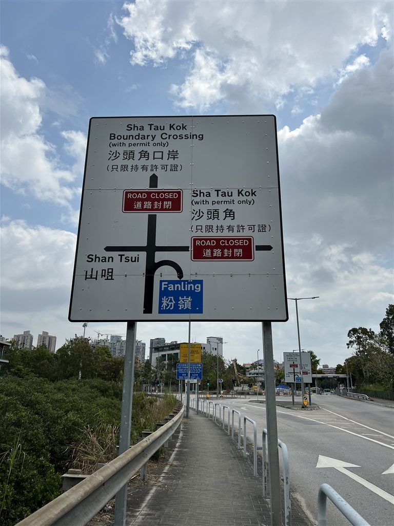
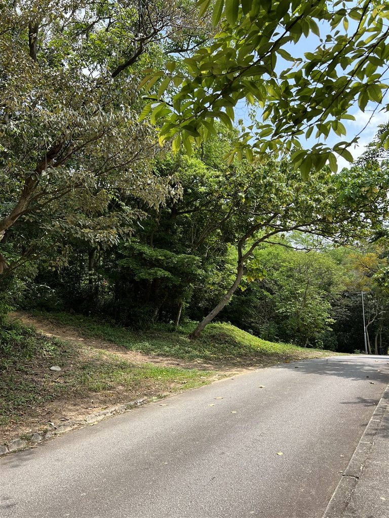
Follow the sign to keep left, and you will arrive at Shan Tsui Road. Keep on going, until you see this opening on your left (if you keep on going, there is a border gatepost at the end of this road). This is the entrance to the trail. Head onto this path to begin the ascent, you will be gradually hiking up to about 300 metres in altitude.
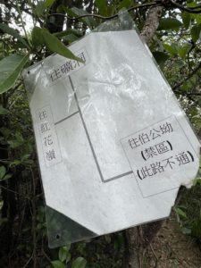
About an hour into the hike, you will come across this sign. Take the Kong Shan path (going straight).
Photos: follow the signs for Mining Pit (礦洞) at this crossroads. Do not turn left.
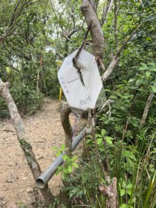
At this sign, follow the Pak Kung Au (伯公拗) direction. Take the path to your right.
Within five minutes, you come across another intersection. Again, take the path to your right.
The Chinese words in the red box says Pak Kung Au. This is warning to visitors that the pathway lies within a restricted area.
You will then come across this red tape.
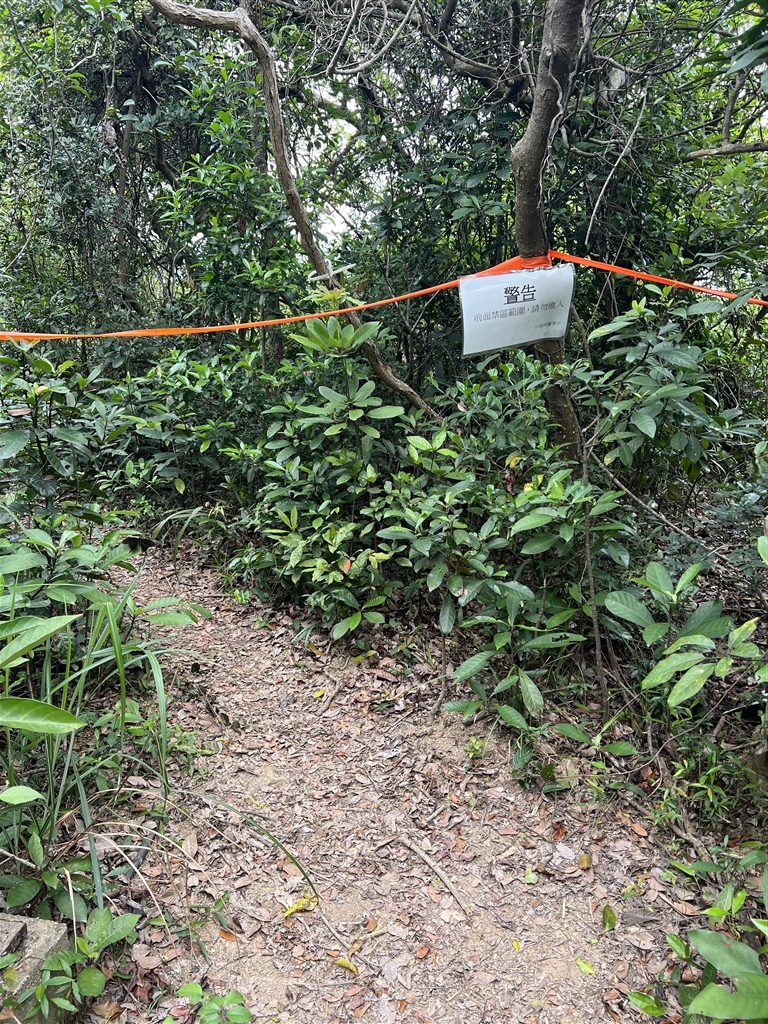
I did go beyond this point. Walk on for about eight minutes, and you will reach a T section.
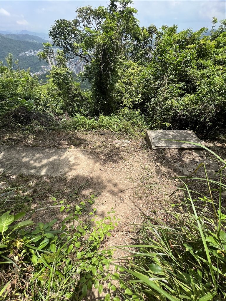
You will arrive at the MacIntosh Fort on your left. It is an absolute no-no to head further on your right, however.
If you would like to visit the Kong Shan and Pak Kung Au MacIntosh Cathedrals in one hike, please see below Suggested Route 3, beginning in Lin Ma Hang.
Suggested Routes
From what I gather on online sources (mostly of hiking and exploratory enthusiasts), people that go to these locations go on foot. And although I did drive to a few of these sites, going on foot is so much more fun and exploratory. Also, the Kong Shan and Pak Kung Au MacIntosh Cathedrals are very close to the frontier closed area and you simply cannot go there by private car. I do think that one can visit all six of the accessible MacIntosh Cathedrals in three separate occasions very comfortably.
Suggested Route 1 (Pak Hok Chau and Ma Tso Lung MacIntosh Cathedrals)
Since the Pak Hok Chau MacIntosh Cathedral is in Mai Po, perhaps it makes most sense to see both Mai Po and the police fort in one go. But if you are only interested in the MacIntosh Cathedrals (like I was), then you may consider visiting the Pak Hok Chau and the Ma Tso Lung MacIntosh Cathedrals within the same day.
I suggest taking Bus Route 76K from Yuen Long and visiting the Pak Hok Chau MacIntosh Cathedral first. When you are finished, go back to the same bus stop and take the 76K again (toward Sheung Shui) and get off at the Ho Sheung Heung bus stop.
After getting off, head on over to Ho Sheung Heung Road. You will soon see Ma Tso Lung Road and turn left. Walk all the way on Ma Tso Lung Road, you will pass by Ma Tso Lung Village. Keep on going until you reach Liu Pok Road. Turn right onto Liu Pok Road, and be watchful on your left. On the first opening of the road on the left, make a left and head up the small hill. You will see the Ma Tso Lung MacIntosh Cathedral at the end of the stairs. Expect that the walk from Ho Sheung Heung to take about one hour.
Perhaps time yourself so that you can also enjoy sunset views at the fish ponds. At the MacIntosh Cathedral, keep on going on the path outside of the fence, and you will soon come upon wide-open, 360 views of the fish ponds, with Shenzhen’s skyline as its backdrop. See my entry here.
Suggested Route 2 (Nga Yiu and Pak Fu Shan MacIntosh Cathedrals)
To visit both the Nga Yiu and Pak Fu Shan MacIntosh Cathedrals on the same day, you will be first taking the green top minibus Route 59K from the minibus station outside of the Sheung Shui MTR Station. Get off at the Muk Wu Nga Yiu stop (see above for detailed directions).
After seeing the Nga Yiu MacIntosh Cathedral, go back to the same bus stop (toward Lin Ma Hang direction). Get on 59K again and ask to get off at Heung Yuen Wai. For the rest of the directions, see above under The Way to Pak Fu Shan MacIntosh Cathedral.
Suggested Route 3 (Kong Shan and Pak Kung Au MacIntosh Cathedrals)
The third suggested route is perfect for a companion visit to the No. 6 lead mine pit of Lin ma Hang. Please see my entry, Beautiful Sha Tau Kok – From the Lead Mine of Lin Ma Hang to San Tsui Tsuen Village. Do note that this is not a kind of route suitable for beginners, and even for experienced hikers you should not be going alone. Bring along a lot of water, and have your hiking app with you throughout.
After climbing a 300m altitude from the lead mine of Lin Ma Hang, you will then be continuing on an eastward hike to Shan Tsui Tsuen Village. There are signs that previous hikers have posted along the way. Watch out for the sign that says Pak Kung Au at this crossroads.
Follow the way of the red box to reach the Pak Kung Au MacIntosh Cathedral. But as discussed above, you will soon come across the red tape stating that you will be entering into the frontier closed area beyond that point. It is your own decision whether to go beyond the red tape and to finally stop at the Pak Kung Au MacIntosh Cathedral. In any event, do not go to the proper border post at the end of the same path.
Sources
The Wikipedia on the MacIntosh Forts.
The Wikipedia on Commissioner of Police (Hong Kong).
The Website of Hong Kong Police Force on the Plan of Frontier Closed Area.
Historic Descriptions at the Police Museum.
R. G. Horsnell, The MacIntosh Cathedrals, 35 J. of the Royal Asiatic Society Hong Kong 171 (1995).
Historic Descriptions on-site at the MacIntosh Cathedrals.