The Wu Tip Shan Path of Fanling
The weather has not been too good lately so I opted for a short hike in my neighborhood. The Wu Tip Shan Path of Fanling serves a good purpose. I clocked in some pretty good exercise and saw some decent views on the way.
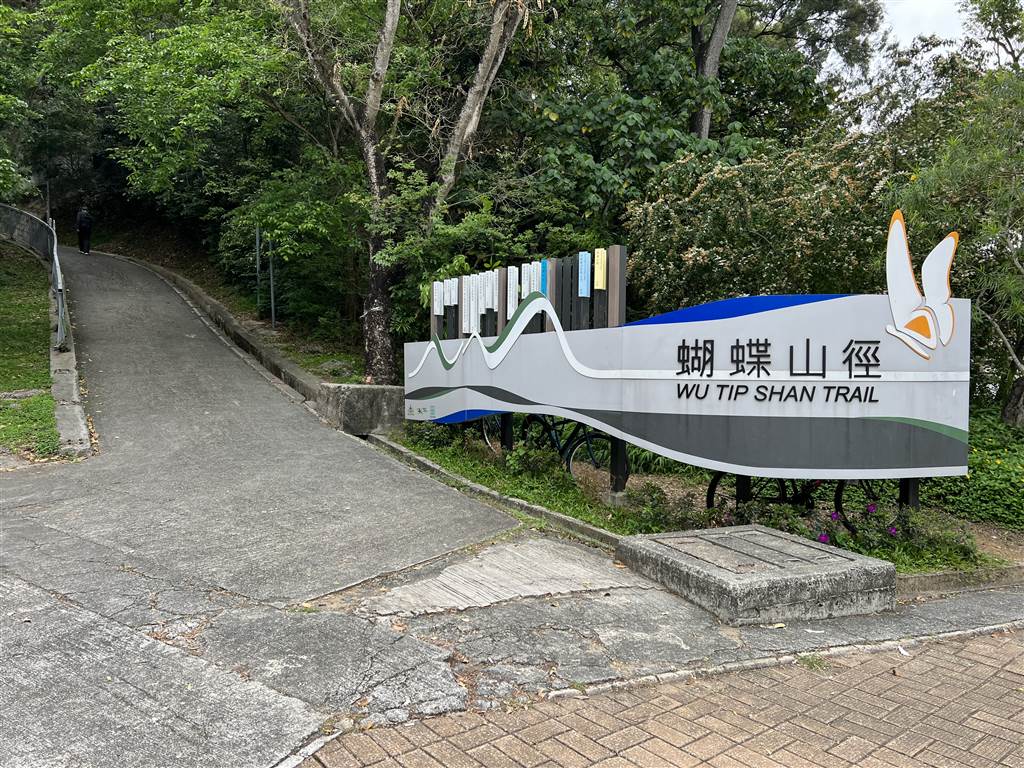
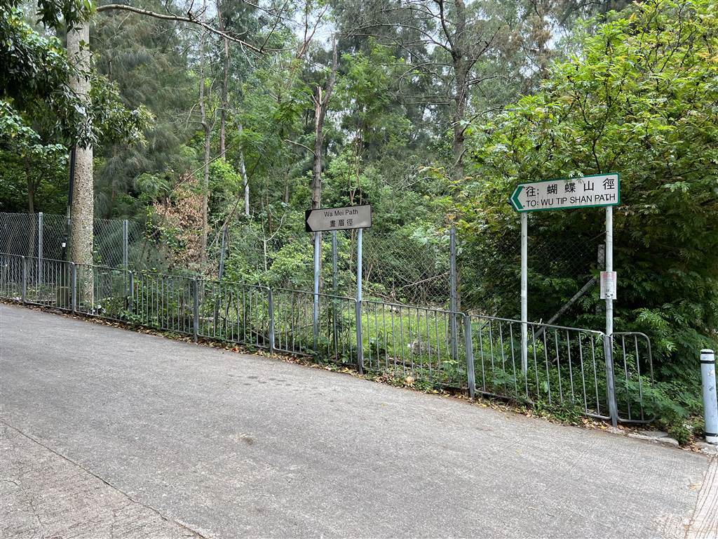
Entrances to the Trail
Wu Tip Shan is a hill in Fanling. At its peak of about 250 metres, the trail comes with some pretty good views of northern New Territories. There are four ways to enter the trail. For most people, the entrance from the Fanling MTR station should be the most convenient. Because I live in the vicinity, I parked at Yung Shing Court and entered via the Wa Mei Path instead.
The Fanling station entrance is very clear. Take Exit B, walk on the footbridge, then cross the street. You will see a big sign saying Wu Tip Shan Path. The climbing will be significant from any entrance, but perhaps the way from Fanling Station is the longest before you reach the peak.
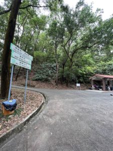
The Wa Mei Path is on Wah Ming Road, about a five-minute walk from the Yung Shing Court shopping mall. Enter the trail when you see the road sign for Wa Mei Path.
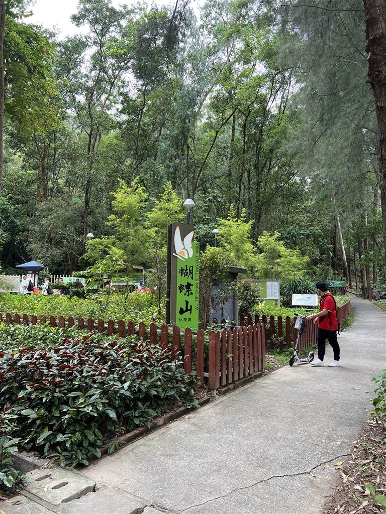
The path next to the Wu Tip Shan Sitting-Out Area is perhaps the shortest way up. This is also along Wah Ming Road.
Finally, one can also enter the Wu Tip Shan Path via the Fung Ying Seen Koon, the big temple also across the street from the Fanling MTR station. However, due to the pandemic, the temple grounds are off bounds to visitors now.
The Walk
On Wa Mei Path, there was first a section of gentle incline on a slope. At this point, I made a left and took a somewhat more circuitous slope up to avoid the more direct way on stairs.

Photos: A gentle incline up from Wa Mei Path, left photo shows where I turned left to go upward to continue on Wu Tip Shan Path.
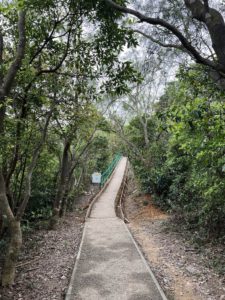
Soon you will come upon this road sign. Take the stairs up on the right. What follows is a seemingly never-ending flight of stairs. Keep climbing.
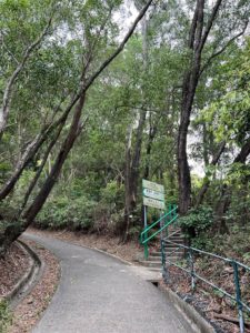
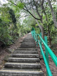
Photos: Left – When you see these signs, head up on the stairs on the right. Right – A seemingly never end flight of stairs up.
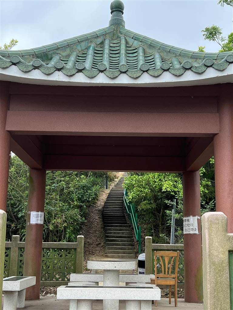
Go through this pavilion and keep on climbing on the stairs.
Finally, I walked further from the peak of Wu Tip Shan, and turned back after reaching Kei Lak Tsai. If you keep on walking, you will go further to Pak Tai To Yan (North Tai To Yan), or even farther to Tai To Yan.
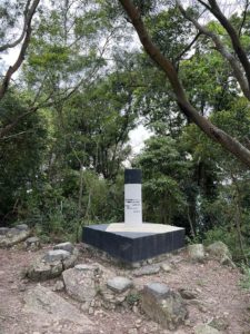
Photos: the peak point of Wu Tip Shan with signpost. Going forward, you will reach Kei Lak Tsai, and further to Tai To Yan.
I walked back the same way until I reached this crossroads. I followed the signs for Fanling Station. The descent begins, again on quite a bit of steps down.
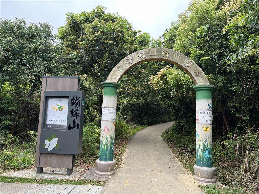
This is the proper sign denoting the Wu Tip Shan Path from the Fanling Station.
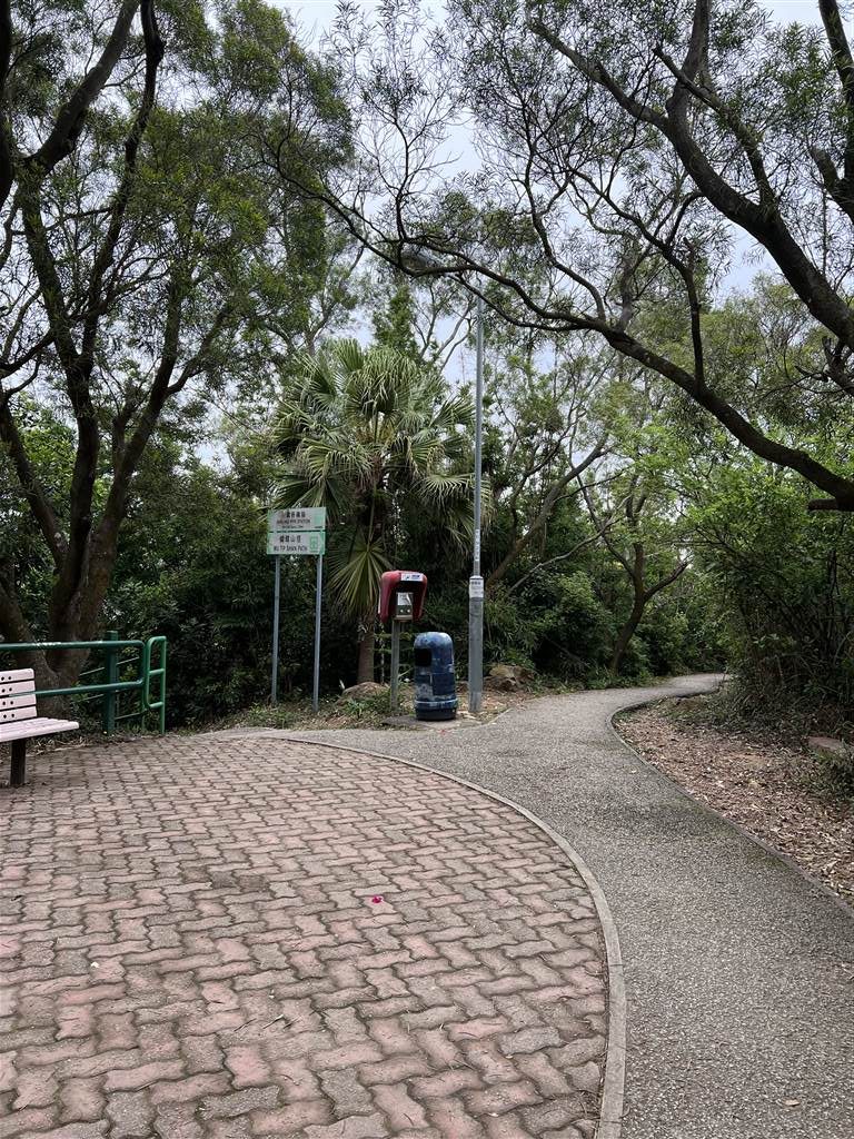
What impresses me on this path is the numerous rest stops on the way. I did gather the feeling that this is a go-to trail for the neighborhood residents. People dance, play badminton, kick shuttlecock and do stretching exercises at the many pavilions and rest areas on the trail. It shows a thriving community at many points on the hill.
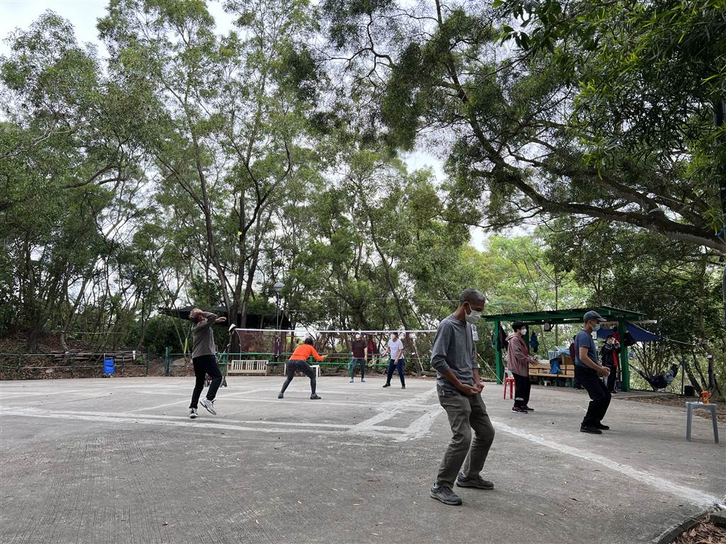
Throughout the Wu Tip Shan Path, the walk is on paved stairs and paths. It is really quite easy on the legs. I do estimate that there are 800-1000 steps to climb, however. It took about two hours for me to do a loop from Wa Mei Path to Fanling Station and then back at Yung Shing Court to get my car.
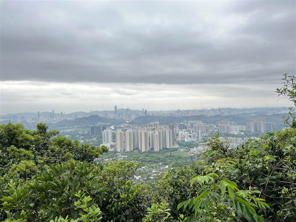
The Views
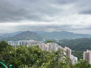
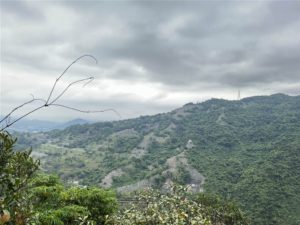
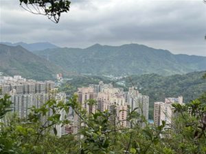
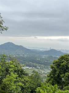
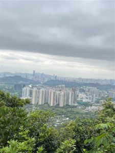
In this part of the New Territories, you will see views of Fanling’s housing estates, the Wo Hop Shek Public Cemetery, the mountains afar, and even the skyline of Shenzhen.
How to Get There
From Fanling Station, take Exit B and walk toward the direction of Fung Ying Seen Koon. Cross the street and the entrance to Wu Tip Shan Path is right there. If you would like to enter via Wa Mei Shan Path, the closest housing estate is Cheong Shing Court.