From Wu Kau Tang to Sam A Tsuen Village via the Double Haven Country Trail

I have hiked the trail between Wu Kau Tang and Sam A Tsuen Village for three times at least, and I finally had a chance to take my camera with me for some nice photographs on this trail. The trail is properly named the Double Haven Country Trail, and the section between Wu Kau Tang and Sam A Tsuen is the first section. The Double Haven Country Trail ends at Lai Chi Wo, which is quite some distance away from Sam A Tsuen. The first section would serve all my purposes, and still it took me about four hours for the hike.
The Trail
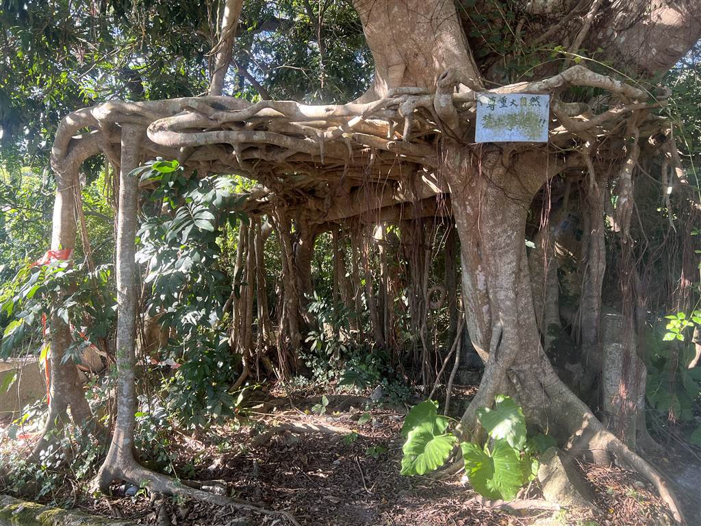
It took me fifteen minutes before I found the entrance to the trail. From the minibus stop, enter toward the village. Note the tree house on your right before you enter the village.
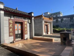
Going straight, you will see a few ancestral halls on your left and the children’s playground on your right. Pass by those and you will soon come across the Wu Kau Tang Public Toilet.
From this point at the Wu Kau Tang Public Toilet, take the path to your left, and you will pass by this big house. At this intersection (photo on the right) in front of this big house, keep to the left.
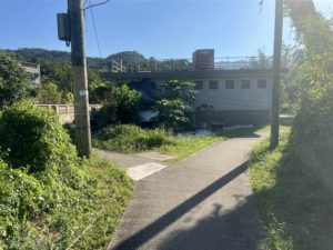

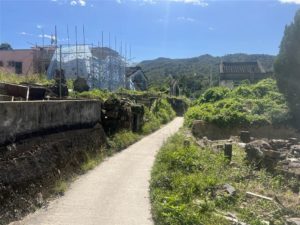
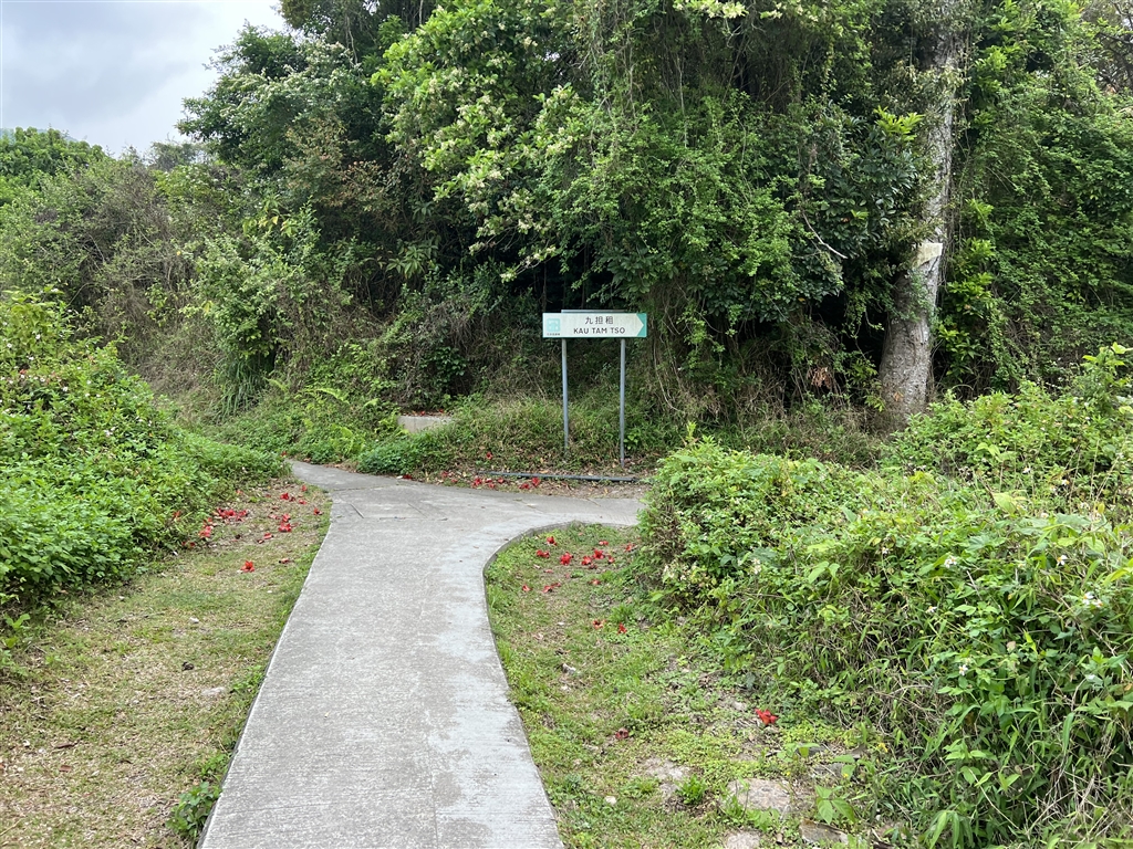
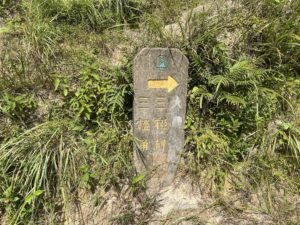
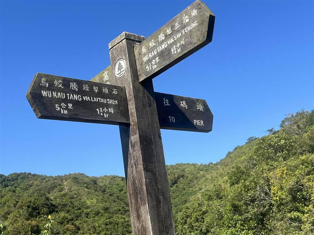
You will then go on a short path and see a sign saying Kau Tam Tso. That is the entrance into the trail, follow the sign and take the path to your right.
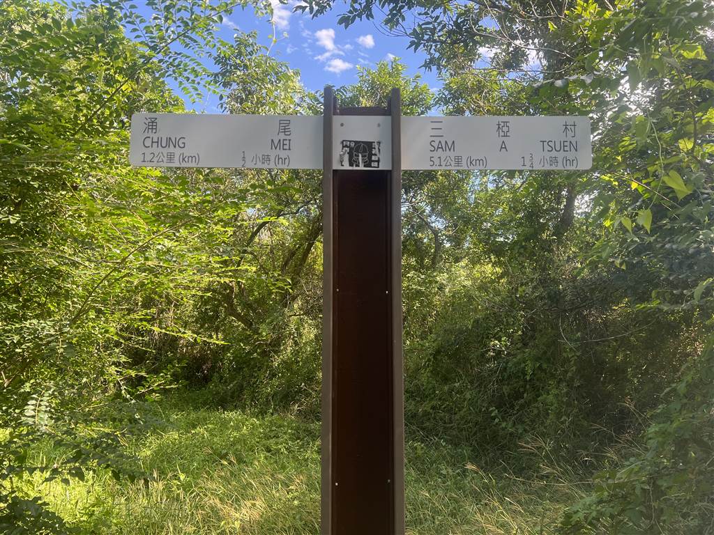
You will also see clear signs after you enter the trail. Follow the signs for Sam A Tsuen.
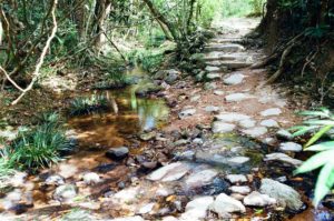
On this first part of the journey, you will pass by some streams. I could not resist the lure of clear streams and stopped by to take some pictures. As it turns out, there will be many such similar sceneries on this trail. See below.
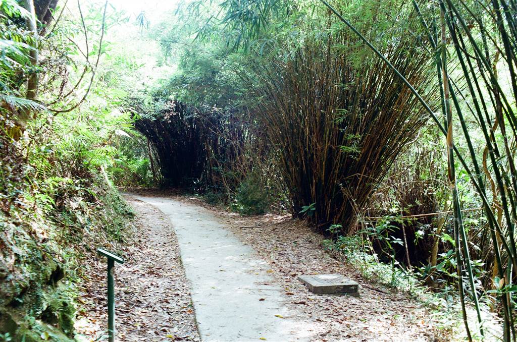
Photo: Bamboo groves along the path at the beginning of the trail.
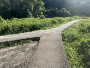
About twenty minutes into the trail, you will come upon this spot. Both roads will take you to Sam A Tsuen, but the path on the right, which is known as the lower path, is significantly more interesting in terms of views. Much of it is regular walking on level grounds. It therefore also takes longer.
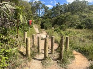
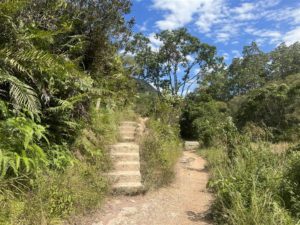
The upper path on the left will take you up the mountains, and there are some steps to climb. It is a quicker way, but perhaps not very interesting. Therefore it is a better option for the return journey.
The Villages of Sheung Miu Tin and Ha Miu Tin
About another 20 minutes later, you will see the signpost for Sheung Ha Miu Tin. These were once villages. According to the descriptions on site, “Sheung Miu Tin and Ha Miu Tin were originally inhabited by 80 Hakka villagers with surnames Tsang and Mo. However, the villagers had moved to Tai Po in the 1970s. Their old houses have all collapsed and engulfed by vegetation.”
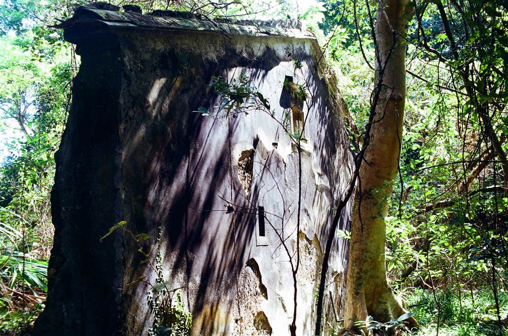
Photo above: I believe I came across the ruins of Ha Miu Tin Village.
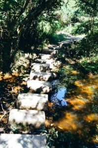
The Miu Sam Stream
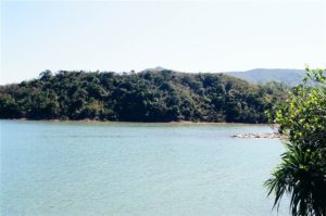
Yet another 20 minutes after the villages, I came across the beautiful site of Miu Sam Stream. Again, I take the descriptions on site here, “Miu Sam Stream refers to the northeast-bound brook that runs from Sheung Miu Tin to Ha Miu Tin and enters the sea at Sam A Wan.” Thus the name Miu Sam Stream.
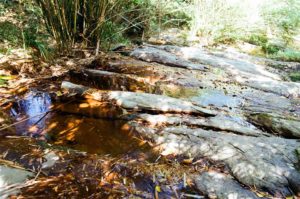
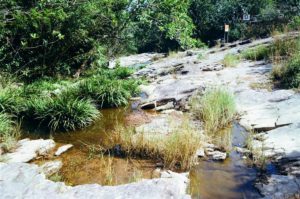
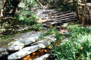
One very special feature on this trail is the existence of streams throughout the hike. I think the pathway was simply built along the way of the stream. The sound of the water was very conducive to meditation, and it really soothed the mind. The bridges and walkways on these streams also made beautiful sceneries. The trail had generous shades throughout, that is until the last half hour before you reach the Sam A Tsuen Village.

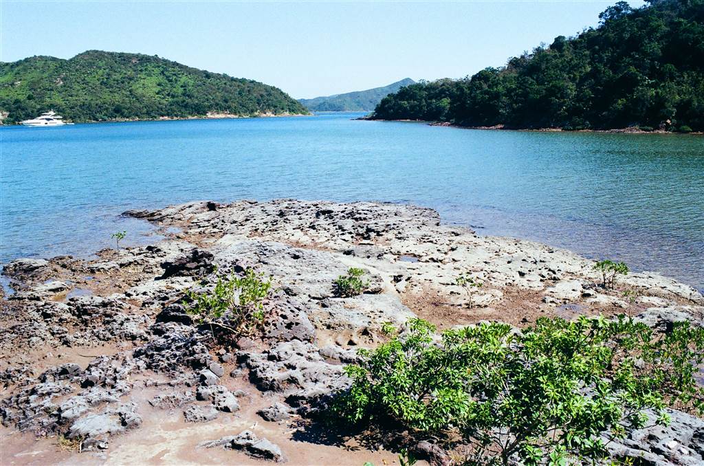
The last section of the trail before arriving at Sam A Tsuen Village is blessed with wonderful views of mangroves. I believe this is the largest area of mangroves I have seen in Hong Kong.
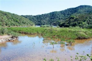
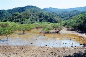
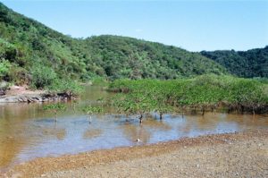
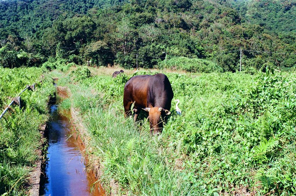
The existence of mangroves enables many kinds of wildlife, especially birds. And this is what I saw at Sam A Tsuen, a cow peacefully grazing while a little egret stands by it.
From the beginning of the trail to Sam A Tsuen Village, I took a little less than two and a half hours. That included rest time, and many photo-taking detours.
Sam A Bay, Sam A Tsuen Village and the Returning Journey
This is the view at Sam A Bay. It was sunny, breezy and just wonderful. I sunbathed here for a bit before heading into the Sam A Tsuen Village.
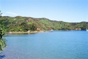
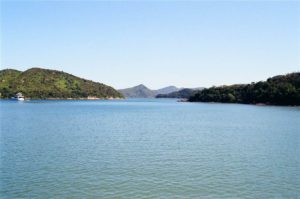
Photos above and below: Panoramic views at Sam A Bay.
At Sam A Tsuen Village, there is a restaurant named Fook Lee Tea House. It serves Hakka cuisine with some seafood selection. There are light meals as well as proper Chinese dishes.
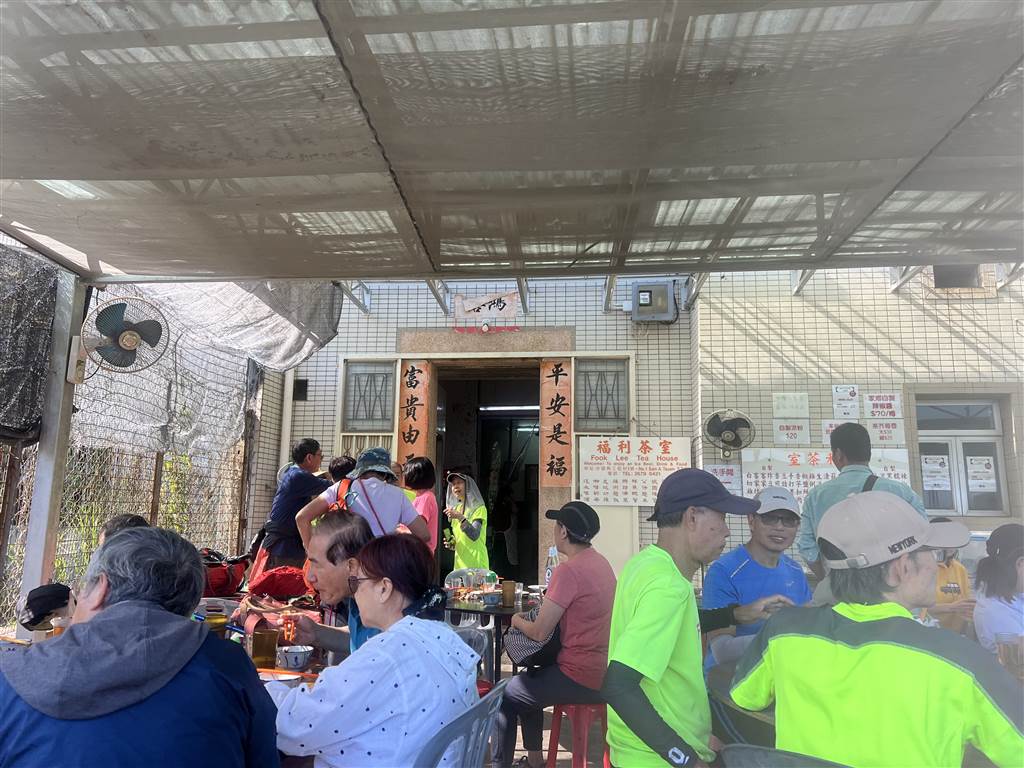
I passed by it without eating this time, for I had to rush back to Wu Kau Tang for the minibus at 3:45pm.
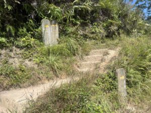
There are clear signs pointing you to the upper path (Wu Kau Tang Via Lai Tau Shek) that I mentioned above. The hike includes a bit of climbing up the hill, but by no means too rigorous. I spent an hour and fifteen minutes on this return journey. There was almost no photo-taking on this leg of the journey.
Autumn Hiking Reminders
The autumn weather has finally shown through in the dropped temperature. I did have to take an old fleece with me on this hike. The first essential for autumn hiking is plenty of water, (I brought more than 1L) as the weather is dry and it can be dehydrating. Then I suggest fellow hikers to wear layers, with short sleeves as the inner layer and some sort of thin jacket or a windbreaker. This trail is generously shaded throughout and if you leave the area in dusk hour it can become quite cold. Next is some snacks, although there is a stop in Sam A Tsuen with a restaurant serving proper food, the trail is rather long. Finally, as always, a sun-proof hat is very important.
How to Get There
By private car, there are some parking spots on the way to Wu Kau Tang, on Wu Kau Tang Road.
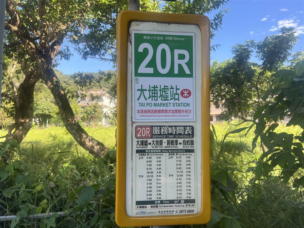
By public transport, take the green top minibus Route 20R at the Tai Po Market Station’s minibus terminus. Do note that the minibus only comes once every hour on weekdays. See the schedule below.
On Sundays and public holidays, take Bus 275R and get off at the final stop.
Sources
Historical descriptions on site.