Blog

Ubiquitously Uzbekistan – The Kyzylkum Desert and Lake Aydarkul

Ubiquitously Uzbekistan – The Kyzylkum Desert and Lake Aydarkul

We would be going to Bukhara on a private car in a five-hour drive from the Syyod Camp. We bid farewell to the staff at the camp and headed over to see the two wonders of Uzbekistan: the Kyzylkum Desert and Lake Aydarkul. Its sheer 

The Hung Lau of Tuen Mun

The Hung Lau of Tuen Mun

Hung Lau, meaning “Red House,” is a lesser-known historic building tucked away in the hinterland of Tuen Mun. It has a special place in the history of Hong Kong. Although its significance is not widely known, it bears a critical remembrance as a home base 

Hung Heung Lo Fung – A Perfect Photo Taking Spot for Hong Kong’s Skyline

Hung Heung Lo Fung – A Perfect Photo Taking Spot for Hong Kong’s Skyline

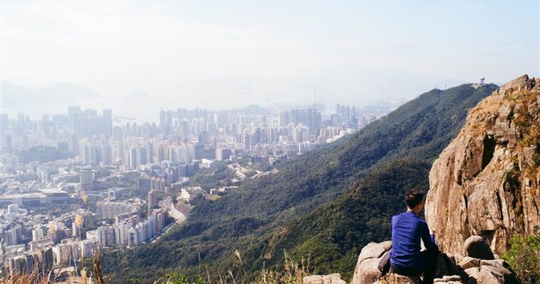
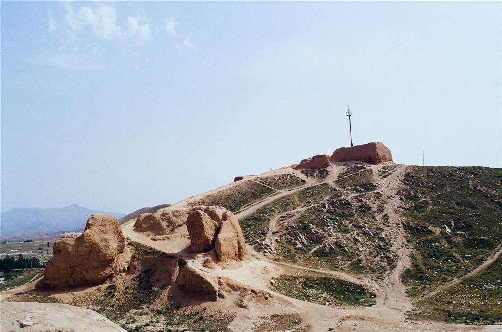
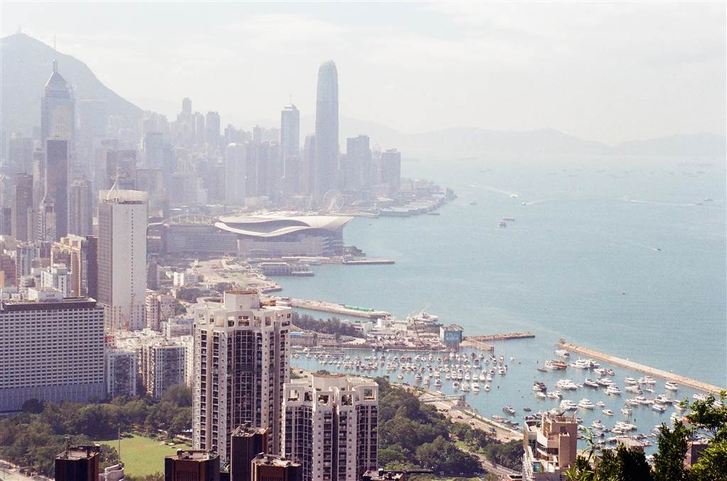
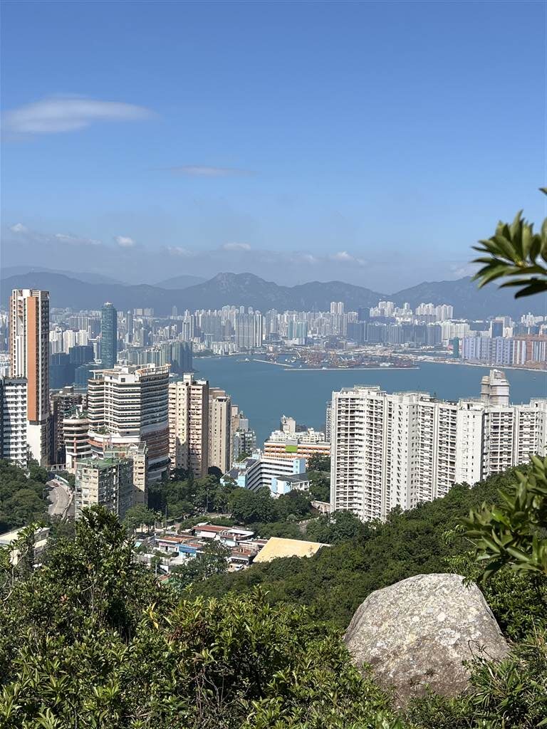
The netizens of Hong Kong are very familiar with Hung Heung Lo Fung, a vantage point that is perfect for viewing and taking photographs of Hong Kong’s famous harbor skyline. At an altitude of 228 meters, the small peak provides unobstructed views on the west side of the Victoria Harbor. It also shows the somewhat less pleasing views on the east.

Photos: A Panorama of Hong Kong’s Skyline on the Western Side

The Easy Way Up

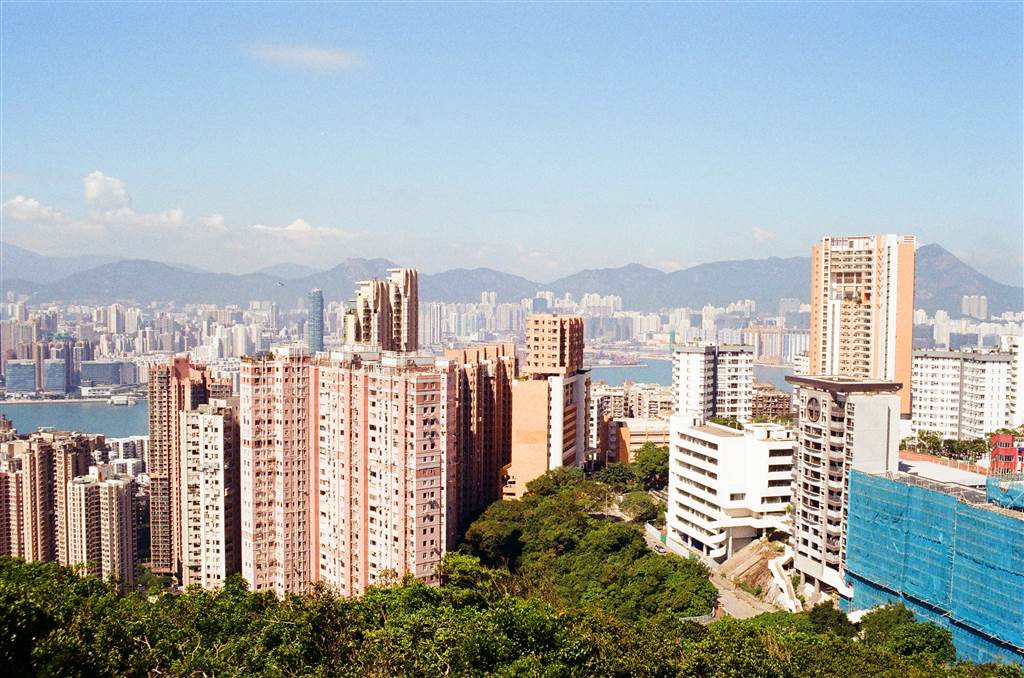
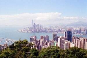
Photo: View of the East Side of Victoria Harbor at Hung Heung Lo Fung

For the hiking of this day I chose the hard way up the Hung Heung Lo Fung, and I will share about this way below. I do not recommend the hiking route that I took, however. For the purpose of simply climbing 228 meters to see the views, there is no need to do it my way.

There is a very convenient shortcut from the city up to Hung Heung Lo Fung. From Paterson Street in Causeway Bay, take Green Top Minibus Route 25 to Braemar Hill.

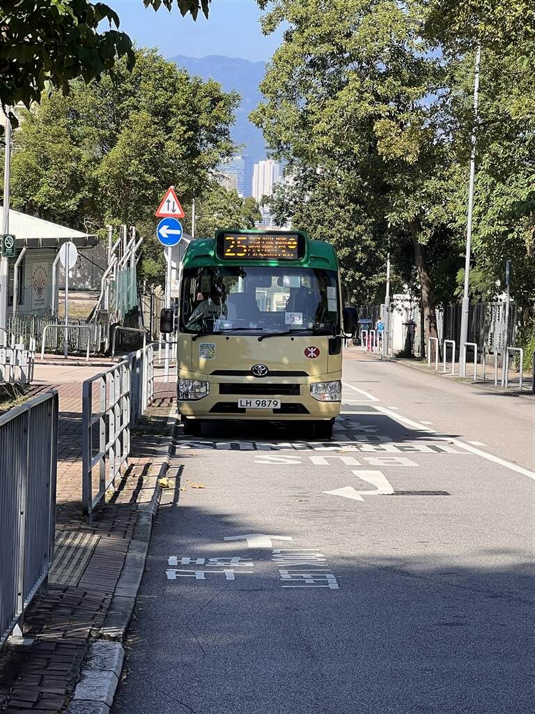
Get off at the final stop, then walk toward the St. Joan of Arc Secondary School. At the end of Braemar Hill Road, there is a set of stairs leading down first and then up. Keep on climbing for about 10-15 minutes, and you will arrive at the path that will lead you to Hung Heung Lo Fung. Once you finish climbing this flight of stairs, make a right. Keep on going for about three minutes, and the path up Hung Heung Lo Fung will be on your right when you come across the first intersection.

Note that, once you are up, there are two viewing points. When you arrive at the first one, just look up and you will see the signpost above you. Find your way up that signpost for even more significant views.

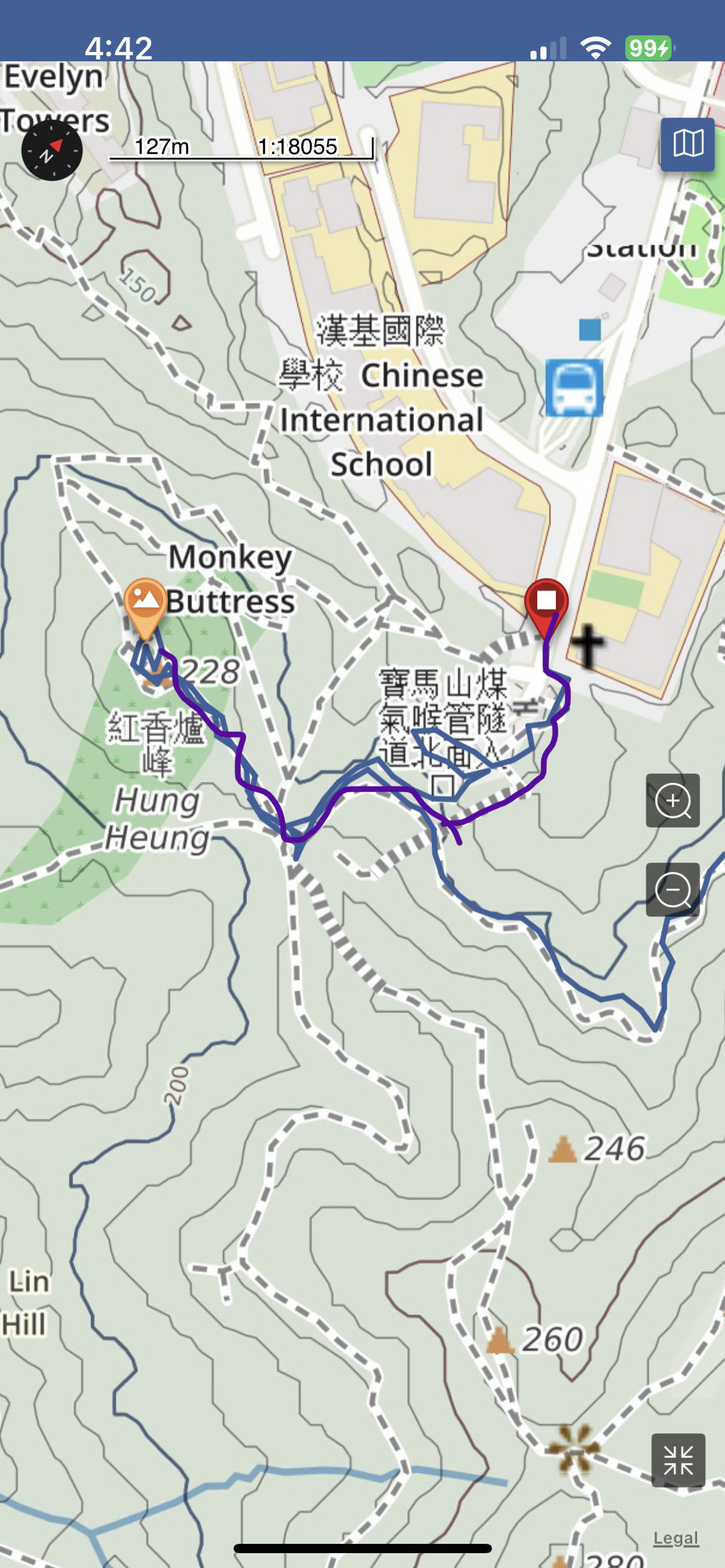
Map: The Easy Way Up (the Purple Line)
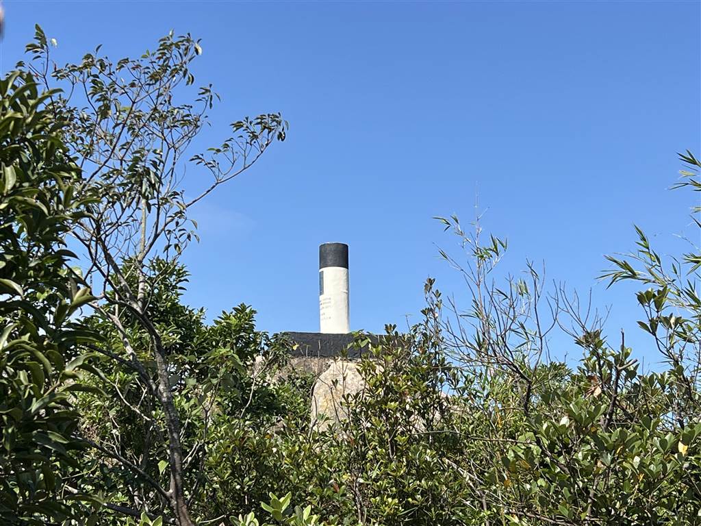
The Hard Way Up

For the purpose of hiking a significant way to Hung Heung Lo Fung, I began the walk from Quarry Bay and went westward toward the Braemar Hill area. The difficult part came in a small, unnamed hill somewhere in between, where I had to engage on all fours to climb, with a pathway that was somewhat obscure. I did clock in quite a bit of exercise within a very agreeable weather that day, however. I was glad that I did eventually make it back to civilization.

I shall not share the way on this entry, for somewhere along I myself did not know which way I went and how I made it back. However, when I was still on the right track in the earlier sections of the walk, I did visit an interesting heritage site.
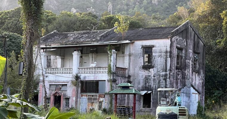
The Woodside

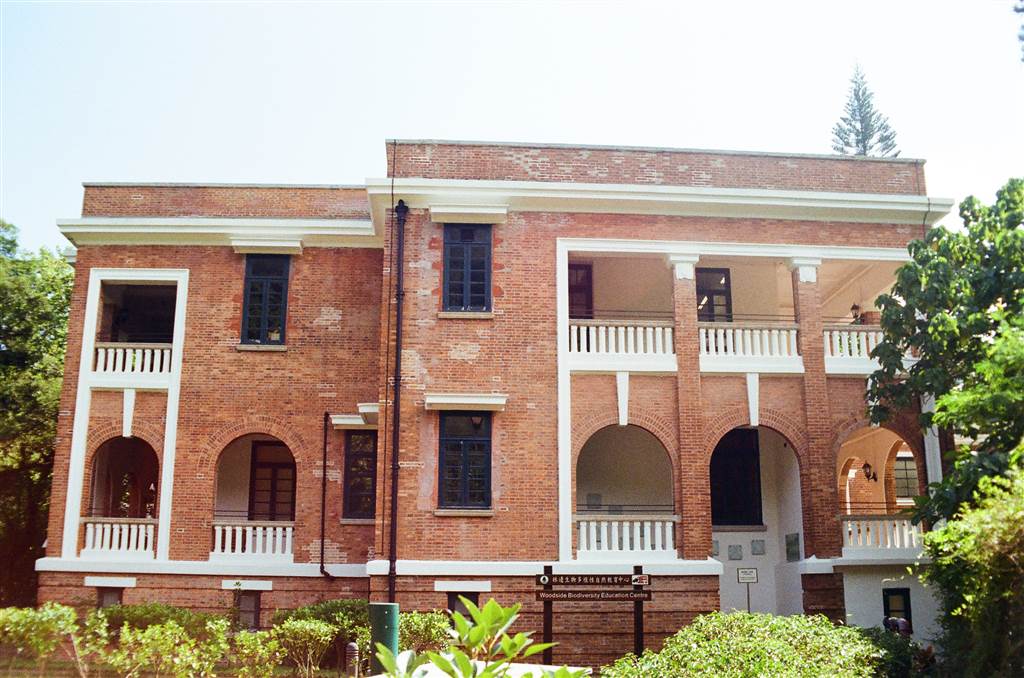
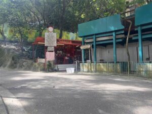
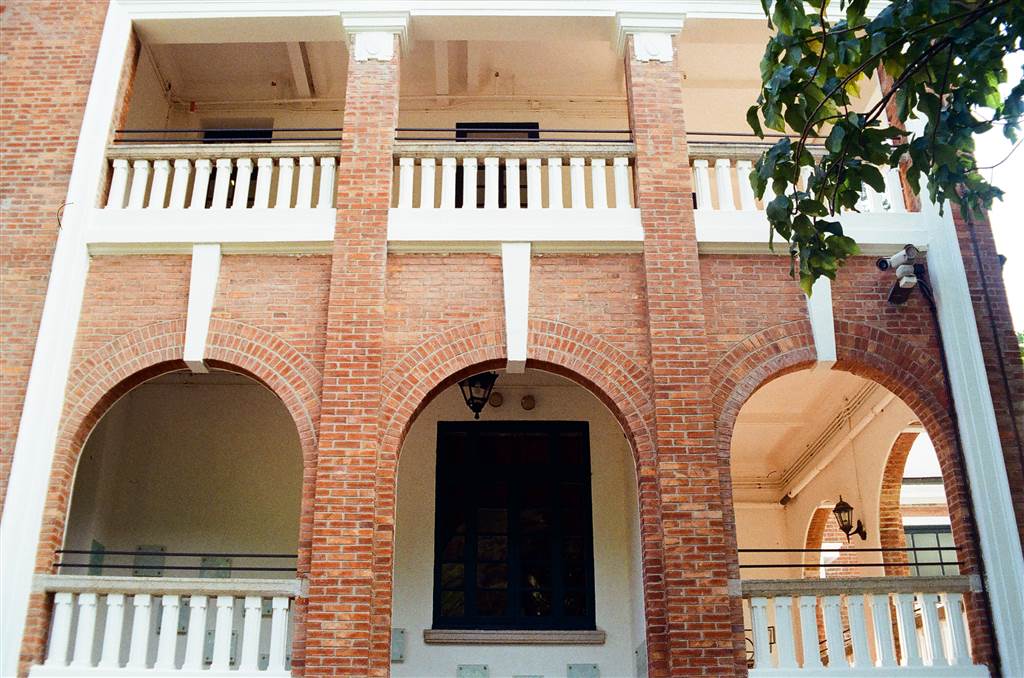
The heritage site of Woodside lies on Mount Parker at the beginning of this trail. The Swire Group built it during the 1920s, originally intended to house the quarters for the European staff in the mid-management of the Swire Group.

The red brick building features two stories with an arched veranda. The foundation is built from granite, and the interiors were fitted with wooden floors and staircases and window frames. The original building had two separate sections.

The first Woodside was destroyed by the Japanese forces during WWII. The Swire Group then restored the building between 1947 and 1951. During this restoration, the former two separate sections were joined together. In 1972, when the Taikoo Sugar Factor closed, the building became vacant.

The building has been restored and managed by the Hong Kong Government since 1976. Since 2012, it opened its doors for public visits as the Woodside Biodiversity Education Centre. Please note that the museum closes on Tuesdays except on public holidays. I happened to visit on a Tuesday so I did not get to see the exhibits. Please check the opening hours of the Biodiversity Education Centre here.

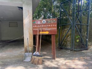
The Woodside is a Grade II Historic Building in Hong Kong. The address of Woodside is 50 Mount Parker Road. To visit, head up from Quarry Bay MTR station toward Mount Parker Road and walk on a gentle incline for some 15 to 20 minutes.

Photos: Mount Parker Road on the Way Up to the Woodside and the Sign for Woodside
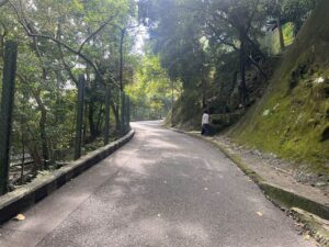
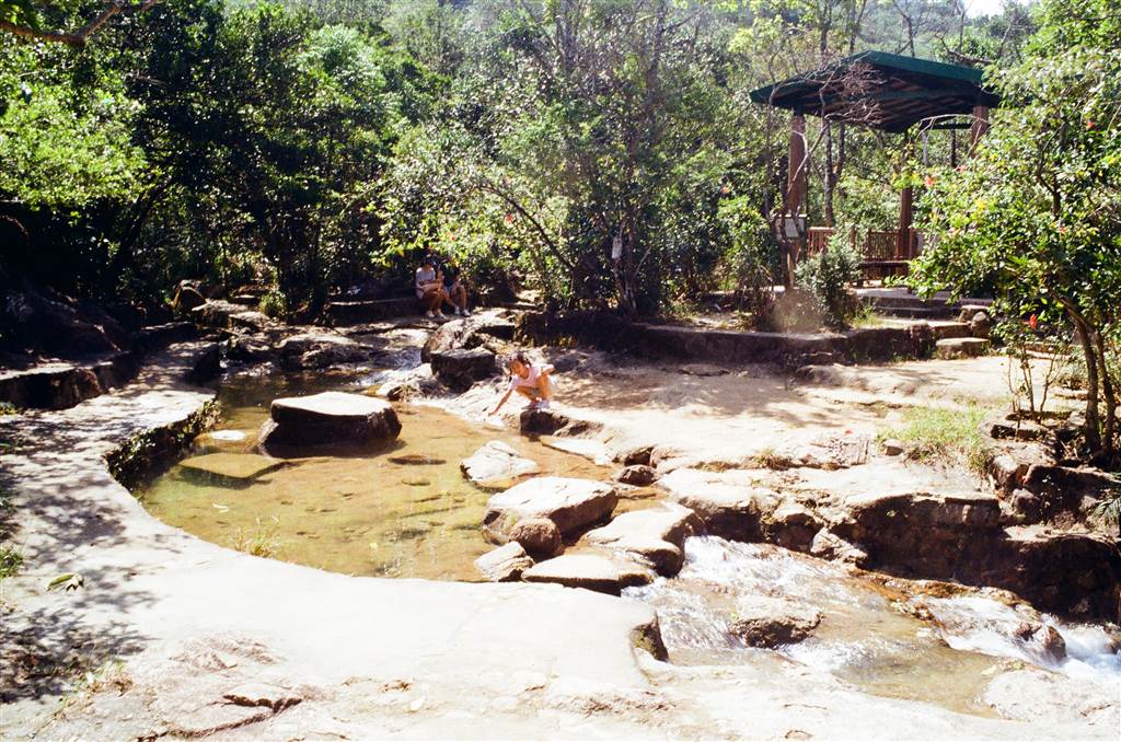
The View

Some of the views along this path were quite nice.

Sources

The Wikipedia on the Woodside (Chin).

Ubiquitously Uzbekistan – The State of Affairs in Uzbekistan

Ubiquitously Uzbekistan – The State of Affairs in Uzbekistan

We spent a day and a half hiking with Mr. S and he shared quite a bit about his thoughts on the world as an Uzbek. I had this incredible privilege to learn about some current affairs in this region, which is not widely known 

A Three-Hill Traverse in Yuen Long

A Three-Hill Traverse in Yuen Long

The hiking trail of the day would take us through three hills in Yuen Long, namely Ho Hok Shan, Cheung Ngau Shan and Tseng Hang Shan. The trail took us three hours because of the slightly hot weather (still, in November), and the traverse of 

Ubiquitously Uzbekistan – Syyod, Day Two at the Nuratau Mountains and a Walk in the Village

Ubiquitously Uzbekistan – Syyod, Day Two at the Nuratau Mountains and a Walk in the Village

We rose early. The hike of the day will be a full 7-hour hike onto the peak of the Nuratau Mountains Range. The ascent is between 900 meters to 1690 meters, almost 700 meters of altitude to climb.

At 1690-Meter Altitude

Unlike hiking in Hong Kong, this hike at the Nuratau Mountains has the advantage of requiring no stairs. All of the ascent was done on slopes, and they were mostly gentle. The most difficult was actually the windiness on the mountains. The wind was so strong I almost couldn’t breathe. It was fortunate that I brought enough clothing to cover my head and my face.

On our way, we did see some really nice wildlife. In the first part of the hike, there was a lot of wild rhubarb. Mr. S took some and showed me.

Without knowing how it tasted, I sucked the juice, and it was incredibly sour. I could see it as a great source of hydration though, in case anyone did not bring enough water for the hike.

Around 1pm, we made it to the very peak of the Nuratau Mountains. We had a quick lunch.

We also saw more kinds of animals grazing on the pastures, including horses.

The descent was rather strenuous with a whole lot of unclear paths. I thought the descent was harder than the ascent. But having made it back to the camp, we then quickly gathered our cameras and headed over to the Syyod Village. This was part of the itinerary for the day.

A Conversation with Mr. S

Mr. S is a native in the Syyod area. At 34 years old, Mr. S has taken up his second career by serving as a mountain hiking guide for the Syyod Camp. He speaks very good English because he studied business in the university. His first career was in private banking. About seven years ago, however, he decided that he wanted to do something he loved to do. He returned to his home town and became a mountain hiking guide for foreigners at the Syyod Camp. It is not as lucrative a business as being a private banker, but he loves his job now.

Naturally we discussed what good hiking options there are in Central Asia. He told us about a five-day hiking trip in Kyrgyzstan, and that is the country that is best known for hiking amongst the five in Central Asia. He said that the best mountainous hiking in Uzbekistan is actually close to Tashkent.

We asked him about his faith. He abides by Islam but he does not actively pursue it as a personal conviction. Like the Czech conversant that I met in Samarkand, Mr. S takes Islam as an innate part of the culture that he grew up with. Its influence in this part of the world is very strong. Although in principle Uzbek men can have four wives, he only has one, and he does not intend to take more than one wife. It is unusual for an Uzbek man to have four wives although it is allowed under Islam. There are two main reasons. Firstly, the man must treat his wives equally. This means that whatever provisions or gifts he gets for one, the other one is entitled to the same. Secondly, the first wife must agree to an Uzbek man’s taking of a second wife as well. From this conversation, I sensed that having multiple wives is simply too difficult both financially and emotionally.

Since we were on this subject, we brought up the equality of women in Uzbekistan. He said that women have equal status in Uzbekistan. They work and they are respected. Our observations on this trip does seem to confirm the status of women in the Uzbek society. The native Uzbeks do wear a hijab, but they are clearly free in their movements. They talk to strangers in the most genuine sense of hospitality and cheerfulness. And we also met Uzbek women travelling in groups. The ways that Uzbeks conduct themselves suggest that the country is moderate in its observance of Islam. Needless to say, the existence of other religious groups (many of which have long historical roots) in the country also indicates that there is a general acceptance for the diversity of beliefs.

The Syyod Village

When we passed by the Syyod Village on our way to the camp, I noted an observation to my friend. The structures that we saw were so poorly constructed that they were worse than the village homes we saw in China when we studied there 20 years ago.

It was dusk hour and we took a leisurely walk in the village. A family was just heading out and the children gave us a warm welcome. They are just like the Uzbeks we know: kind, attentive, curious, hospitable, and genuine.

Mr. S explained to us the seemingly primitive, shoddy structures that I noticed when I was on my way to the camp. He said that the mud-looking material is exclusively for livestock. That explains it.

Then he pointed out at some really nice structures nearby, these ones I did not notice. Indeed, those are the nice village homes for the villagers. Apparently, a few members of the household (and their immediate families) typically share a big structure. Multiple generations live together.

Mr. S showed us the 500 year old tree that stands next to the village mosque.

We bid farewell to Mr. S as we finished our dinner. He gifted us a bottle of Uzbek Vodka.

Ubiquitously Uzbekistan – Syyod, Day One at the Nuratau Mountains

Ubiquitously Uzbekistan – Syyod, Day One at the Nuratau Mountains

Early in the morning we bid farewell to Samarkand. We would be heading to the Nuratau Mountains for a significant change of scenery from the ancient sites of Uzbekistan, and stepping into a wonderful embrace of its wilderness instead. A driver from the Syyod Camp 

Midnight In Peking

Midnight In Peking

Midnight in Peking, a book by Paul French Midnight in Peking has all the captivating elements that make it an amazing work of historical fiction. Based on a true crime that occurred in a time long past in the last century, it fuses history, diplomatic 

An Easy Half-Day Trip in Yim Tin Tsai

An Easy Half-Day Trip in Yim Tin Tsai

I have plans to venture out to all the walkable islands lying in Sai Kung’s eastern waters. Since the weather turned somewhat cooler, I have visited the Sharp Island twice, once to hike and another time to visit its Kiu Tau Islet at low tide. This time I am visiting Yim Tin Tsai, and Kau Sai Chau is in the plans.

How to Get there

At the Sai Kung Pier, seek out the ferry carriers that offer service to Yim Tin Tsai. I found the Salt and Light Preservation Center, and its $80 return ticket to Yim Tin Tsai includes the entrance fees for the Heritage Center and the Salt Pans. Remember to keep the heart sticker with you for free entry, otherwise you will be charged $20 each to visit those sites.

A trip in Yim Tin Tsai alone will take about three hours or so. You must plan ahead if you would like to also go to Kau Sai Chau from Yim Tin Tsai (the two islands are walkable in one visit via the connecting Jade Girdle Bridge). At both locations there is a last departure time for ferries back to Sai Kung before sunset, perhaps the very latest at 5pm.

For an island of this size, Yim Tin Tsai has a good list of exceptionally interesting features to offer tourists. I will walk through these spots in the island in this entry.

Photo: Quite a number of old Hakka Houses lie in ruins. This one shows beautiful artwork.

Yim Tin Tsai, meaning “little salt pan,” is just what its name suggests. The Salt Pans were certainly the highlight of this outing for me. Otherwise the island has had a long history of settlement, industry and religious heritage.

The History of Yim Tin Tsai

The first inhabitants in this small windswept island on the eastern waters of Hong Kong were of Hakka origin. The ancestor Chan Meng-tak came from Changle in Guangdong and first settled down in the salt fields of Sha Tau Kok. He then came to Sai Kung. The early villagers have inhabited this island as early as 1670. They took on farming, livestock rearing, fishing and salt-making as their trade. The Chinese character “tsai” in the island’s name means “homeland,” eliciting the idea that one must not forget his roots.

During the mid-19th century, foreign missionaries set foot in the island. They established the church in the island and the islanders all turned to Christianity. This explains the absence of a Tin Hau Temple (or ancestral halls) on the island, and instead the existence of the St. Joseph’s Chapel. In this respect, Yim Tin Tsai’s conversion to Christianity is similar to the experience of the Christians of Ap Chau (the residents of which turned to Christianity much later, in the 20th century).

Photo: A Former Home of a Father

It was a general trend that the rural and island dwellers in Hong Kong would eventually leave their rustic homes to work in the cities. A lot of them also went abroad. That was a natural result of the economic takeoff during the 1980s and 1990s in Hong Kong. By the 1980s, there were only four residents still living in Yim Tin Tsai. When the very last family also moved out in 1998, the island became wholly deserted.

But the villagers of Yim Tin Tsai remembered their roots. In 1999, the newly-elected village head Chan Chung-yin led the efforts with some other villagers and Father Chan Chi-ming to revitalize the island. They restored all the key structures on the island, most notably the St. Joseph’s Chapel. Since 2004 or so, they have organized tours with heritage, religious and industrial themes on the island. Their efforts are truly laudable.

A Walk in Yim Tin Tsai

St. Joseph’s Chapel

The St. Joseph’s Chapel was built in 1890. It has a simple, humble and minimalist appearance, a very basic kind of Italian Roman Catholic style. It stands in a very picturesque location, at a relatively high point of the island.

The interior is also minimalist and peaceful.

The Heritage Center

The building that now gives home to the Heritage Center is the former school grounds of Ching Bo School. It has provided education for the children of Yim Tin Tsai beginning in the 1920s. It finally closed its doors in 1997, like so many other rural schools in Hong Kong. The revitalization of Yim Tin Tsai has found a very good way to renew the spirit of education in this very site.

The Heritage Center shows the traditions of Hakka by exhibiting a large and interesting collection of daily goods. Furniture, tools, cooking utensils, clothing, and excavated archaeological artefacts—all came alive as testaments of Hakka life in this showroom.

Do note that both the St. Joseph’s Chapel and the Heritage Center close between 12:00 to 1:30 for lunch.

The Pavilion Lookout on Kau Sai Chau

Photo: On the way to the Pavilion, the Living Water Well used to supply fresh water to the islanders.

At this vantage point, looking north you will see the St. Joseph’s Chapel and the Catholic Cemetery. Looking south, you will see the only public golf course in Hong Kong, run by the Jockey Club. The golf course is in Kau Sai Chau’s northern section.

The Jade Girdle Bridge

The Jade Girdle Bridge has existed since the 1950s. It provides a throughway between Yim Tin Tsai to Kau Sai Chau. It took a whole village mobilized to build this connecting bridge, originally intending to serve the interests of Yim Tin Tsai villagers by providing access to the markets in Kau Sai Chau.

The Salt Pans of Yim Tin Tsai

The Industrial History of Hong Kong Group claims that salt production was Hong Kong’s oldest industry. It is far older than the first settlement of Hong Kong’s indigenous clans. It is also far older than the other two ancient industries that Hong Kong was known for, incense wood production and pearl fishing.

The salt trade was the lifeline for Yim Tin Tsai’s villagers for two hundred years. However, about one hundred years ago, the village’s salt trade slowly declined. They faced intense competition from cheaper salt exports from mainland China and Vietnam. With the advance of better transportation, the tax collector was able to visit the island to collect tax. The salt trade was no longer profitable. By the 1920s, the salt pans in Yim Tin Tsai have all but disappeared.

If you follow my route, the Salt Pans would be the very last point of interest in Yim Tin Tsai. Perhaps the first thing to note about the Salt Pans is that the salt that they produce is of edible grade.

Then the rest of the learning is about how sea water is channeled into the salt pans and eventually turned into salt. During high tide, sea water rises, and passes through the mangroves into the north gate. It is then channeled through the ducts into the storage and drying pools. The staff there said that the mangroves act as a natural filter for the water. By the time the water gets to the ducts, the mangroves have already filtered out some of the larger impurities in the water.

Once the sea water reaches the storage pool, it sits there and the slow process of sun and air drying begins. Only when the saltiness of the water reaches 25-28 Baume degrees (of saltiness) does the salt crystalize and form.

The most amazing is the illustration of the salt’s crystalline structure by the staff. When you look closely at the salt, you see clearly that it comes in an interesting two-square structure. There are diagonal lines connecting the four corners of the outer square and the four corners of the inner square.

There are two pieces of artwork on the island that drew inspiration from this very special crystalline shape of the salt. One is right at the Ching Bo School Heritage Center, the other is at the Salt Pans.

The staff has to be very mindful of the weather. For the salt that has already been crystallized but not yet completely dried, they must store them in the big blue rubber barrels on rainy days to prevent rain from diluting it. One way to test whether the salt is completely dried is to shake the salt on the rectangular containers. Signs of the crystals sticking to the pan indicate that there is still moisture.

I asked the staff there whether I could purchase this salt. He told me that because this current setup is for demonstration purposes only, the amount that they produce is only about enough for little tubes of salt souvenirs that they sell at the reception office, which is located right off the pier. This salt is certainly not meant for making my pasta, although the products here do go through testing (and pass) for the level of heavy metals. Finally, surely that this salt pan is for the sake of heritage preservation, but it is still the only salt-producing venue remaining in Hong Kong now.

Beginning in 2010, there were plans to revitalize the salt pans of Yim Tin Tsai and to bring back this industrial heritage that once thrived in the island. The whole process of reconstructing the salt pans with all the working facilities took five years. In 2015, the Salt Pans came back to life, although in a much smaller scale than originally envisioned due to the enormous costs involved. It took millions.

According to the Hong Kong Tourism Board, “in 2015, the historic salt pans earned a UNESCO distinction for conserving an important piece of Hong Kong’s industrial heritage.”

An Afternoon Coffee at Chef De Yim Tin

There are two restaurants on the island and they are both very close to the pier. I wanted coffee so I chose to sit in the air-conditioned dining space in Chef De Yim Tin. There is another restaurant operated out of a tent, in a half-open setup. There you will find traditional Hakka tea cakes (sort of like a mochi), silken tofu dessert and other Hong Kong styled drinks.

The Sai Kung Arts Festival

This year, the Sai Kung Arts Festival takes place between November 15th 2023 to January 4, 2024 in the various islands of Sai Kung, including Sharp Island, Yim Tin Tsai, Kau Sai Chau and High Island. I was told that there will be new pieces of installations coming to the islands for this arts festival. Please check this website for more information.

For now, there are already a number of interesting artworks in the island from the last festival.

Sources

Descriptions on site in Yim Tin Tsai.

Hong Kong Tourism Board, Yim Tin Tsai: Hong Kong’s Little Salt Pan.

The Industrial History of Hong Kong Group, Salt Production, Oldest Industry in Hong Kong, Tai O.

The Sai Kung Arts Festival.

Ubiquitously Uzbekistan – The Shah-I-Zinda, Crown Jewel of Samarkand

Ubiquitously Uzbekistan – The Shah-I-Zinda, Crown Jewel of Samarkand

We took a quick lunch at the Siab Bazaar and then headed toward the Shah-I-Zinda. On our way, we passed by the Hazrati Hizr Mosque. The Hazrati Hizr Mosque The Hazrati Hizr Mosque was built in 1823. Although as compared to the myriad other ancient