The first hike of 2024 was on January 1st and I went to the Grass Island. I wanted a reasonable walk with views of the ocean. In Chinese we like to say “ride the wind and break the waves” to mean that one will stare down all challenges in life and climb to its peak. That was my intention for 2024.
The Ferry Schedule
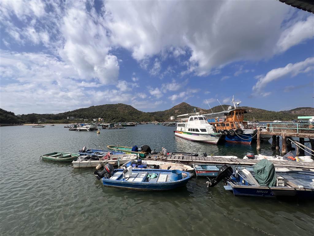
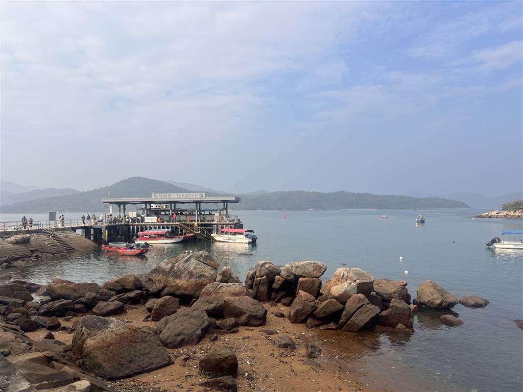
There are two ways for one to reach the Grass Island. First is from the Ma Liu Shui Pier, the second way is from the Wong Shek Pier in Sai Kung. I went to the Ma Liu Shui Pier because it is a lot easier to go there from the University MTR Station.
The first sail to Grass Island leaves the Ma Liu Shui Pier at 8:30am. You will arrive at Grass Island at a little before 10am. On public holidays, there is an additional ferry that leaves the Ma Liu Shui Pier at 12:30pm. For return, on public holidays there are three departure times, one at 11:10am, 1:45pm and 5:30pm. See below for the schedule.
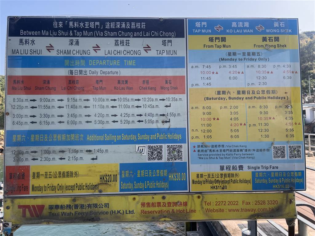
Note that on non public holidays, there are two return ferries to Ma Liu Shui, leaving Grass Island at 11:10am or 5:30pm. You are likely only able to get on the 5:30 return because leaving at 11:10am would not give you sufficient time to tour the island.
There are always some ferries run by locals that will take you to Wong Shek Pier throughout the day, but schedules are not set.
The Story of Grass Island
In Chinese, the Grass Island is known as Tap Mun. Its name refers first to the idea of a “Buddhist Tower,” for the word “tap” in Cantonese means a tower. This reference came from the Balanced Rock. Because the Balanced Rock looks like a Buddhist pagoda tower from afar, and the Tap Mun Cave at its north looks like a door, the people called the Island “Tower” and “Door,” and thus Tap Mun became the Chinese name of the Grass Island.

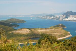
Situated at the mouth of Tolo Channel and within the Mirs Bay, the Island has a size of 1.69 square kilometers and it is an inhabited island. Even as early as the Ming Dynasty, the Grass Island was a mid-way stop for vessels sailing between Guangzhou and Huizhou and Chaozhou.
Unlike other islands, where significant efforts have been made to highlight the island’s heritage, the Grass Island does not come with any official introduction of its culture and history. Although there is no heritage museum that provides a coherent narrative of the Island’s history, unlike in Yim Tin Tsai, Ap Chau or Kat O (Crooked Island), the villagers in Grass Island do have cultural practices that are well known. I had the opportunity to talk to a villager there to learn about the people of Grass Island.
At the peak of its population, the Island had about 3,000 villagers living there. Now the number of residents there are about 100, and they tend to be retirees. There are two distinct lineages in Grass Island, one group of villagers being Hakka, and another group being shui ga, meaning the boat people. The villages are of mixed surnames.
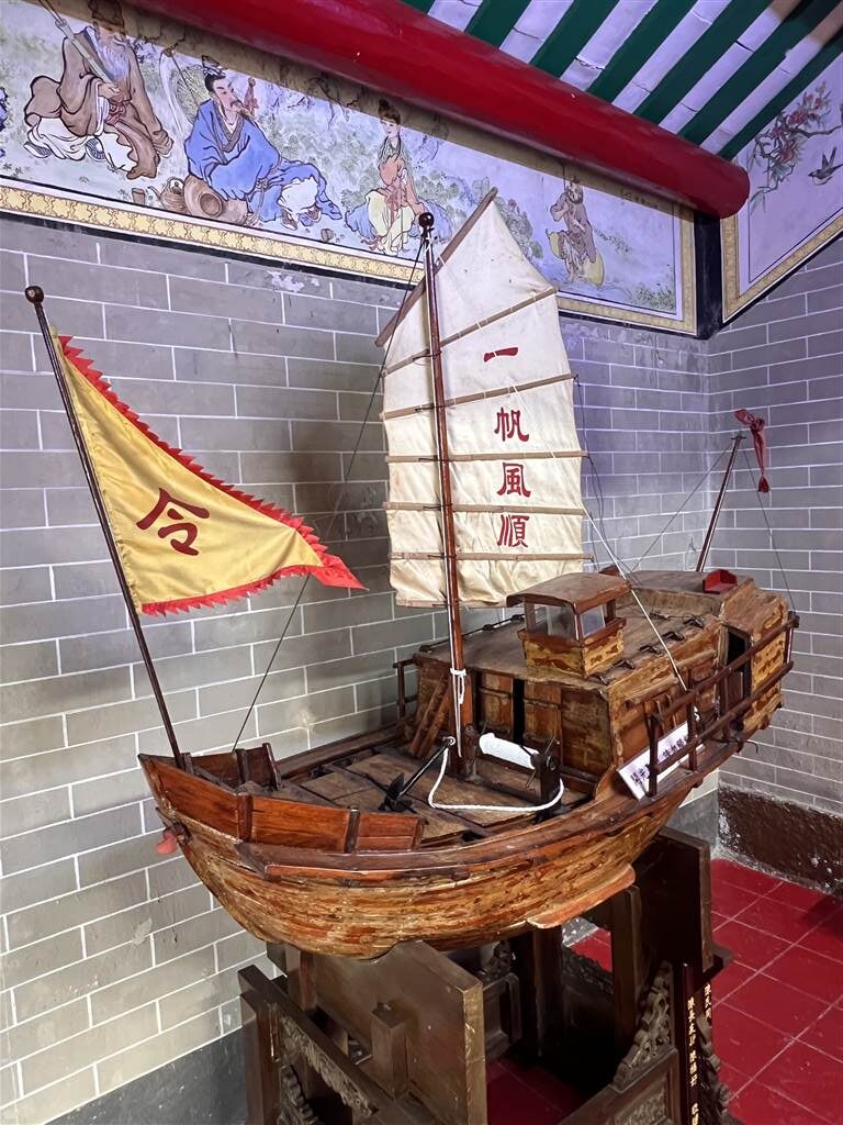
In terms of cultural activities, the Grass Island certainly celebrates the birthday of Tin Hau, the Sea Goddess. The villager told me that the Tin Hau celebration costs a few million dollars each time. There are usually free ferry rides, a stage has to be set up for a traditional performance, and two vegetarian meals per day for two days for the villagers. All these involve significant expenses, and the villagers abroad, mostly in the United Kingdom, will be seeking donations to cover these expenses.
Like so many villagers in the New Territories, many people have migrated abroad. Many of them ended up in the United Kingdom. They never forget their roots, however. In next year, the Grass Island will celebrate the anniversary of the villages’ establishment. This event will bring together many former villagers again for a merry good time in the Island.
Some Geological Features of Grass Island
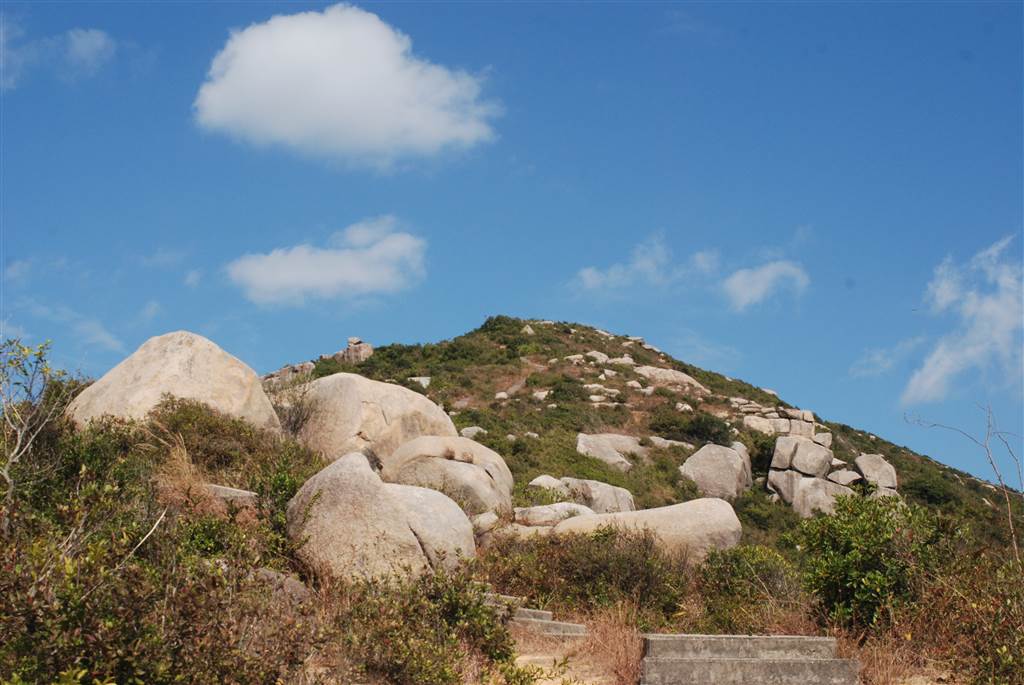
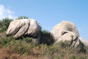
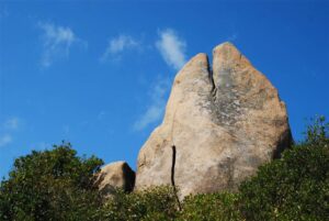
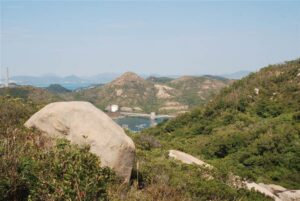
There are three geological sites of significance in Grass Island and I managed to see one, which is the Balanced Rock. The three are namely Balanced Rock, Lung Keng Gun (Dragon’s Neck) and the Tap Mun Cave.
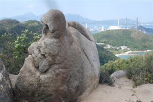
The Balanced Rock was made of hexagonal volcanic rock columns, which were formed from the volcanic activities that took place 143 million years ago. Volcanic eruptions spewed large amounts of volcanic ash. After a period of cooling and contraction, vertical hexagonal columns were formed. With sea and wind erosions that took place in the following tens and thousands of years, some rocks broke away from the mass and stood independently, just like the Balanced Rock does now.
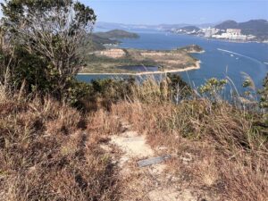
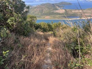
A Walk in Grass Island
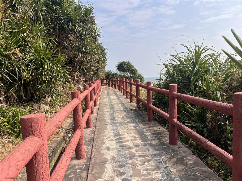
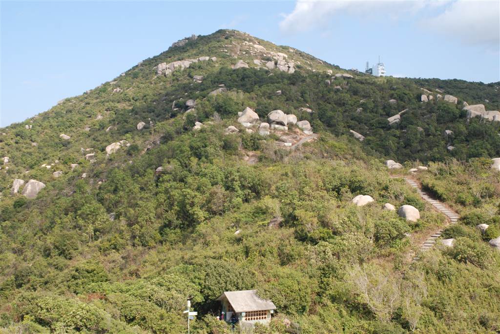
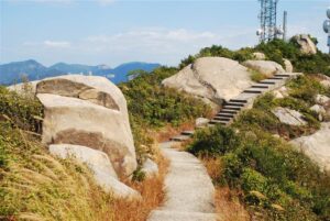
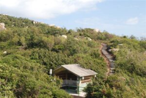
Allow for two hours if you want a good, leisurely walk on the loop trail of Grass Island. More time is necessary if you want to reach the Balanced Rock and the Tap Mun Cave.
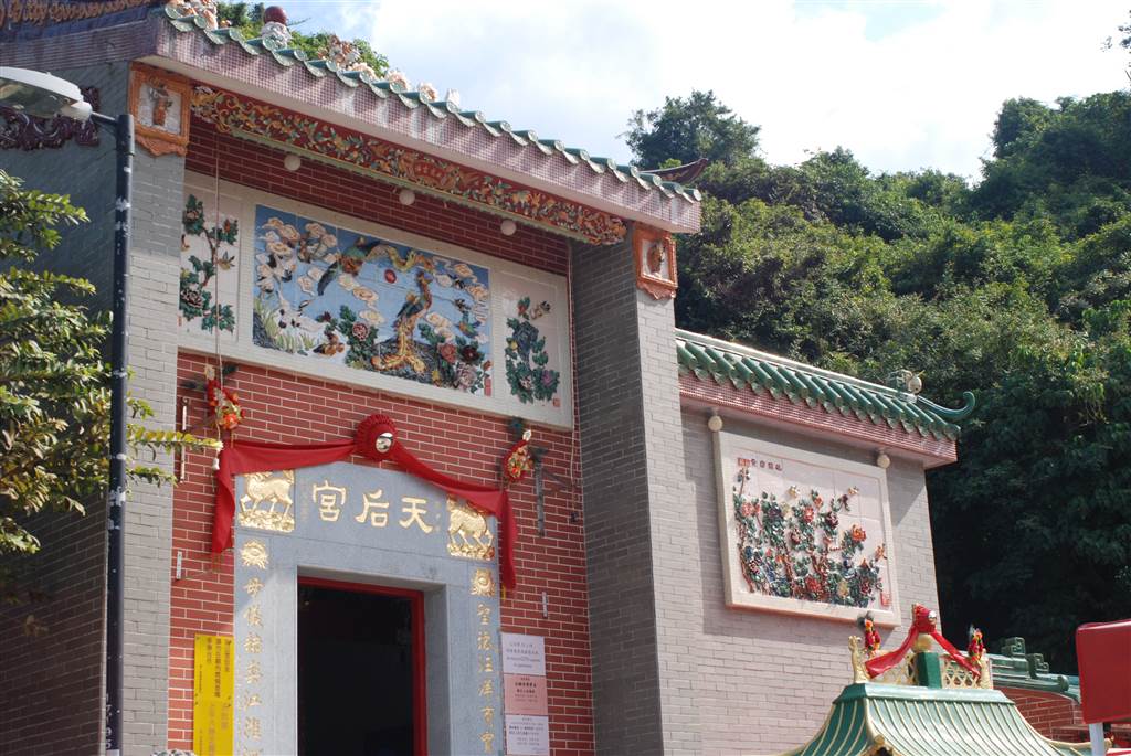
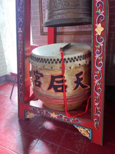
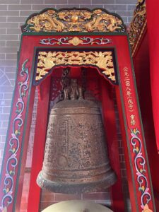
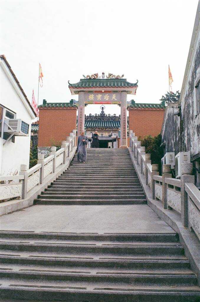
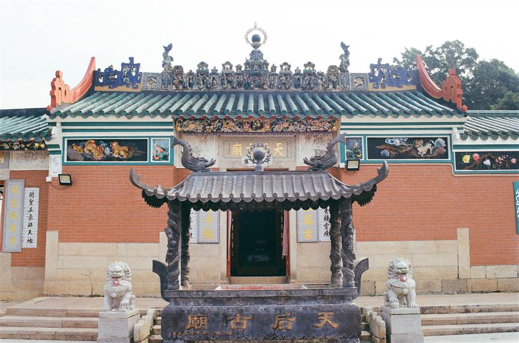
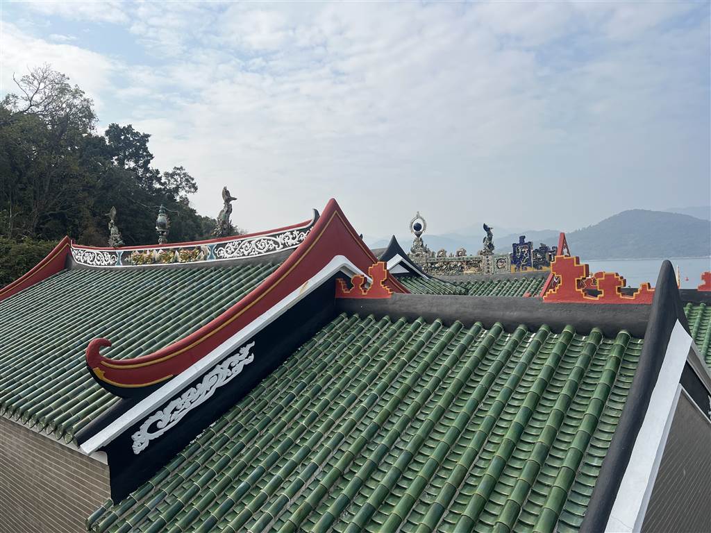
The Tin Hau Temple
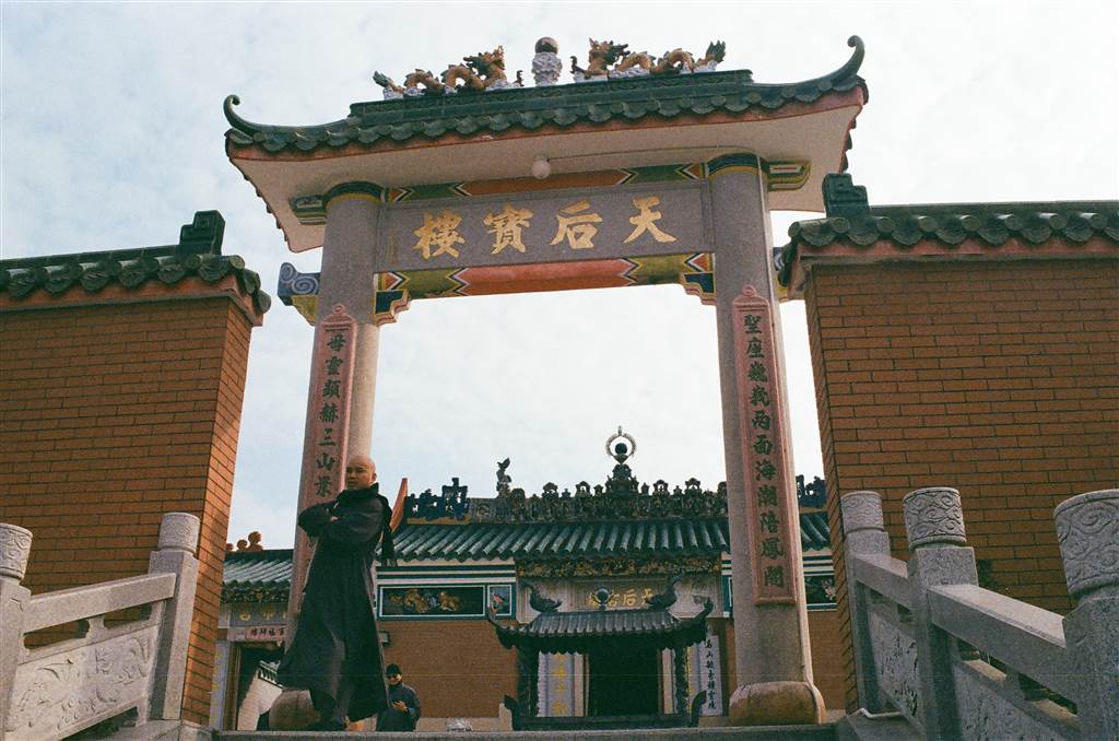
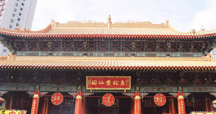
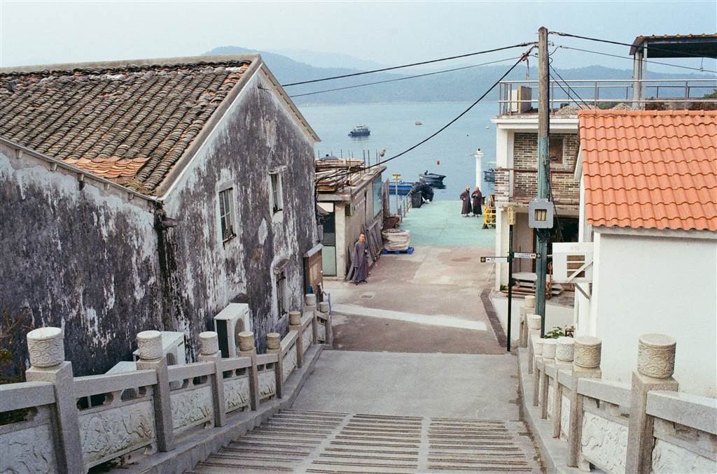
At the Pier, turn left to begin the walk. You will soon find yourself at Tin Hau Temple. The Tin Hau Temple of Grass Island was built during the early Qing Dynasty. A plaque inside the temple indicates that as early as the 8th year of the Qianlong Reign (1743), the Tin Hau Temple has been in existence, established by the fishing merchants of the region.
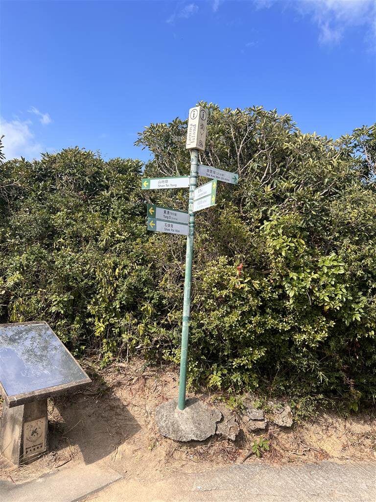
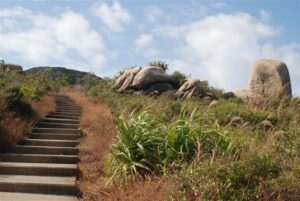
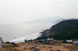
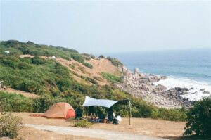
On the left side of the Tin Hau Temple, the trail continues. Follow signs for Balanced Rock throughout this section of the trail. Soon you will be climbing a gentle incline to reach what the locals call the Grassland. This is where most campers find their spots (more below).
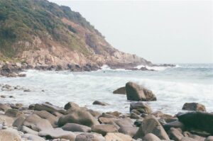
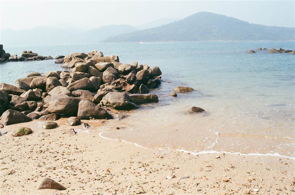
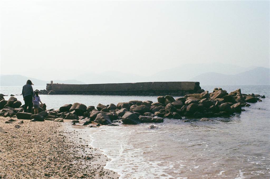
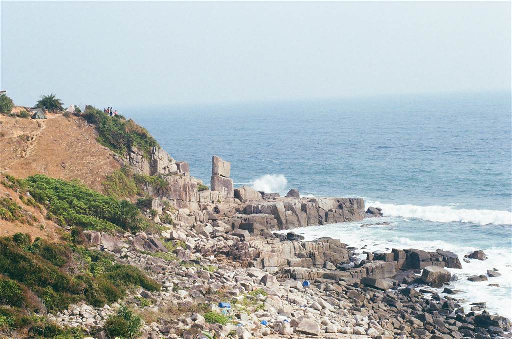
The Kung Pui Pebble Beach
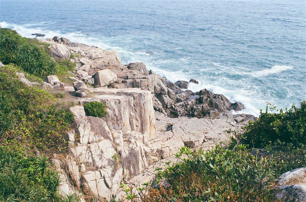
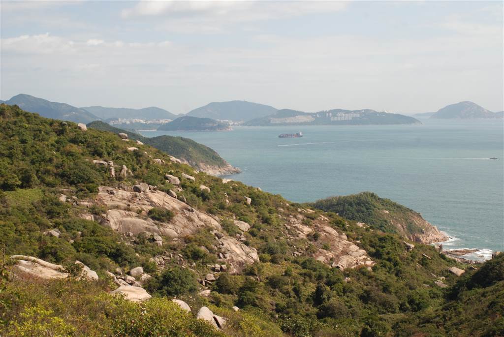
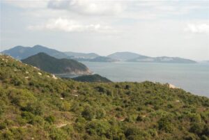
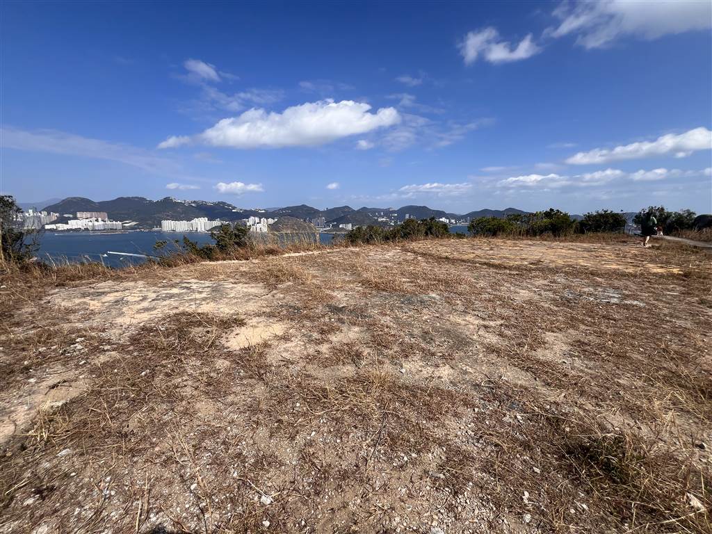
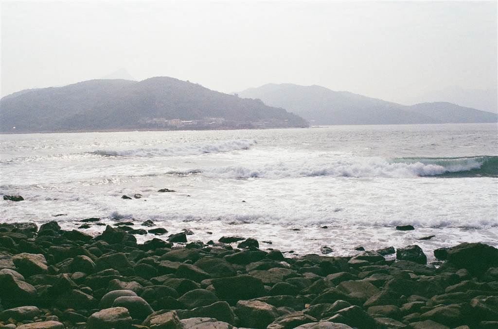
The Kung Pui Pebble Beach lies on the eastern side of the Grass Island. It offers wonderful views of the ocean, and I spent about 20 minutes there hearing the waves. It is a pebble beach so walk carefully amongst the large and small rocks.
The Balanced Rock
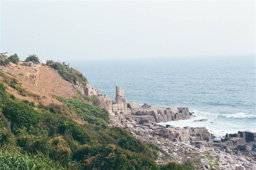
The Balanced Rock of Grass Island is a natural wonder, where two large rock boulders sit on top of each other and do not fall down.
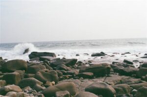
Ta Long Pai
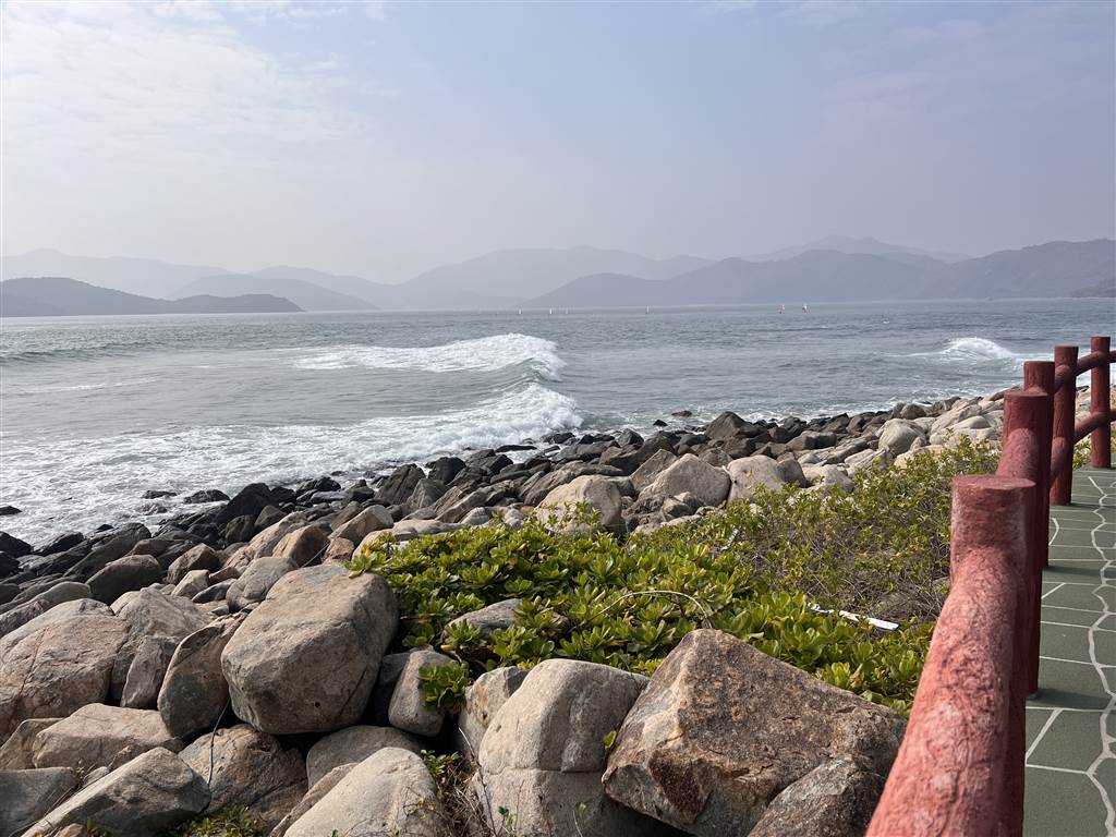
In this segment of the walk, you will enjoy the sights and sounds of the raging waves of the ocean against the coastline. In Chinese, Ta Long Pai means a “row of beating waves,” and true to its name, this coastal walk offers exceptional views of such.
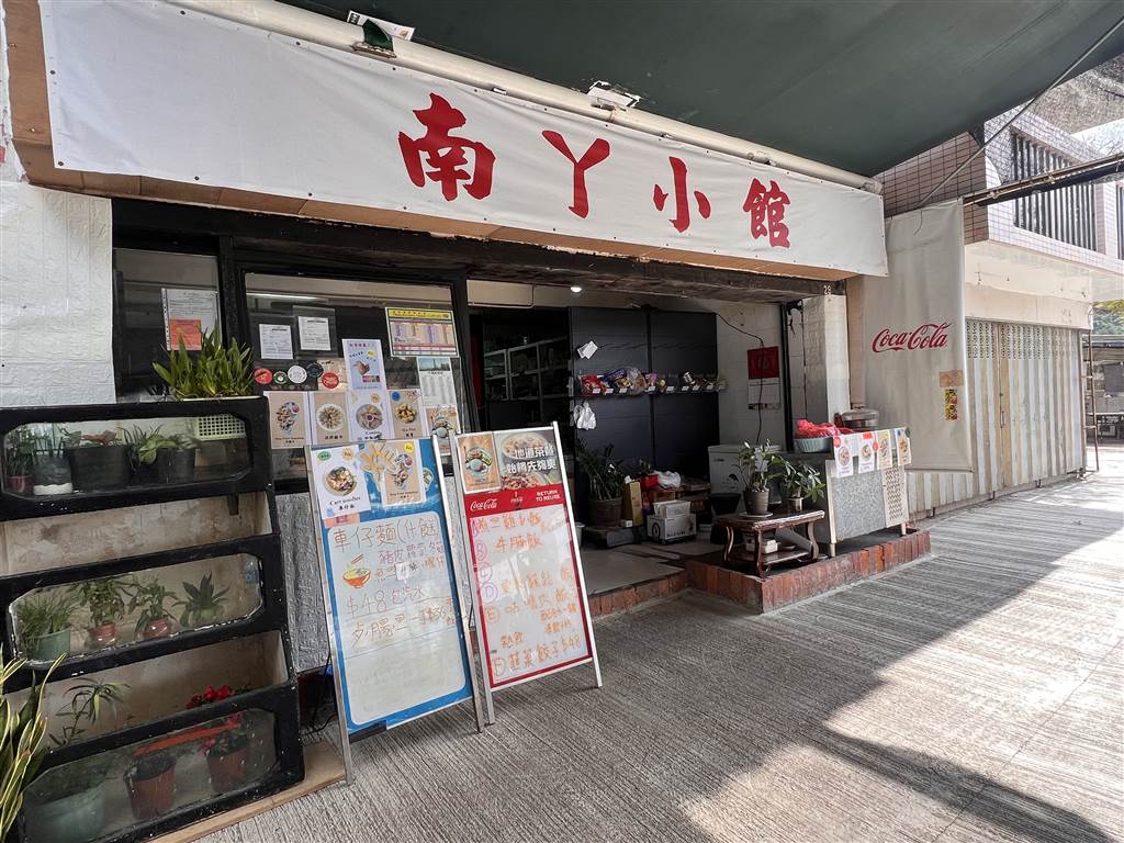
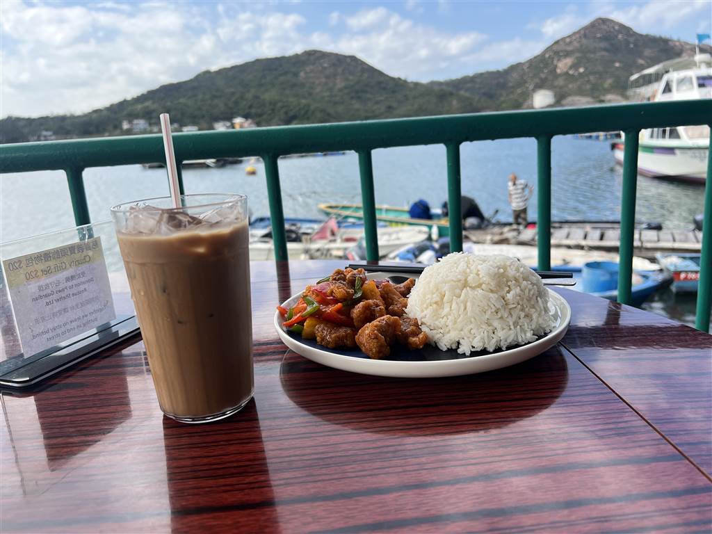
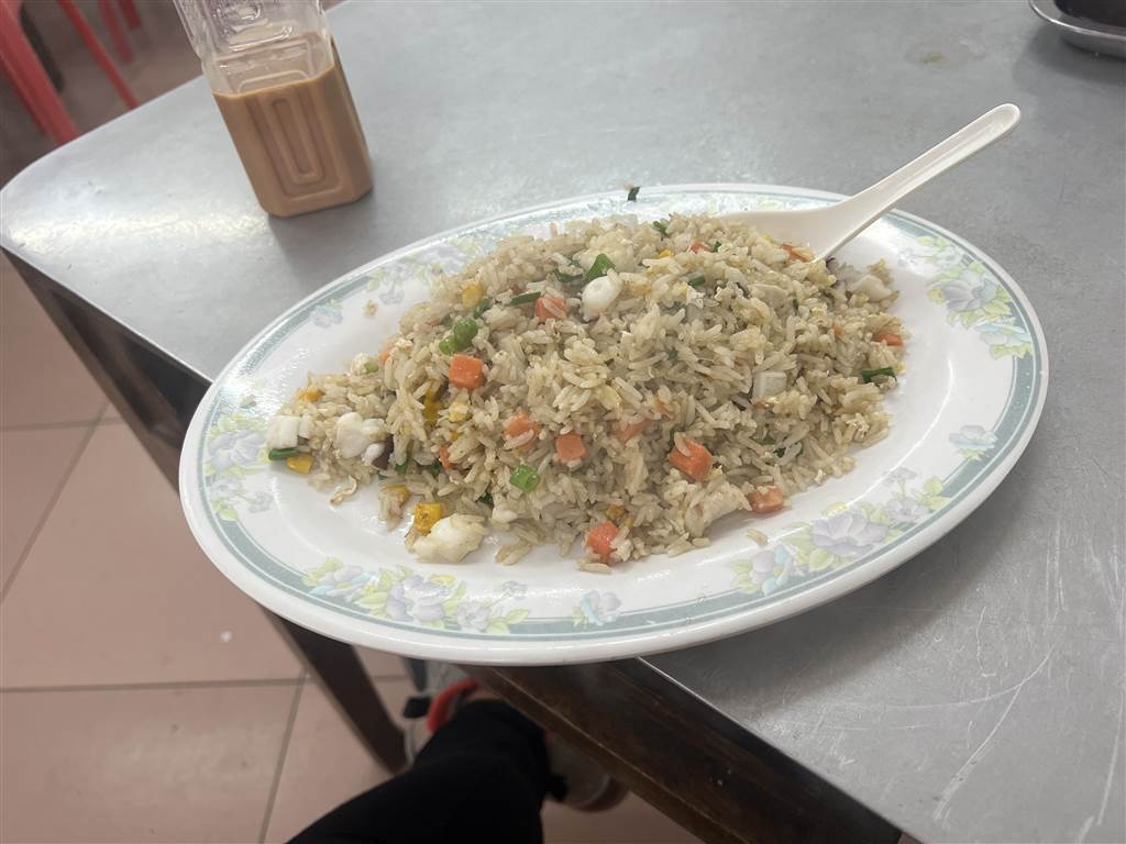
Finally, a Much-needed Lunch
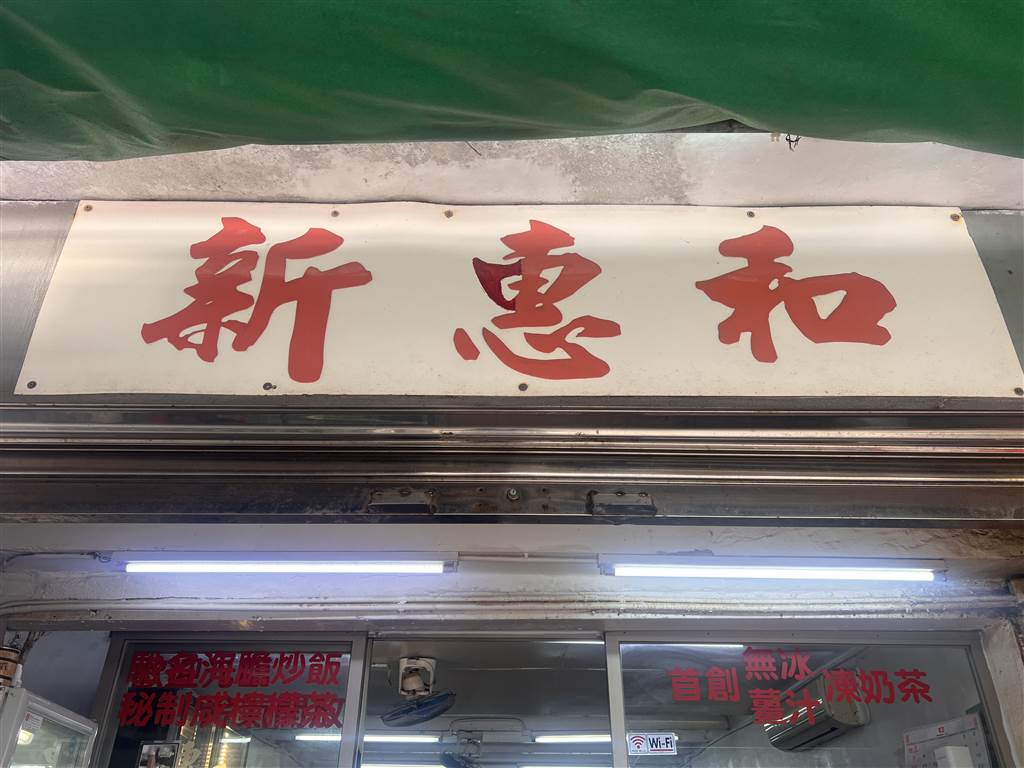
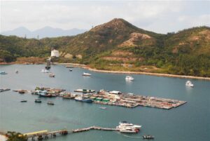
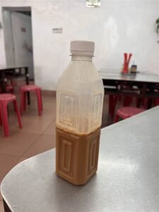
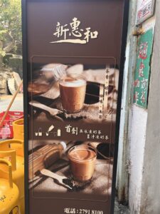
There are two main restaurants on the coastal strip and I chose Xin Huihe because it offers the very special ginger milk tea. Usually, tourists would pick the sea urchin fried rice but I thought it was too expensive. I ordered a squid fried rice with shrimp paste. It was a wonderful lunch.
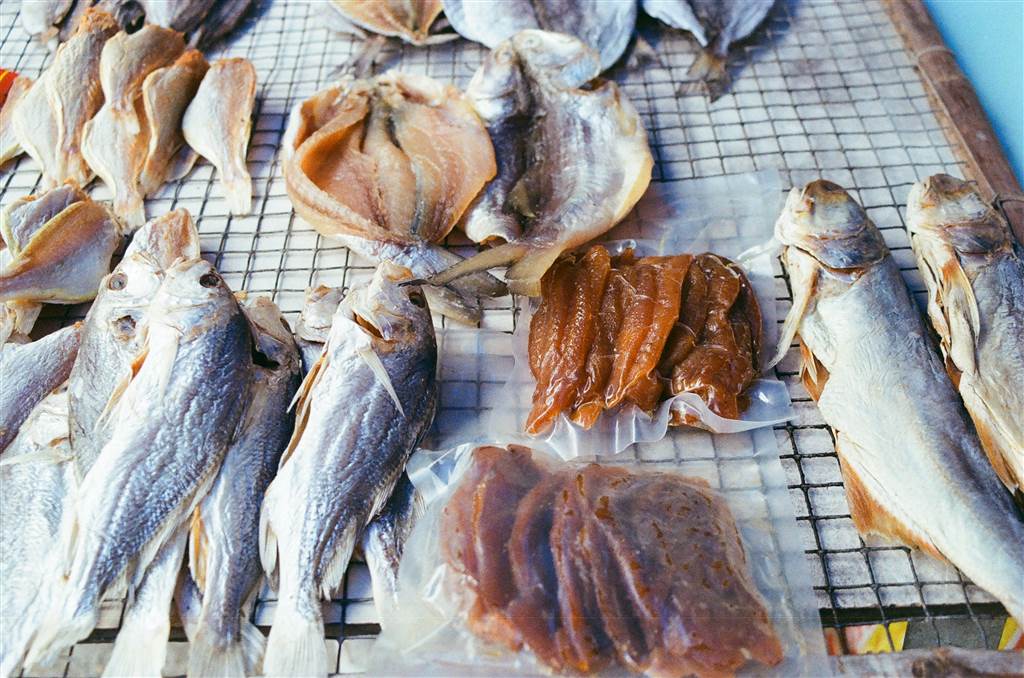
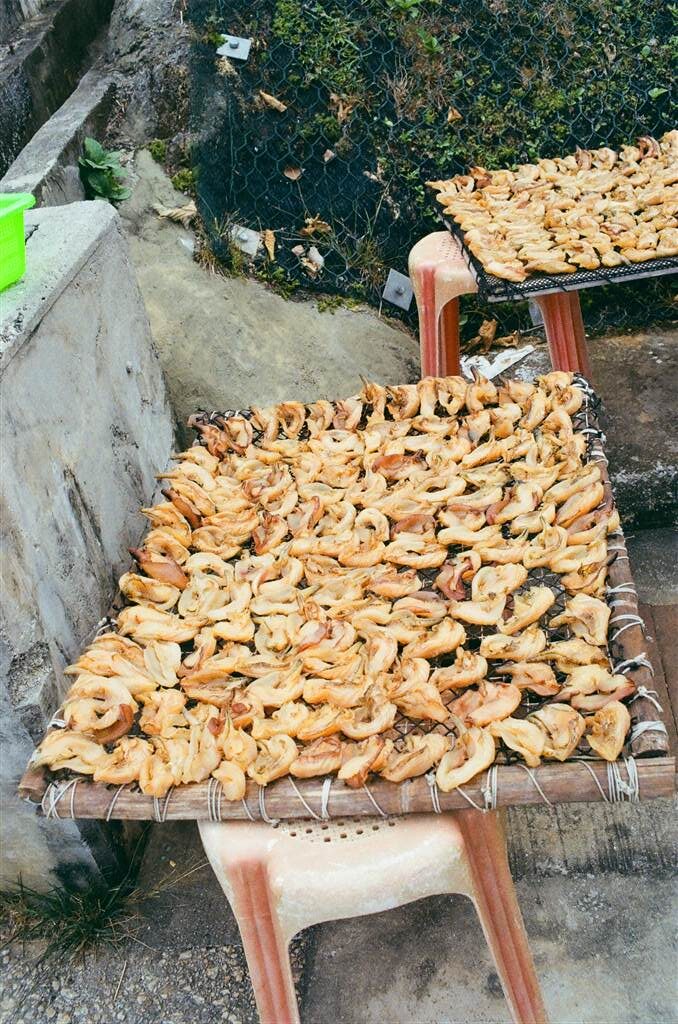
The shops in this part of the island also offer some really interesting dried seafood for sale. They should be wonderful soup ingredients.
Camping in Grass Island
Of all the outlying islands that I have been in Hong Kong, I have seen the most number of campers at Grass Island. On the day that I visited, the grassland was taken over by campers and cows, respectively. There is one camping shop on the island, from which you may call in advance to arrange for camping supplies rental. The TMDB provides camping supplies as well as water sports gear for campers and adventurists. Look up their Facebook page for details. The shop is located in the restaurant area on your way to the Tin Hau Temple.
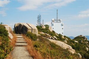
Finally, the Mau Ping Shan shows on the TrailWatch App with seemingly clear paths. It lies in the northern section of the Grass Island. However, it is certainly not advisable to hike up this hill. The villager told me that there were quite a few instances where firemen were called in to rescue hikers that were lost in that area. The pathways are not clear once you ascend the hill.
Sources
The Wikipedia on Tap Mun (Chin).
Hong Kong National Geopark (2nd Ed.,) (2011) at 242-243.