Blog

The Story of Soy – Yuet Wo in Kwu Tung Village

The Story of Soy – Yuet Wo in Kwu Tung Village

Although Yuet Wo as a brand name may not readily ring a bell with most Hong Kong people, most Hong Kong people have had its soy sauce in one form or another. Currently based in Kwu Tung Village in Sheung Shui, Yuet Wo supplies its 

The Hau Mei Fung Ancestral Hall in Kam Tsin Village

The Hau Mei Fung Ancestral Hall in Kam Tsin Village

The Kam Tsin Village is a village close to the northwestern edge of the Fanling Golf Course in Sheung Shui. Kam Tsin, in Cantonese, means money. Indeed, my first impression of Kam Tsin Village was that this is a well to do village. From what 

Tsang Tai Uk

Tsang Tai Uk

In the indigenous villages of Hong Kong there is this idea of the “wai,” wherein the villagers built their villages surrounded by a brick wall. “Wai” means a girdle, and these villages are usually referred to as “Wai villages,” or “walled villages.” These walls were meant to be fortifications, chiefly to protect the villagers from both pirates and wild animals.

I have visited a number of Wai villages in Hong Kong, including the famous Kat Hing Wai of Yuen Long, the Hakka Wai of my home village of Tsung Pak Long, the Lo Wai of Lung Yeuk Tau in Fanling etc. I do find the Tsang Tai Uk of Shatin to bear some unique features as compared with its counterparts in the New Territories.

The History of Tsang Tai Uk

The reasons for Tsang Tai Uk’s unique features in its layout are closely tied to its history. The founder of the village, Tsang Koon Man, built this walled village in 1847 with the typical village layout of his own Hakka hometown in mind. He came from Ng Wah.

Proper historic accounts tell the story of Tsang Koon Man, a mason in trade, who had a quarry in Sai Wan Ho and a masonry in Shau Kei Wan. He began his business by serving as an apprentice in the then-thriving quarry businesses in Lei Yue Mun. Then he founded the Sam Li Masonry. At the time, the Hong Kong Government had plans for many infrastructure projects that required granites. As such he prospered greatly from his businesses.

Legend has it that one day, some pirates approached Tsang Koon Man with 12 large urns of dried salted fish. They asked for $800 per urn, and so Tsang bought them. He later found out that, beneath the dried salted fish, the urn contained all silver and gold coins. The pirates never returned and he kept these 12 urns of treasures.

With enormous wealth, he decided to contribute to the good of his clan by constructing a village.  Although the surname Tsang does not belong to one of the “five great clans” of the New Territories, this clan of the Tsang’s have settled down in Hong Kong for 300 years, as early as the 17th century.

As residents of Shatin, the Tsang’s were also prominent members of the community. They supported the construction of a few key infrastructures and buildings in the New Territories, including the neighboring Che Kung Temple, the Kwong Fook Bridge in Tai Po, and most importantly, the construction of the Tai Chung Bridge in Shatin, which provided throughway over the Shatin Sea (now Shing Mun River) during the early 20th century.

The construction of the walled village began in 1847 and it took some twenty years to complete. During WWII, the Tsang clan provided refuge to the people that were seeking refuge in Hong Kong from the war in the mainland. As such, people gave it the respectable name of Tsang Tai Uk, meaning the Big House of the Tsang Clan.

Tsang Tai Uk is rated a Grade I Historic Building.

Architectural Features of the Tsang Tai Uk Walled Village

The Tsang Tai Uk as a village compound spans a total area of more than 60,000 square feet. It was built in a shape of a rectangle. The original Tsang Tai Uk had five courtyards surrounding a beautiful ancestral hall.

The wall was built in granite and blue bricks. On the four corners of the wall stand four gun towers, each three stories high. Needless to say, they come with gun and observation holes at the towers. These towers were meant to guard against the pirates that ran rampant in Hong Kong until the early 20th century.

The ancestral hall adopts a three-hall structure. The upper, middle and lower halls are separated by a courtyard. This is the proper entry into the village. The main hall served the purpose of receiving guests, and the “Chung Shu Tong” was a communal meeting space, where the Tsang clan held their conferences.

Photo below: the wooden plaque with the wording “auspicious omen for millions of blessings” was the calligraphy of Zhang Yutang, the Vice General of the Walled City of Kowloon.

Perhaps the most unique feature of the Tsang Tai Uk walled village are three formal entries into the village now, all with a proper arched gateways. They are very beautiful.

The two wells used to supply drinking water to the whole village, and they are close to the first and third entry gateways.

The descendants of the Tsangs still live in the village today, but like so many residents of walled villages, most of them have chosen to live abroad already. Those who bear the surname Tsang but still living in Tsang Tai Uk number a mere one hundred or so.

 The public may visit the Ancestral Hall, the arched gateways and the two old wells, all of which lie on the northern section of the walled village. I only managed to see two raised gun towers there from the ground level.

How To Get There

The closest MTR station for Tsang Tai Uk is the Che Kung Temple Station on the Tuen Ma Line. The official name of the village is Shan Ha Wai, as the road signs call it.

Sources

Hkedcity, Tsang Tai Uk’s Lantern Lighting on the First Month of the Year.

The Signal Tower at the Signal Hill Garden in Tsim Sha Tsui

The Signal Tower at the Signal Hill Garden in Tsim Sha Tsui

The Signal Tower in Tsim Sha Tsui has an inseverable relationship with the Former Marine Police Headquarters (now 1881 Heritage). The small hill of Blackhead Point lies in a nondescript location in the middle of Tsim Sha Tsui. To my surprise, a short walk up 

The Hong Kong Trail Section 2 from Pok Fu Lam Reservoir to Peel Rise in Aberdeen

The Hong Kong Trail Section 2 from Pok Fu Lam Reservoir to Peel Rise in Aberdeen

The day was foggy and there were drizzles, but the cold temperature made the hike pleasant throughout. The Hong Kong Trail Section 2 begins at the Pok Fu Lam Reservoir. Then the trail routes through Mount Kellett and Tin Wan Shan. Due to time pressure, 

The District Office (North) in Tai Po

The District Office (North) in Tai Po

The District Office (North) is just a stone’s throw away from the Old Tai Po Police Station as both are located on the former Flagstaff Hill on Wan Tau Kok Lane. Both are also declared monuments. Now the Law Ting Pong Scout Center, the District Office (North) has completed a series of long and faithful service as a government office.

The History of Civil Administration at the District Office (North)

Since its construction completed in 1907, it was the first official venue of civil administration by the British colonial government of Hong Kong in the New Territories. As a government office, the District Office (North) was engaged in a wide range of civilian affairs, including land survey and registration, tax collection, licensing, district-wide infrastructure, judiciary, dispute resolution and the assessment of public sentiments.

Between 1948 and 1979, the District Office (North) was the office for the civil administration of Tai Po. In 1979, it actually became the office for the civil administration of North District, which covered the areas of Fanling, Sheung Shui, Ta Kwu Leng and Sha Tau Kok.

Until 1961, a magistrate’s court was also on site. Between 1998-2000, it served as the branch office of the Environmental Protection Department. Finally, the venue became the regional headquarters of the Boy Scouts in Hong Kong in 2022.

Architectural Features of the District Office (North)

Although having quite a different appearance from the Old Tai Po Police Station, the two neighboring structures do share a number of elements that are distinctly characteristic of that period of colonial buildings.

First of all, a walk around of the whole building will reveal the veranda that does line all the extended area from the structure’s arched doors.

Of course, the red bricks of this building really stands out as a colonial era architecture. Like the Staff Quarters Block of the Old Tai Po Police Station, these red bricks are very likely to have been shipped from Britain for the building’s construction.

Perhaps my favorite features of the District Office (North) are the arched doorways alongside the veranda and the tall arched doors and the arched windows. They are classy and elegant.

Finally, according to the AMO, the colonial era fireplaces remain intact inside the building, but the premises of the Law Ting Pong Scout Center are not open to public visitation.

Sources

The Wikipedia on the District Office (North) (Chin).

The Antique and Monuments Office on District Office (North).

Ubiquitously Uzbekistan – The Lyab-I Hauz Square and the Jewish Old House

Ubiquitously Uzbekistan – The Lyab-I Hauz Square and the Jewish Old House

The Lyab-I Hauz Square is the gathering place for the people of Bukhara and even in our first night there we had a preliminary view of the jovial atmosphere there. Locals and tourists alike sit at all the restaurants at the Lyab-I Hauz Pool for 

Ubiquitously Uzbekistan – The Celebrated Bukharan Documentary Photographer Shavkat Boltayev

Ubiquitously Uzbekistan – The Celebrated Bukharan Documentary Photographer Shavkat Boltayev

There was no mistake that Bukhara’s climate is that of the desert. On our second full day in Bukhara, we woke up to what seemed to be a sandstorm. We had already left the Oasis Boutique for the adventures of the day, but decided to 

Ubiquitously Uzbekistan – The Ark of Bukhara

Ubiquitously Uzbekistan – The Ark of Bukhara

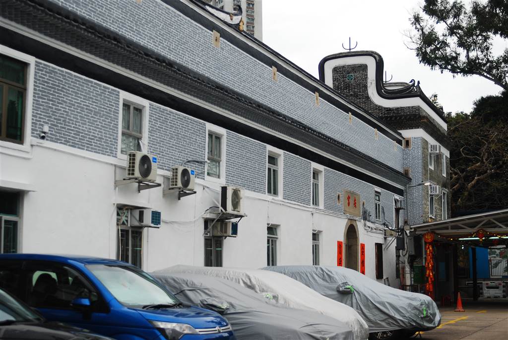
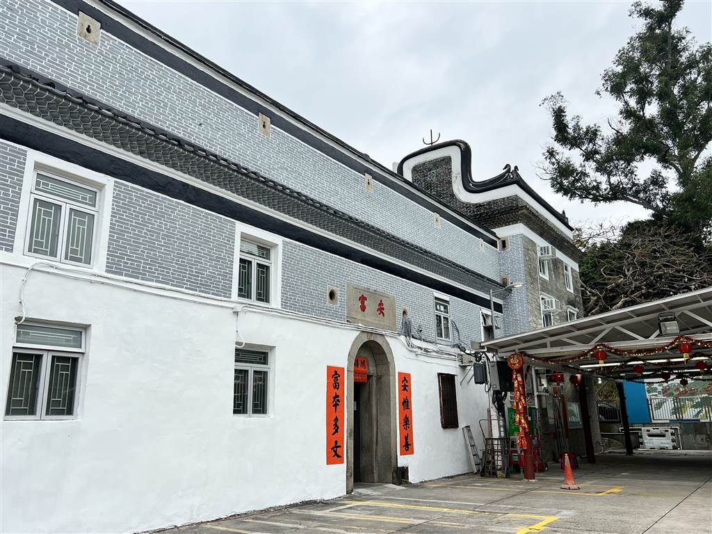
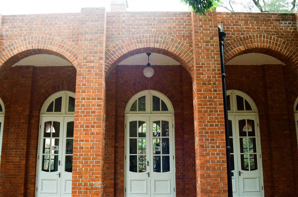
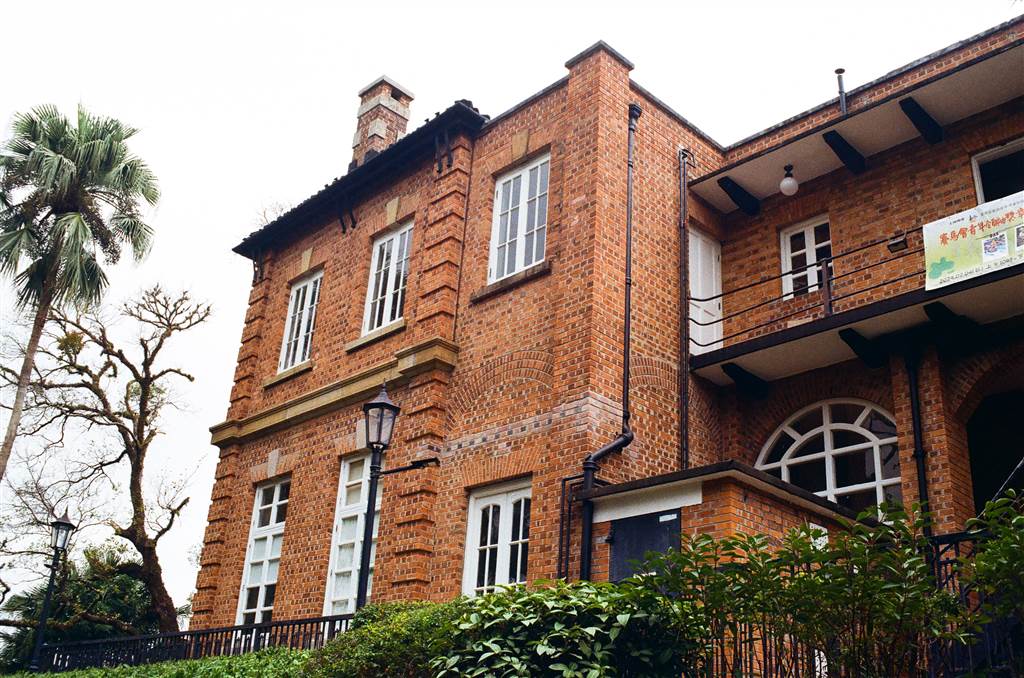
The Ark of Bukhara is namely the most significant historical relic in the heritage-rich city of Bukhara. I enjoyed the walk there very much because it clearly is a unique structure. The mosque there is beautiful. It was built in a style that, at that point in my trip in Uzbekistan, I had not seen in Samarkand or otherwise in Bukhara.

Some Preliminaries

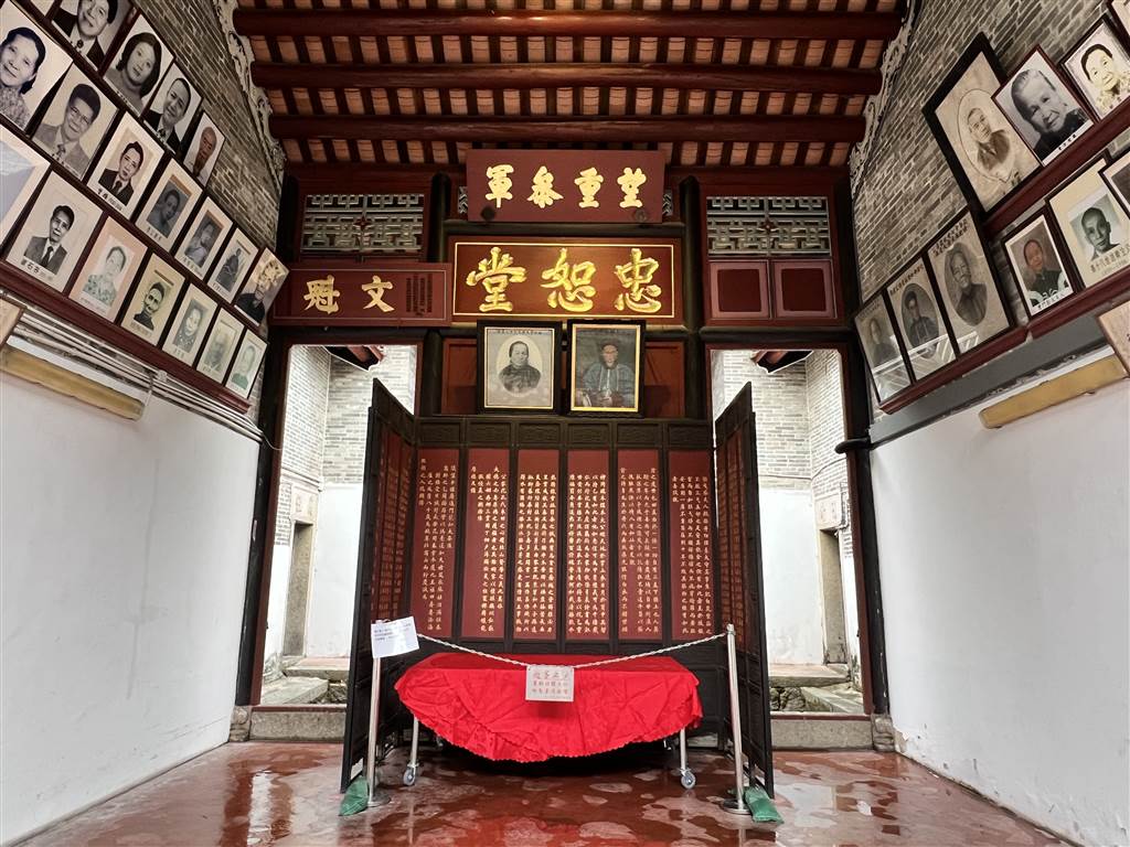
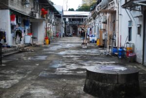
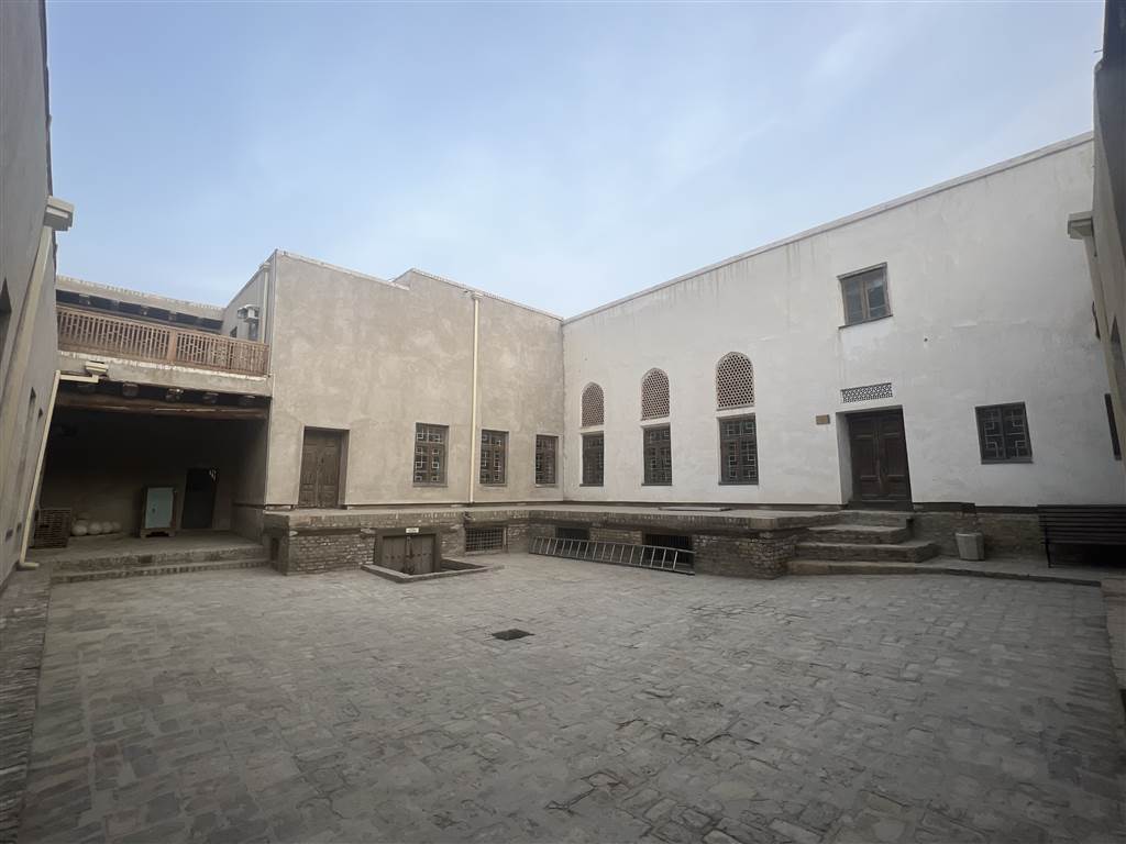
On this day we spent a couple hours there in the afternoon and stayed till dusk. The Ark is an enormous compound spanning acres, but only a selected section is open for touring. At a few sections the rooms are turned into small museums that are somewhat interesting. The difficulty with all Uzbek museums is the lack of English descriptions, and many times I could only guess at the meaning of the exhibits.

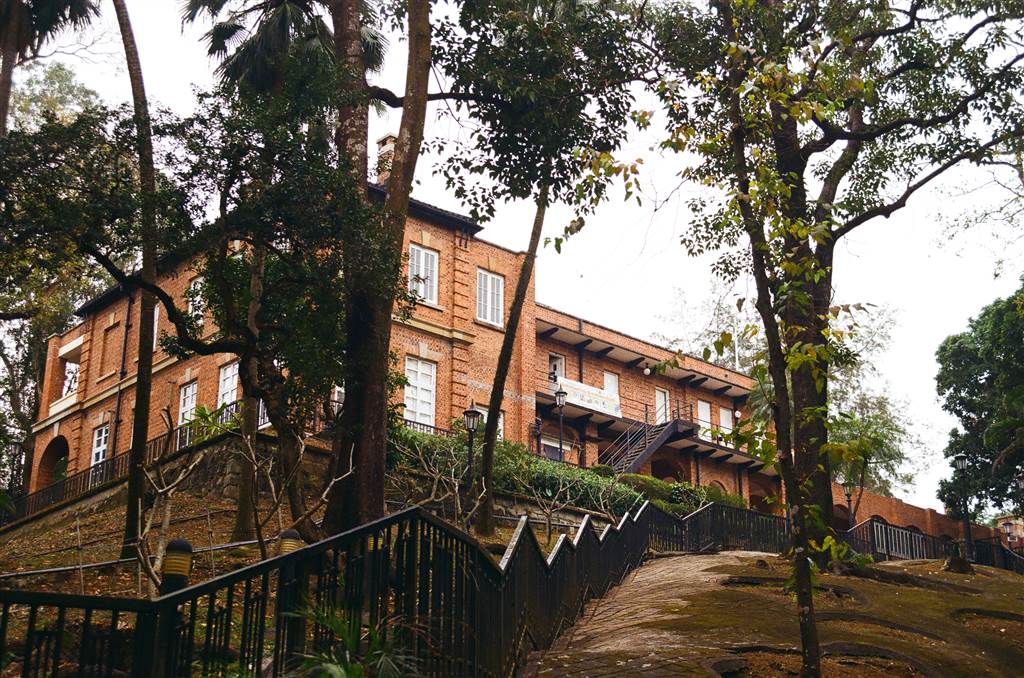
The Ark was a fortress as well as an inhabited city. At some point, there were whole communities living in the Ark itself besides the royal family. As such it was in every way a standing testament to Bukhara’s history.

Out of my experiences in Uzbekistan, the Ark was the only heritage that imposes a camera fee. Although many sites post signs saying that camera fees are required, I really only had to pay here. If you only use your phone, or keep your big camera in your backpack until after you checked in, there is no fee.

The Former Registan

The open space area outside of the Ark is the Registan. Its history is worth a brief mention. The Registan was a gathering place for all sorts of commercial and penal purposes. It was once a slave market and public execution ground.

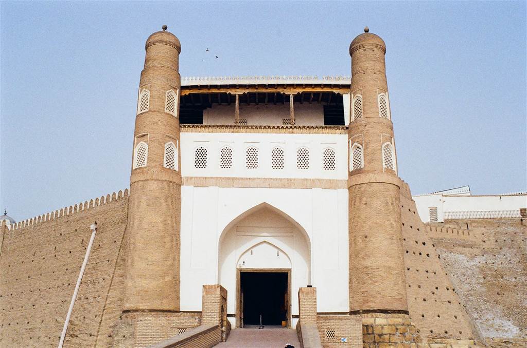
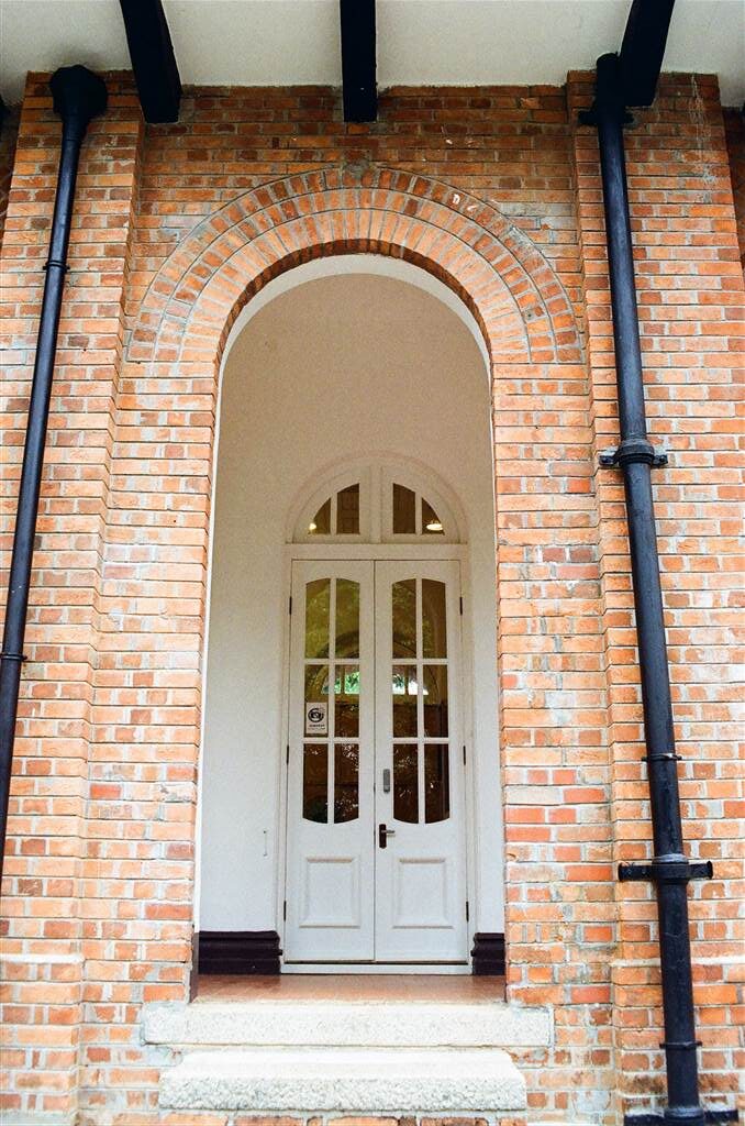
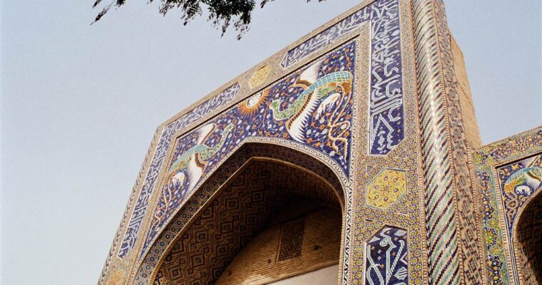
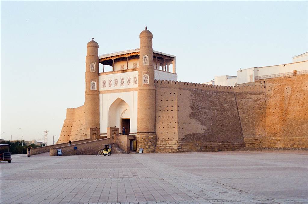
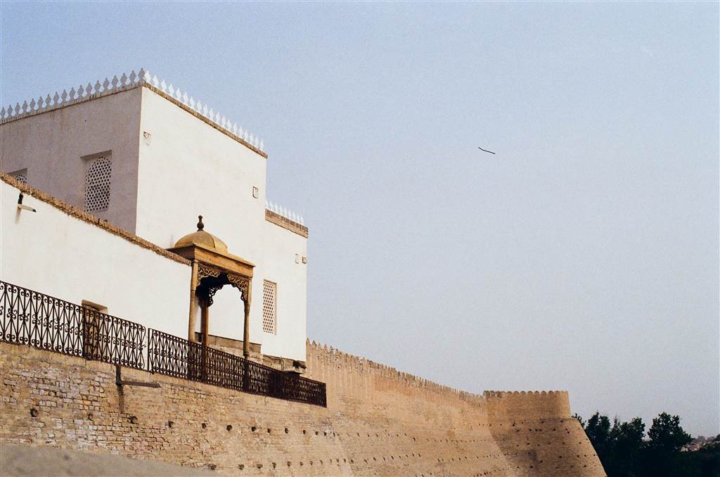
Then you would enter the Ark through the beautiful West Gate, built in 1742 by Nadir Shah.

The Basic Layout of the Ark

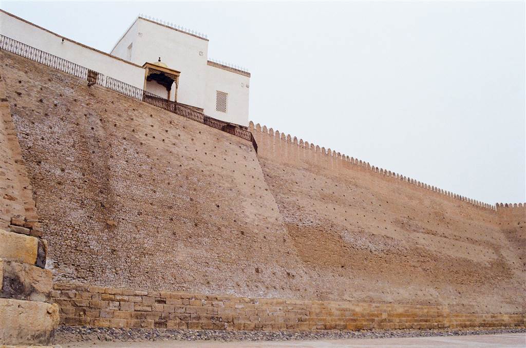
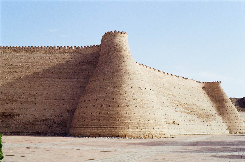
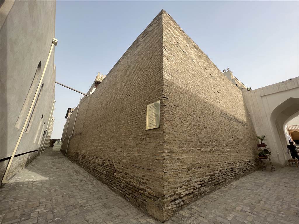
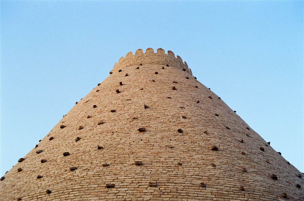
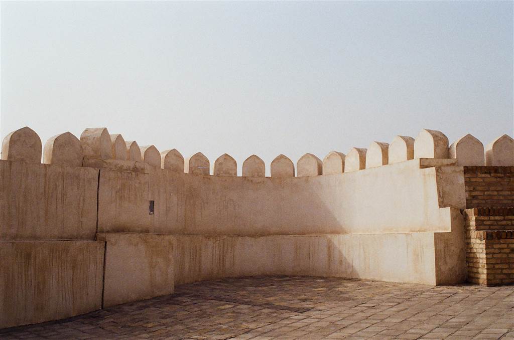
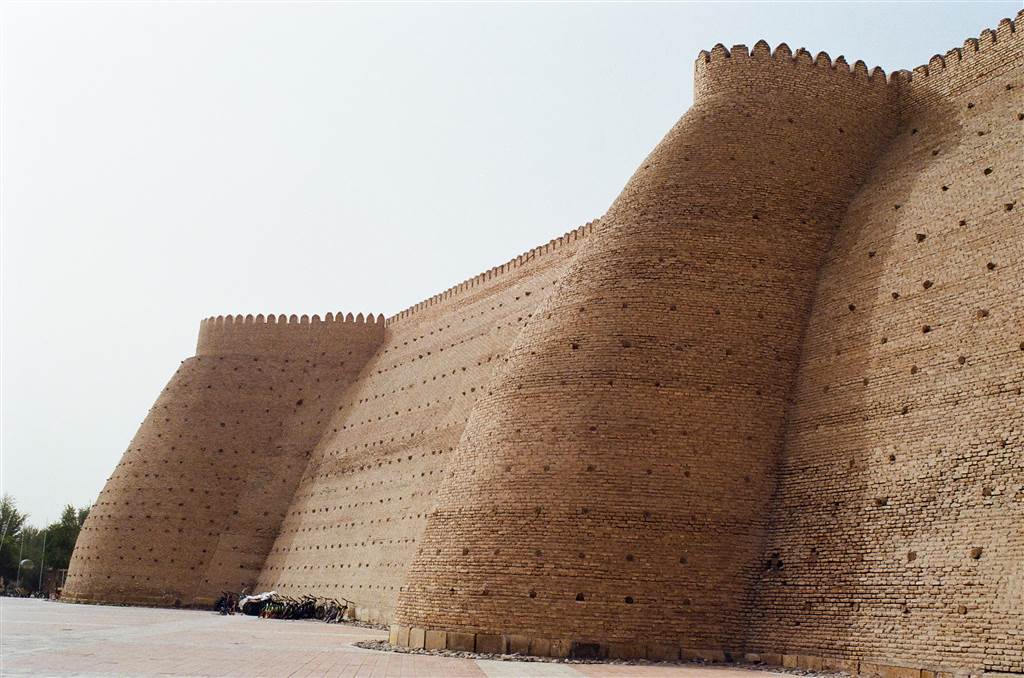
The Ark is a fortress enclosure that encompasses an area of about 3.96 hectares. In a near rectangular shape, the Ark has a perimeter of about 789.6 meters. The earthen walls stand at a height of 16 to 20 meters.

A Brief History of the Ark

It is believed that, as early as the 5th to 6th centuries AD, the Ark was already in existence. This was during the pre-Islamic era, and throughout the remaining of its history the Ark was a work-in-progress for many of the Bukharan rulers. The original structure should have been rectangular like what it is now. There was a palace and a Zoroastrian fire temple then. However, that original structure, including its early successors, collapsed.

In around 713 AD, the Arabs built the first mosque upon the foundation of the original temple, as a symbolic act of asserting the power of Islam over all other faiths. This would be the first mosque in Bukhara as well.

The current fortress and citadel standing was a structure of the 16th century Shaybanid dynasty. During this time, there was a city living within the fortress. “The ark was expanded to accommodate not only the royal family, but also a population of 3,000 people, their homes, workplaces and mosques. Everything from the royal mint and the treasury to the dungeons and slave quarters were within the citadel’s walls.” (Bradt 234)

The Ark was the subject of conquest during the Mongolian invasion, as well as the subsequent wars in Bukhara. Fast forward to 1920, a devastating fire destroyed most of the Ark. Some 80% of the structures there were burned to the ground. The Red Army had also caused significant damage to the Ark by their bombing campaigns. There was speculation as to whether the Soviets or the exiting emirs started the fire. The Ark remained in ruins throughout much of the 20th century.

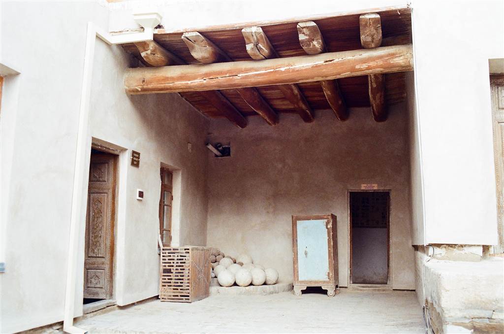
There are quite a few venues of interest open to tourists at the Ark, I have selected the following few in a brief introduction. They are representative of the lives lived in the Ark.
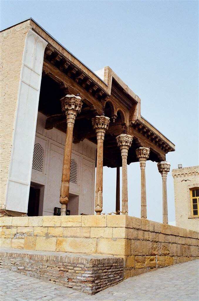
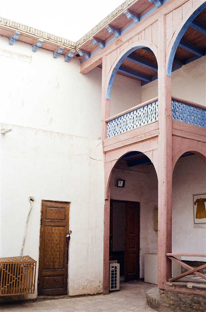
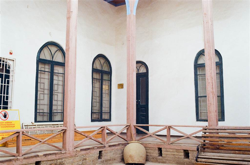
The Throne Hall

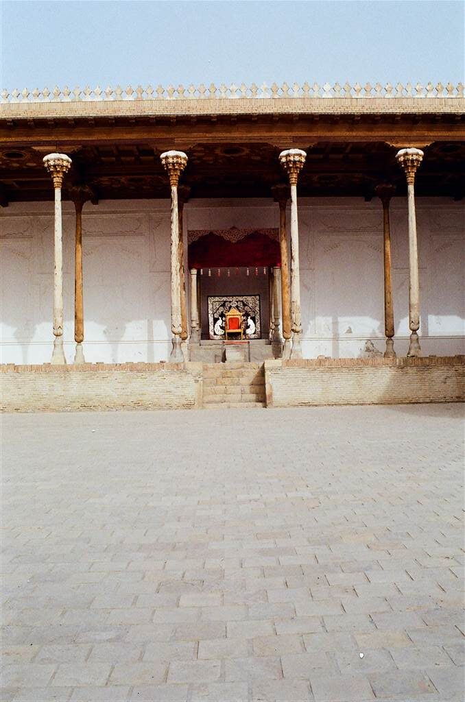
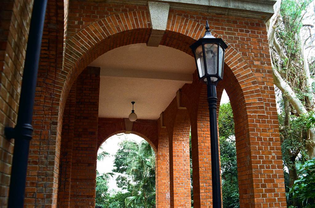
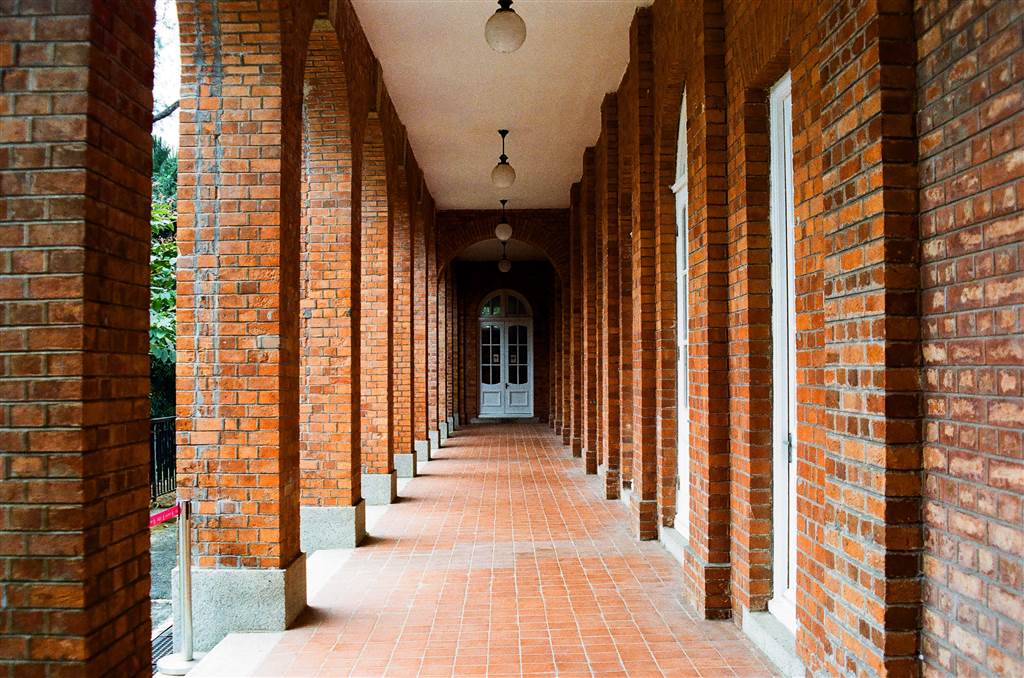
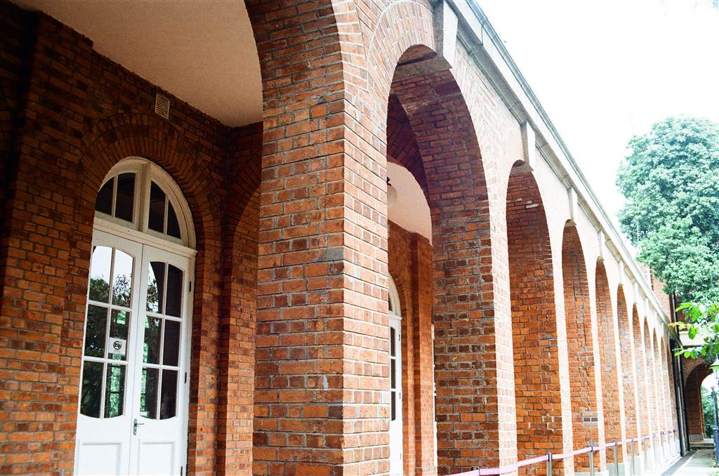
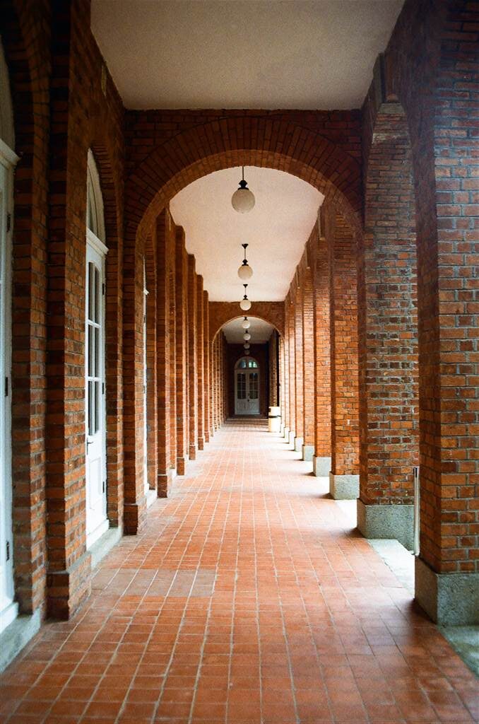
The Throne Hall dates to the 17th century. In the courtyard sits a marble throne made by the masters of the Nurata district in 1669. A painted wooden canopy is fixed to the carved marble columns above the throne. The Throne Hall was the venue for coronation of the Bukhara rulers.

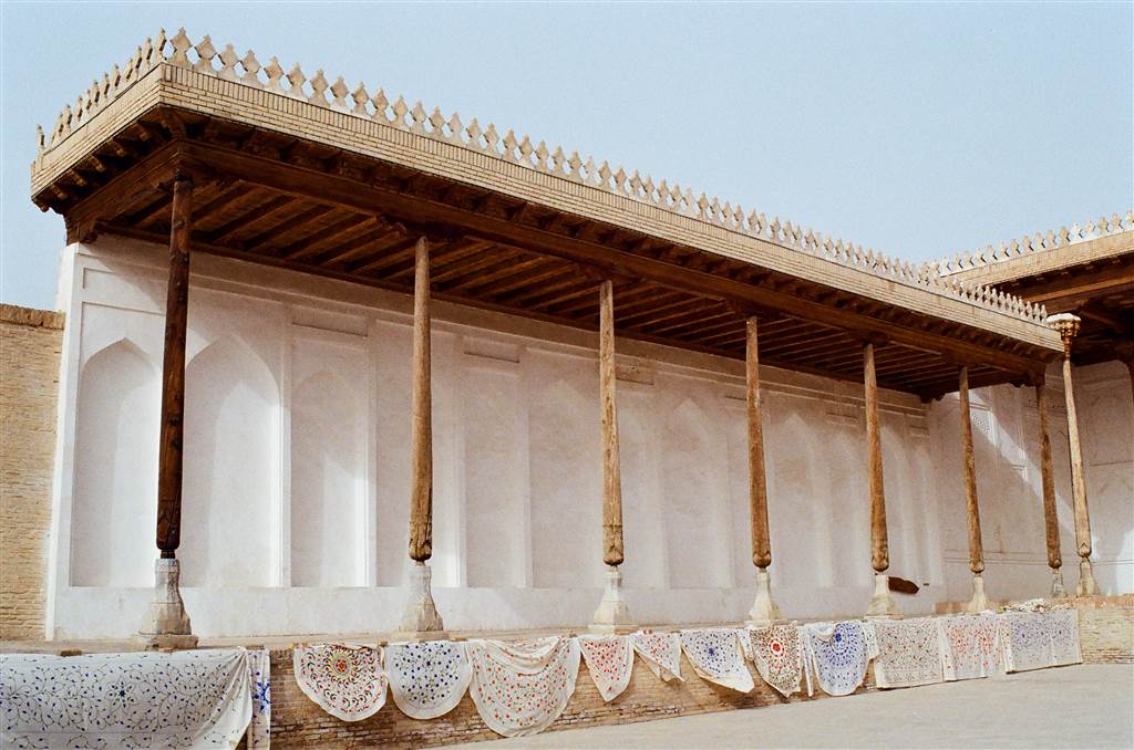
Standing as it was when I toured the Ark, the Throne Hall exhibited a solemnity that certainly fits its purpose. There are beautiful columns lining three sides of the covered and elevated veranda of the courtyard. Although the throne seems humble, a clear sense of authority is present.

The treasury is also located here. The 30 by 30 square meter basement held gold, silver and copper coins that were minted in the Ark itself.

The Greeting Courtyard

This space was designated for the Bukharan rulers to meet their guests, and greeting ceremonies were held here. Guests waited here in a queue to greet the king.

The Kushbegi Courtyard

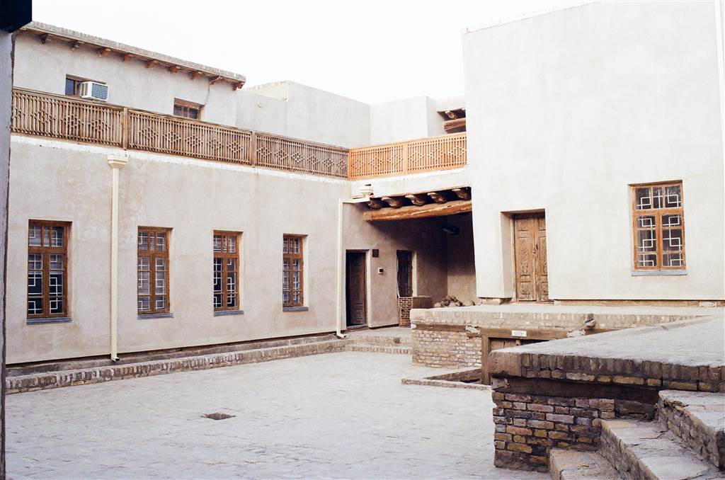
The Kushbegi holds the highest title of state administration and he is right beneath the emir in the hierarchy of power under the Mangit Dynasty. In essence, the Kushbegi is the equivalent of a modern-day prime minister.

The Kushbegi Courtyard at the Ark (it is named “Kushbegi Complex”) has double gates that used to be closed from midnight to dawn. This space is connected to the Embassy area. The Kushbegi’s chamber was located here. This part of the Ark belongs to the relatively modern times.

The Embassy

The Embassy provided the resting place for the visiting representatives of the Russian Embassy including ambassadors. This section of the Ark was also relatively modern, originally built by Jonmirzo Kushbegi and then later expanded by Astankul Kushbegi in 1908.

There was a telephone room here and the telephones were connected to different parts of the city in Bukhara circa 1900.
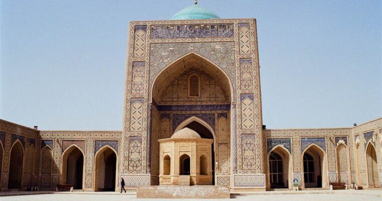
The Djome Mosque

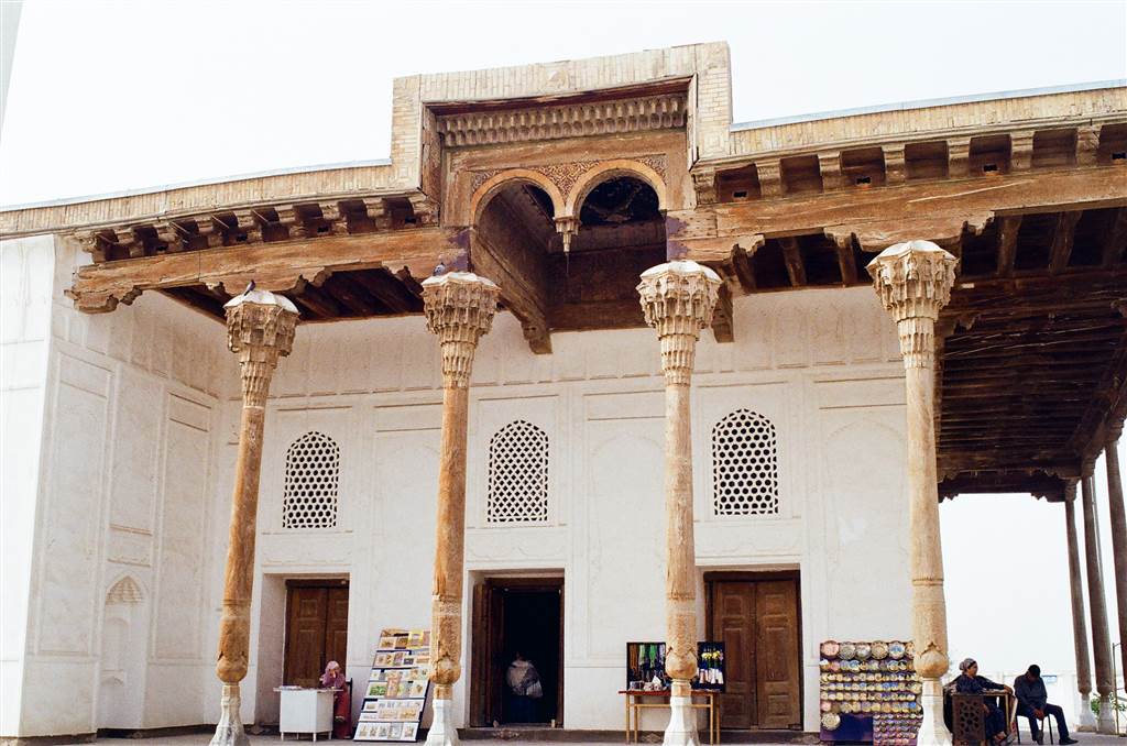
Although not the original mosque that was built as the first mosque of Bukhara, the Djome Mosque was the Friday mosque of the Ark built in the early 18th century during the reign of the emir Subhan Kulikhan.

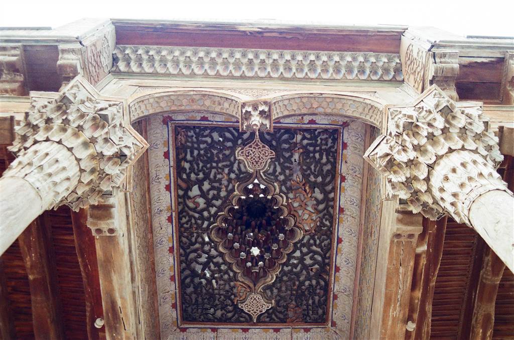
I noticed how different this mosque is as compared to the other grand mosques that I have seen in Uzbekistan, including the Kalon Mosque of Bukhara. The special wooden gallery, called “ayvan,” surrounds the mosque from three sides, supported by wooden pillars. The ceiling is decorated with carved geometric and floral patterns. There are eight front doors.

According to the description on site, the last major restoration took place in the early 20th century, certainly before the bombing of the Ark by the Red Army.

As I would learn later in my tour of Bukhara, the Bolo Hauz across from the Ark would also exhibit similar architectural features, but on a much grander scale.

The Horse Stable

15-20 horses were kept at the Horse Stable as the emir’s entourage. 4 saddle hoses were what the emir rode. 8 were racing horses, and 8 were horses for transportation. The two-story building is the storage cellar for keeping carpets, valuables and royal utensils.

Sources

Descriptions on site at the Ark.

Sophie Ibbotson, Uzbekistan, Bradt Travel Guide (2020).

The Wikipedia on the Ark of Bukhara.

Ubiquitously Uzbekistan – The Kalon Mosque, Kalon Minar and the Mir-I Arab Madrassa

Ubiquitously Uzbekistan – The Kalon Mosque, Kalon Minar and the Mir-I Arab Madrassa

The Kalon ensemble of architecture is a key site to visit in Bukhara. In this part of Old Bukhara you will come across the Kalon Mosque, the Kalon Minar and the Mir-I Arab Madrassa. The Sights and Smells of the Bukhara Marketplace On our way