An Easy Half-Day Trip in Sharp Island

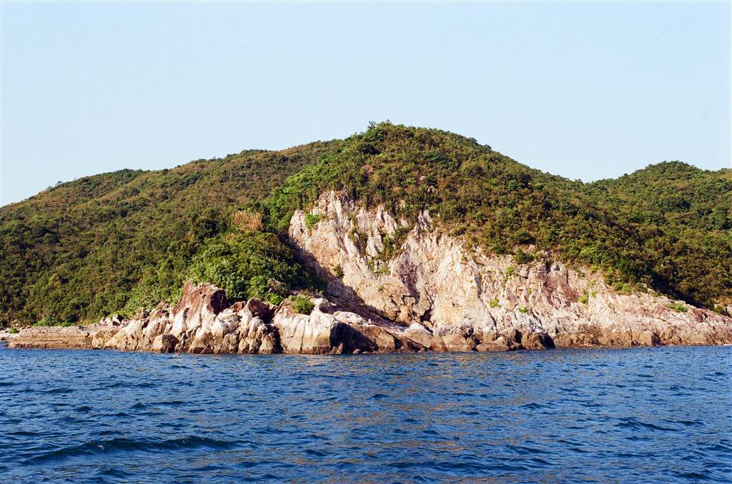
A visit to Sharp Island will fulfill a few wishes for nature lovers. There is the fun walk out to the Kiu Tau Islet on the tombolo at low tides, close to the Sharp Island Pier. At the Sharp Island beach area you will observe some interesting rock formations.
Then one can head over to a short hiking trail with a reasonable altitude. Along the trail you will see wonderful sea views of Sai Kung’s eastern waters. If you want to swim, the waters of Hap Moon Bay (Halfmoon Bay) is pristine. On a sunny day, the Sharp Island offers an exceptional selection of outdoor activities. Its proximity to Sai Kung also makes it an easy outing.

Sharp Island was the first short hike that I did since the summer months. I thought the weather was cooler, but when I went there, it was scorching hot. As a result, I did not bring enough water with me for just a gentle climb up the high points of the island. All else was easy though, so this is a brief introduction to a good afternoon spent at the island.
The Sharp Island Beach
As soon as you get off the Sharp Island Pier, you will be at the Sharp Island Beach. The water is pristine and the sand is white.

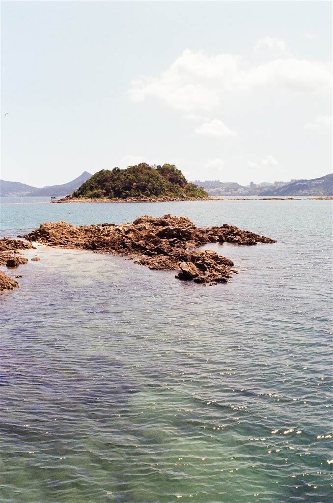
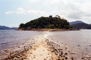
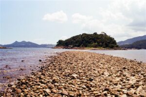
I headed right over to the tombolo, hoping to reach Kiu Tau Islet. However, the tides were a little high at around 1:15pm, and I stopped half way at the Tombolo, by then my socks were already soaked. Therefore do watch out for the times of the low tide on the Hong Kong Observatory website. If the tidal information is too difficult to digest, I have also learned the rule of thumb to catch the low tide to the Kiu Tau Islet. Please see this entry.
On your way to the tombolo, look for the Pineapple Bun Rock. You will know it when you see it, because it really does remind one of the sweet crust on a pineapple bun.
The Kiu Tau Islet has a high point of a 30 meter altitude and you may climb it.
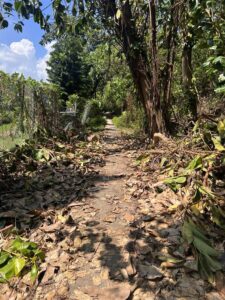
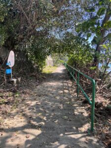
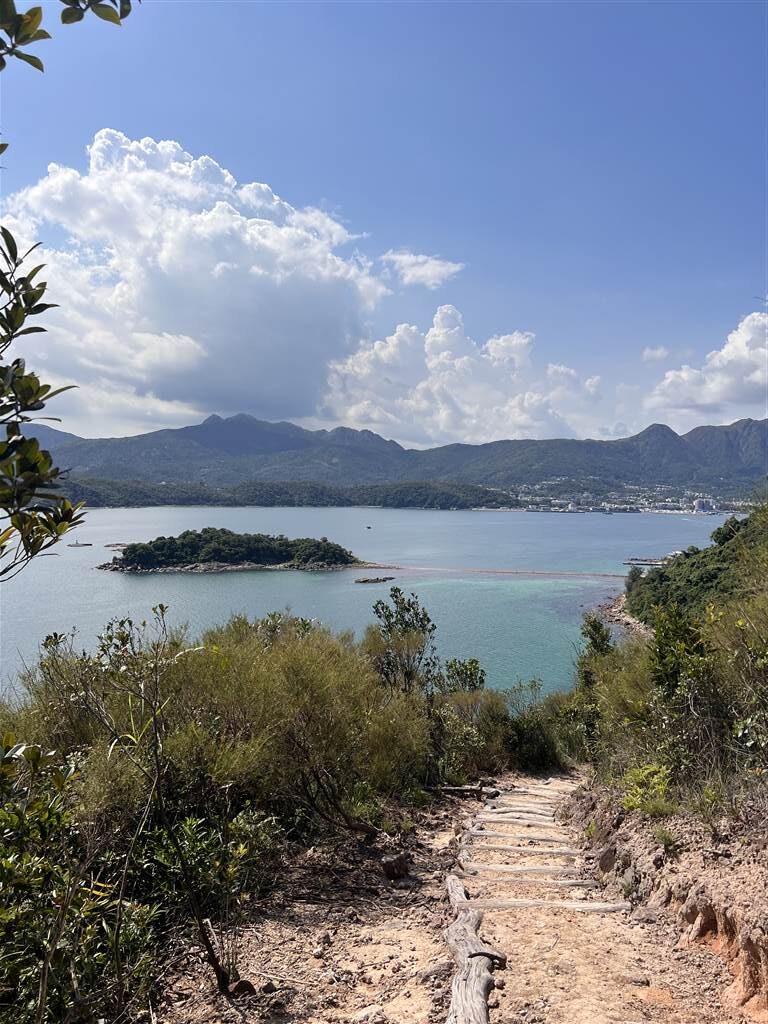
The Sharp Island Geo Trail
The entrance to the trail is near the beach, there is no need to head back to the pier area.
Photos: The Sharp Island Geo Trail is behind the Sharp Island Beach
The highest altitude on this trail is only a little over 90 meters, therefore the climb is suitable also for young children. However, if you go in the summer, do prepare enough water. A good section in the latter half of the trail has no shades.
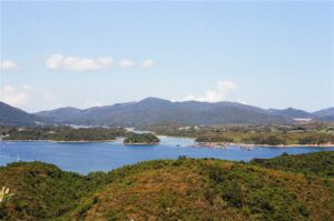
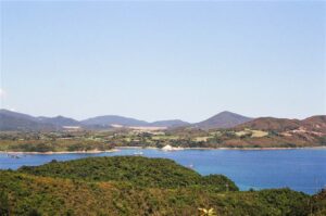
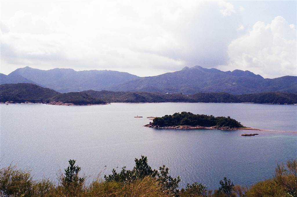
Photos: A Panorama of the Islands East of Sharp Island
The walk provides excellent aerial views of the eastern waters of Sai Kung. Looking west, the Kiu Tau Islet is seen multiple times throughout the hike. Looking east, you will see many of the outlying islands.
Allow for about 2 to 3 hours if you want to do a full tour of the Kiu Tau Islet, followed by a hike up this trail. At the end of the trail, you will reach the Half Moon Bay.
Hap Mun Bay (Halfmoon Bay)
The Hap Mun Bay, also known as Halfmoon Bay, is a wonderful small public beach. I think the facilities here are better than at Sharp Island Beach, as there is a store that provides beach umbrellas. However, there is a large area with natural shades at Sharp Island Beach.
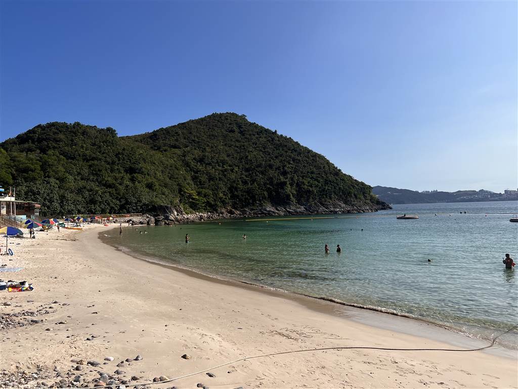
The water and the sand are both wonderful at Half Moon Bay. But there is absolutely no shade, therefore if you go, expect to rent umbrellas from the store.
Water sports is also possible, I see many people doing kayaking there.
The shower there provides sea water only.
The Geology of Sharp Island
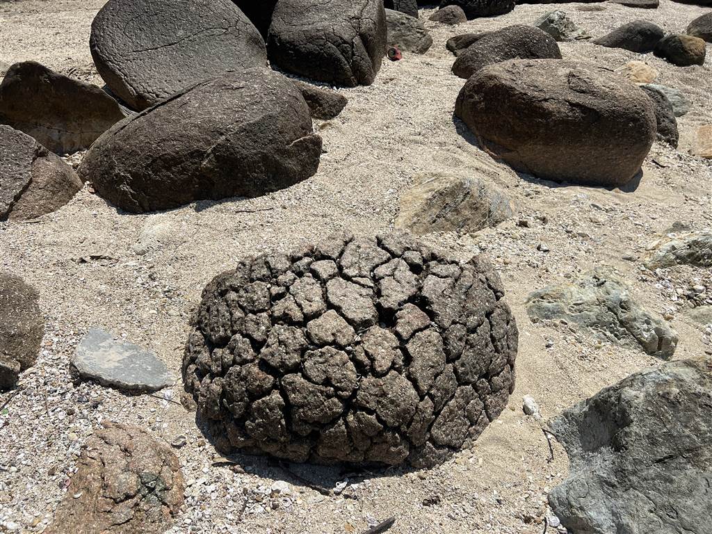
As a Geopark, Sharp Island features many interesting rock formations. When you head on to the tombolo toward the Kiu Tau Islet, you will see the famous pineapple rocks. The island does offer more, although it probably requires a trained professional to find them and explain them. I certainly did not notice interesting rock formations on the Sharp Island Geo Trail.
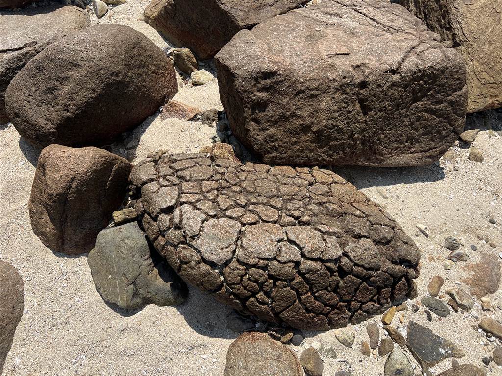
Photo: From the descriptions on site, “These granite boulders got their unique reticulation from multiple weathering processes and sea water erosion. The name is a nod to Hong Kong’s famous local delicacy: the pineapple bun.”
Therefore I will keep the introduction here brief. The rocks that form the land mass of Sharp Island are volcanic. This is certainly the case for most of Hong Kong. However, the volcanic rocks of Sharp Island are special in that there was lava exposure, which is less common for the volcanic rocks of other parts of Hong Kong.
A caldera is a collapsed volcano due to major eruptions. The Sai Kung caldera produced the rocks of the Mang Kung Uk Formation. The Mang Kung Uk formation consists mostly of ash and an abundance of crystals. The rocks that underlie the Kiu Tau Islet are fine-ash tuffs of the Mang Kung Uk Formation, formed during the Cretaceous period.
About 141-140 million years ago, the High Island Caldera formed close to the now Sharp Island area. The heaps of volcanic ash resulted in thick layers of tuffs, and this caldera did also spew lava. In the earlier phase of this formation, the Clear Water Bay Formation resulted. Then later the magma intrusions produced the Tei Tong Tsui Quartz Monzonite. As the name suggests, the Tei Tong Tsui Quartz Monzonite consists of large, well-developed crystals.
These are older rock formations even as compared to the hexagonal columns in other parts of Sai Kung. The volcanic activities that took place after the High Island Caldera eruptions are what resulted in the hexagonal columns surrounding the High Island Reservoir.
How to Get There
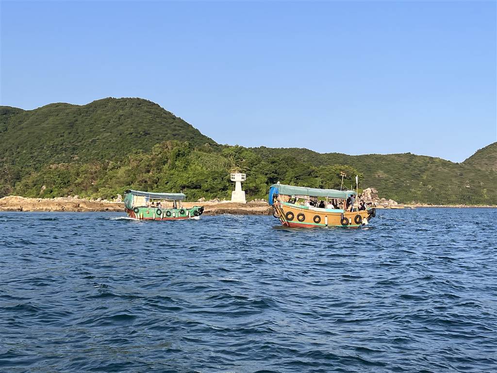
Of all of Hong Kong’s Geoparks, Sharp Island is perhaps the most accessible. A boat ride from the Sai Kung Pier only takes about 15 minutes to reach Sharp Island Pier. It is a good first course for the outlying islands of Sai Kung.
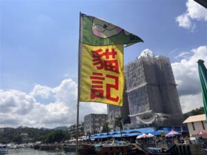
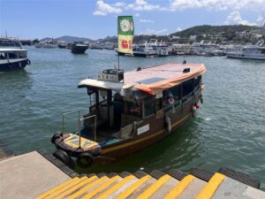
At the Sai Kung Pier, you will see many ferry carrier booths. Inquire with one that goes to Sharp Island. On this day, I took Kitty’s Boat. The cost was $30 return, but because I boarded the ferry at Half Moon Bay instead of Sharp Island Pier, I had to top up $10 for my return trip.
Your boat ticket will tell you the times that the boat returns from Sharp Island. However, you likely will leave at Half Moon Bay, unless you do a return trip hike back to the Sharp Island pier. You can either call the carrier, or inquire early the departure times at Half Moon Bay.

Sources
Hong Kong Geo Park, Sharp Island: Half Day Tour.
Bernie Owen & Raynor Shaw, Hong Kong Geopark All in One (2011).