Geopark Island Hopping – Ap Chau (Duck Island)
In celebration of the 10th Anniversary of the Hong Kong UNESCO Global Geopark’s inclusion into the Global Geopark Network, the Hong Kong Government has organized a number of activities in various interesting Geopark locations. The activity period comes with special arrangements for ferry transport, storytelling by the natives of the islands, interesting workshops, lion dances and other celebratory initiatives.
The activities for Kat O (Crooked Island) and Ap Chau (Duck Island) have already concluded in November. My father and I went island-hopping with a group of his friends. We visited both Kat O and Ap Chau on this day.
The itinerary was to first meet at the Ma Liu Shui Pier (note that the boarding point for the Kat O ferry is about a hundred meters toward the Shatin direction). The ferry departs at 9am sharp. The ferry would first make a stop at Kat O, then to Ap Chau. We skipped Kat O on our way there, and boarded off the ferry at Ap Chau instead. At 11am we were at the pier in Ap Chau and stayed there until the ferry would take us to Kat O at 12:30. For the rest of the afternoon we stayed in Kat O, which is a significantly larger island, until the ferry would leave for Ma Liu Shui at 4:30pm.
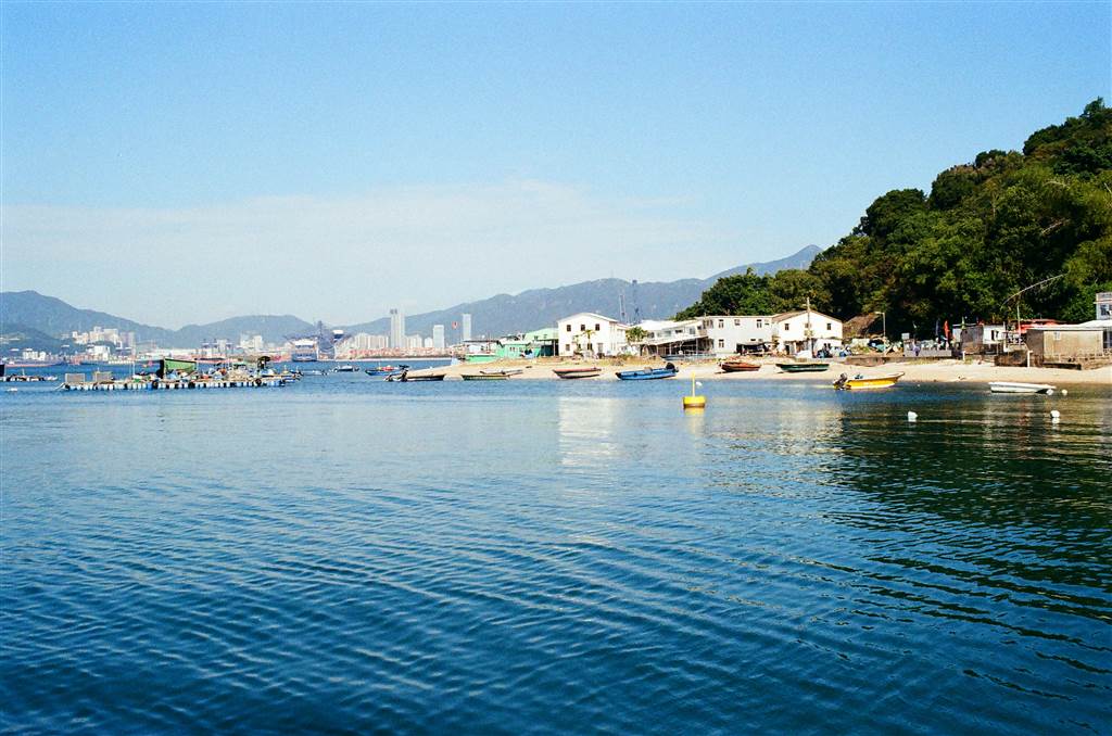
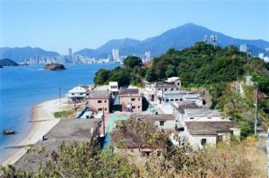
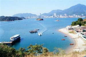
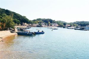
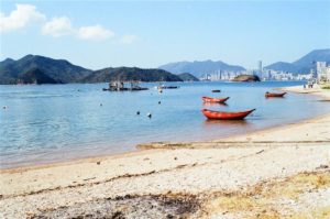
Views of Ap Chau from Afar
Both Kat O and Ap Chau are islands on northeastern New Territories. Ap Chau is the outlaying island closest to China. Therefore at most points in the island, one can observe the well-developed, busy port of Yantian, Shenzhen. At a mere 0.04 square kilometers, Ap Chau is also the smallest inhabited island in Hong Kong’s UNESCO Global Geopark.
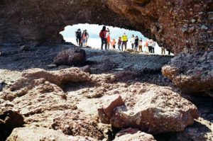
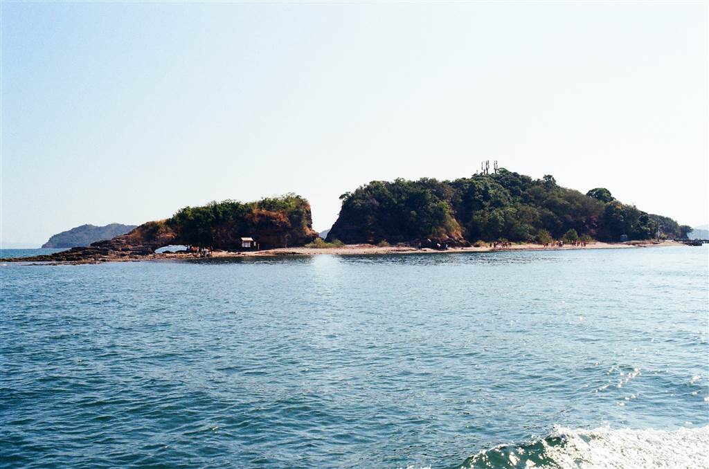
Ap Chau is called Duck Island for a reason. The landscape of the island looks like a duck lying flat on its tummy. In fact, I thought it looked more like a roasted duck than a living duck. Even from afar, you can tell first the sea arch that makes the Duck’s Eye (more below).
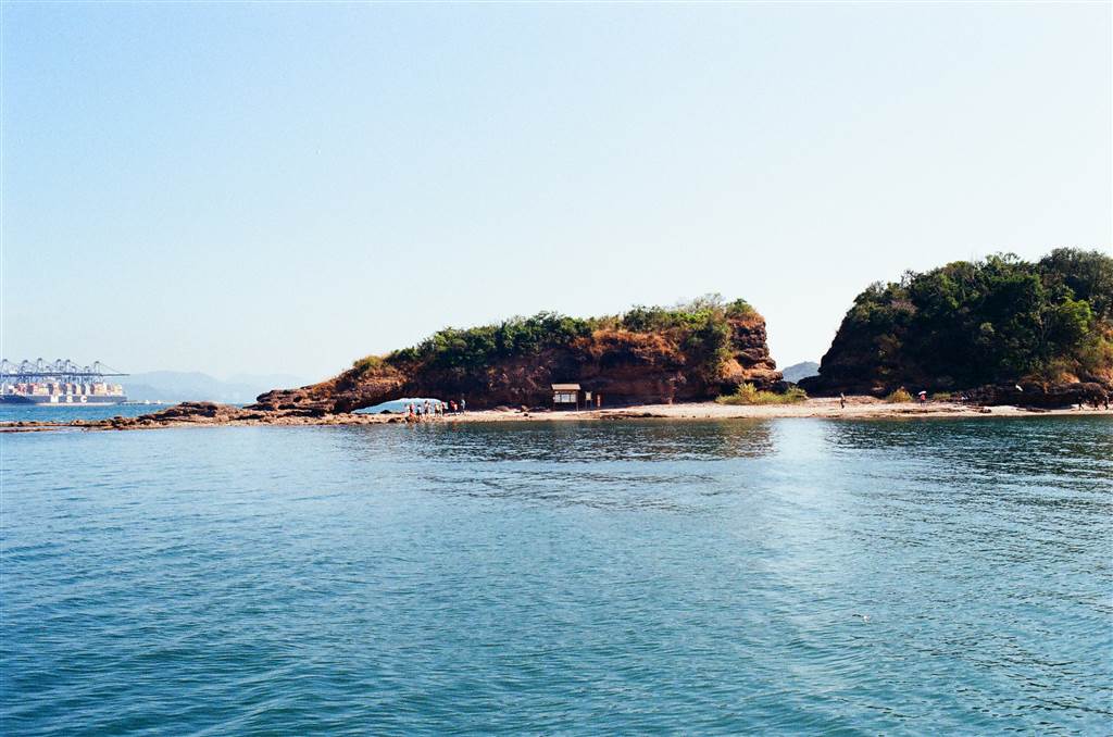
There are also views of other smaller, uninhabited islands nearby. There are the Duck’s Egg and the Small Ap Chau within view.
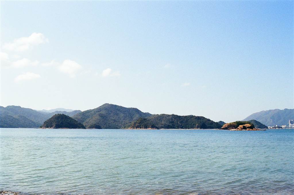
The Landscape of Ap Chau
There are some remarkable natural features of Ap Chau that are observable even as we approached the island from the ocean.
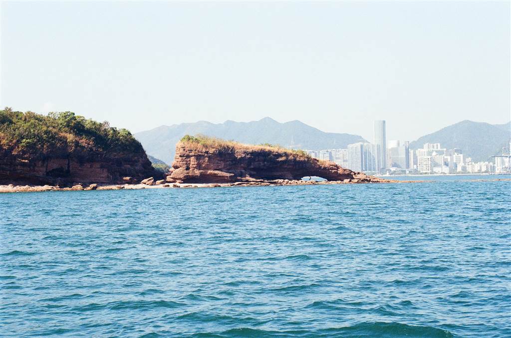
Photo: the small sea arch on the right is the Duck’s Eye, and the large fracture on the left is the Duck’s Neck.
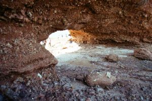
The first one is what people call the Duck’s Eye. According to the pamphlet on Ap Chau, sea arches are formed when “the weakest point of a coastal cliff is eroded into a cave. As wave erosion continues, the cave deepens, eventually forming an arch.” The Duck’s Eye is the most visited site on the island. Literally every tourist rushed there to take photos. As such, prepare to queue for long lines there.
There have been warnings against visitors climbing up to the roof of Duck’s Eye for photos. The arch continues to erode and the top part is weathering away constantly. Any weight on the arch could cause it to collapse eventually. Yet we still saw people doing that.
After visiting the Duck’s Eye, visitors can backtrack a little and visit the Duck’s Neck. Geologically, the Duck’s Neck phenomenon is a fracture zone. “The rocks are fragmented and easily weathered and eroded, resulting in a narrow channel.”
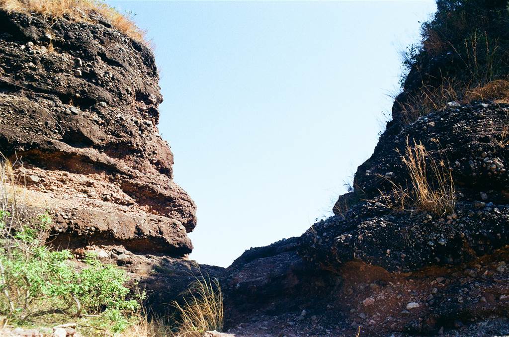
The island is full of reddish-brown sedimentary rock called “breccia.” The breccia is formed when the sediments in a sheet are cemented by calcareous minerals. High pressure from layers of later sediments solidify them. The surface of the breccia is coarse, showing the angular rock fragments that form them.
The reddish brown color indicates an oxidation process in a semi-arid environment, perhaps some 100 to 65 million years ago. I believe it is a similar formation process as the red earth of Chek Chau. The breccia is rare in Hong Kong. You can see them in Kat O, Ap Chau and a few other islands in Starling Inlet. I believe I have come across them in Ma Shi Chau.
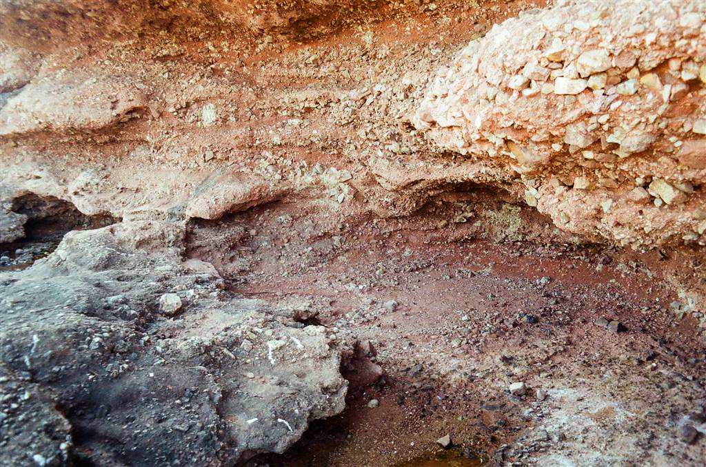
Finally, outside the Duck’s Eye lies the wave-cut platform. It is formed by continuous wave erosion of the rocks in the intertidal zone. The wave carry the rocks away, “eventually leading to the formation of sea cliffs and a flat area above the water surface.” The wave-cut platform protects the cliff by reducing the force of the sea waves, thus slowing down the erosion of the cliff.

After lining up for photos in Duck’s Eye, I hurried to the only high point on the island for open island and sea views. The highest point of the island is a mere 28 meters. You will see the stairs up behind the True Jesus Church. It took just a few minutes to walk to the viewing point. I saw great views there.
The Story of Ap Chau
The Ap Chau Story Room stands at the former site of the Ap Chau Fishermen’s Children Primary School. It is a great pity that the Ap Chau Story Room was closed when I visited. I will draw on the pamphlet on Ap Chau and the guided tour I heard on the ferry for the island’s story.
The village in Ap Chau had its heyday during the 1960s and 1970s. The population then were more than a thousand strong. Villagers were once fishermen. It was around this time that missionaries of the True Jesus Church from Taiwan approached the island. They promised the villagers that, if they were all to turn to Jesus Christ, the missionaries would provide economic assistance. One of the initiatives was to provide housing for the whole village.
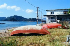
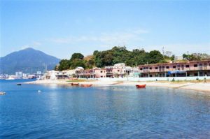
The Ap Chau Fisherman’s Village consist of four two-storey blocks and 48 units. They were built in 1961. Because the missionaries of Taiwan built these for the fishermen at the same time, these buildings in the island had a uniform design.
The tour guide that introduced this story said that the Christian tradition remains strong in the island today. Unlike many other former sea-faring islanders, the villagers of Ap Chau do not worship Tin Hau, the Goddess of the Sea. As such, there is no Tin Hau Temple in Ap Chau. In fact, the village head has complained that some people come to the island and do odd things like blowing trumpets and worshipping deities in the open areas. He does exercise his power in forbidding these kinds of practices on Ap Chau.

Currently, there are about twenty families still living in Ap Chau. Like so many of Hong Kong’s villages, many villagers gradually moved out of their rural homes in search for better education and opportunities in the urban areas. Some have gone abroad to live as well.
The Ap Chau Story Room opens only on Sundays and public holidays.
Finally, the celebration of the Hong Kong UNESCO Global Geopark will include a guided tour of Sam Mun Tsai and Ma Shi Chau on the weekend of December 18. I highly recommend doing this guided tour. Without proper training it is very difficult for anyone to find, recognize and appreciate the special geological features in Ma Shi Chau.
Sources
Guided Tour on the Ferry.
Pamphlet on Ap Chau, Agriculture Fisheries and Conservation Department.
Hong Kong UNESCO Global Geopark 10th Anniversary Website.
How to Get There
Ferries depart at the Ma Liu Shui Pier Landing No. 3 for Kat O and Ap Chau. The easiest way to get there is by walking about 15-20 minutes from the University Station on the East Rail Line. Again, this landing point is about a hundred meters toward the Shatin direction from the Ma Liu Shui Pier.
The tickets to Kat O and Ap Chau cost $90 return, and $45 one way. The staff will check your tickets when you leave Ma Liu Shui and when you do your return trip back to Ma Liu Shui. There is no ticket checking between Kat O and Ap Chau. People usually do visit both islands in one go. Please visit (and study carefully) the ferry schedule for Ap Chau.
See also the same website for boarding for Kat O and Ap Chau at the Sha Tau Kok Pier instead.

