The Red Earth of Chek Chau (Port Island)
It was a rainy and stormy weekend but we managed to visit the Port Island for a good stretch of eight hours, and the sun shined upon us throughout.
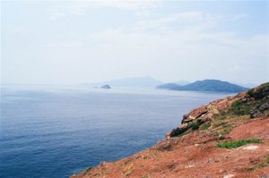
The Port Island is a small island in the middle-to-western side of Mirs Bay (Tai Pang Wan), lying at the eastern approach of Tolo Channel. The closest island is Grass Island in its south.
Port Island — First Impressions
I joined a well-organized group for this outing to the Port Island, also known as Chek Chau. Our hired boat departed the Wong Shek Pier at around 10am. The group brought with them lots of booze and ordered catered party food for the day.
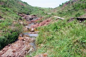
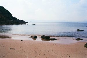
Our boat dropped us off at the Northern Bay of Port Island. I learned that we would be spending most of the time at Lau Shui Hang, a sandy shore at Northern Bay, during the day. From afar, the spot looked very appealing. There was a fresh water stream flowing down in a mini waterfall.

Photo: Our boat dropped off at the Nothern Bay, view of the mini waterfall. It was at the highest tide of the year and as a result we did not see the beach until the tides receded in the afternoon.
We arrived at around 10:30, and on that summer day it was at one of the highest tides during the year. Therefore I did not see the sandy beach when we landed. When the tides turn low, the beach would show.
At a close encounter, however, the first impression of this part of Port Island was not too favorable. There were a whole lot of rubbish at the shore, floating on the water. Despite the very clear water, this accumulation of trash was discouraging. I was almost sure I would not be soaking at the beach, as all the others in the group have intended to do.
We learned that when the tides are low, the trash would disappear. I found it incredulous, but if that turned out true, then I might enjoy the beach too.
A Walk on Red Earth
As the high tide prevented us from settling down at the beach, we decided to go for a walk. The sun was very bright that day. Even a ten-minute climb up the narrow stone path was trying. I did make it up to the highest point of Port Island, which is just above the Northern Bay. We then took a look around the eastern side of the island.
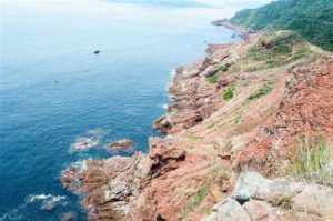
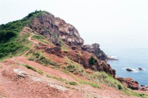
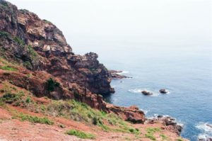
Photos: Above – Views of the southern coast of Port Island, overlooking Grass Island. Below: View of the northeastern coast of Port Island at the high point.
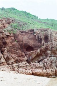
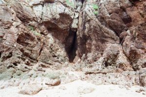
The others decided to visit the Chek Chau Cave, on a low point off the eastern shore. I figured that my shoes were not likely to protect me on a steep slope down, so I stayed on the high point. I enjoyed the views of the red earth all around me.
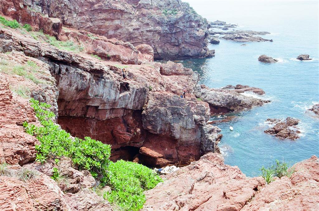
Photo: View of the Chek Chau Cave from the highest point.
A Geological Introduction
Chek Chau, in Chinese, means “red island.” True to its name, the island is full of red earth. It is a part of Hong Kong’s Geo Park. Together with Tung Ping Chau, Double Haven, Tolo Channel and Bluff Head, the Port Island comprises the Northeast New Territories Sedimentary Rock Region. According to my research:
“Showcased here are sedimentary rocks, fossils, sedimentary landforms and structural features of Devonian and Permian Periods of the Palaeozoic Era, the Jurassic and Cretaceous Periods of the Mesozoic Era, and the Palaeogene Period of the Cenozoic Era.
The Rock Region provides a basically complete record of the geological history of Hong Kong for about 400 million years, including changes in sea level, tectonic movements, weathering, erosion, transportation and deposition. It also presents a range of sedimentary rocks from different geological periods, and many rare landforms created from different geological processes.” – Hong Kong National Geopark at 46-67
There were two questions on my mind for which I sought answers from research. First, what were these rocks that made up the island, and secondly, why were they red?
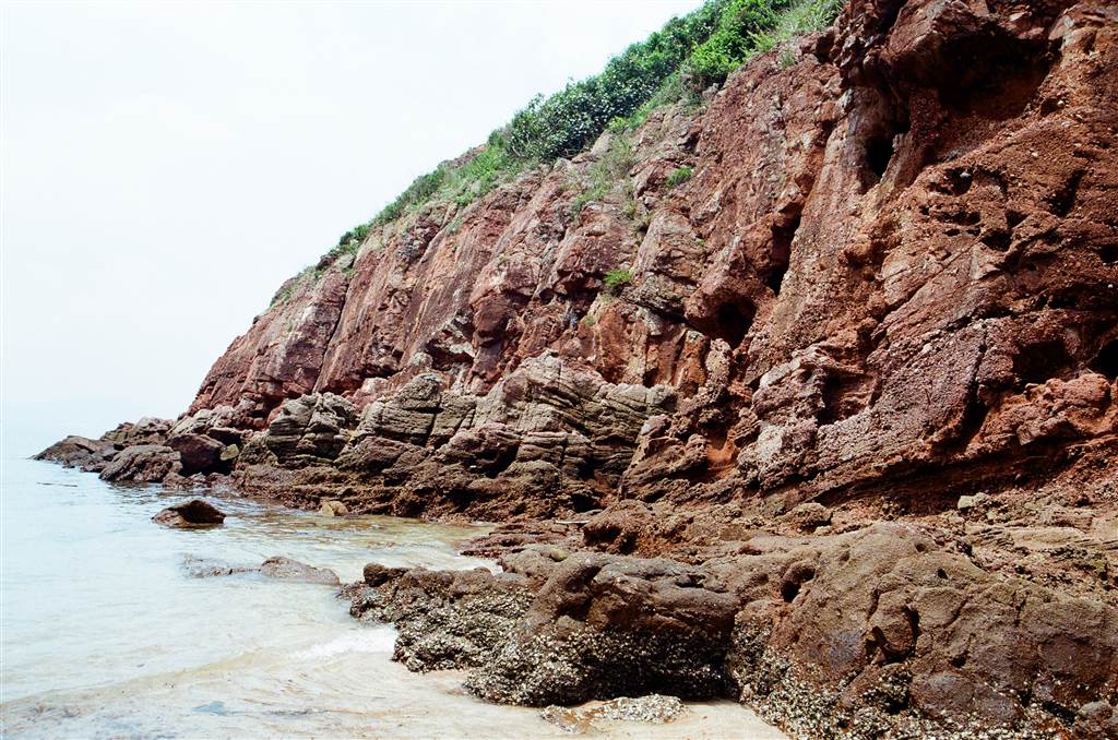
The Port Island landform is made mainly of sandstones and conglomerates of the Late Cretaceous age (100 million years ago) on the east, and the older coarse-grained tuffs of Early Cretaceous age (~143 million years ago) on the west.
The Long Harbour Formation (as named after the Long Harbour Caldera) in the west of the island came from millions of years of volcanic activities. As such, the basic composition of the rocks there is volcanic ash, with crystalized appearances. The rocks that formed are called tuffs.
On the east, beds of rock 1,200 metres thick began to form above the original Long Harbour Formation. The sediments were washed to form beds from rivers and floodplains.
“Because the area experienced an arid to semi-arid climate at that time, the sediments have a characteristic dark red colour. This reddening results from exposure of the deposits to the atmosphere which causes oxidation and the formation of red haematite (Fe2O3) that coats each of the millions of sand particles.”
– Hong Kong Geopark All in One at 97
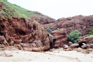
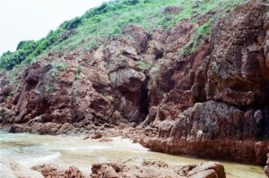
The sandstones and conglomerates are what give the island its red color. The siltstones, sandstones and conglomerates in the east make up the Port Island Formation.
Sandstones and conglomerates are distinguished by the composition of their surfaces. Sandstones have smooth, uniform surfaces but with sandy texture. They are formed by the compression of the bits and pieces eroded from large rocks or volcanoes over millions of years. Normally, the sandstones are mostly in a light creamy yellow color. The arid climate of the then-Port Island area has enabled a chemical process that turned each individual, millions of sandy particles red to result in red sandstones.
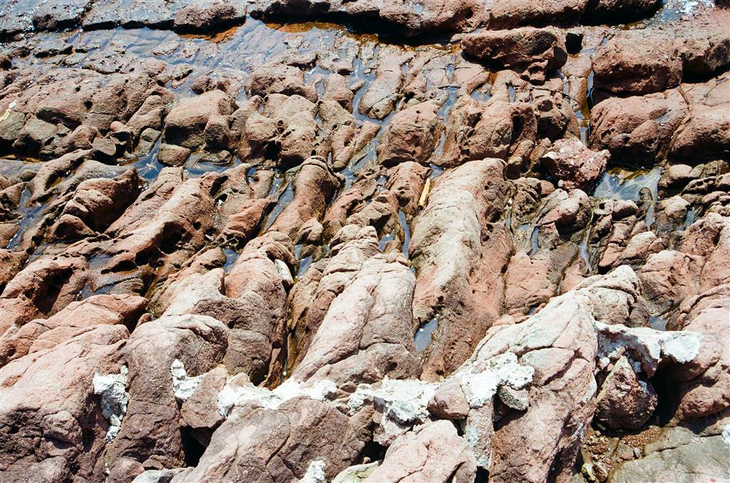
Photo: Red sandstones, eroded.
Conglomerates are rare in Hong Kong. They show individual, smaller pieces of rocks and pebbles on their very coarse surfaces. They appear to be jumbles of rocks being cemented together. “This reflects their tumultuous origin as masses of loose material carried down to the desert basin by turbulent floodwaters during intense periodic rainstorms.” Id. at 102
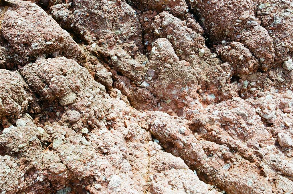
Photo: Conglomerates
An observable feature of the Port Island Formation is the 20 to 30 degree angular inclination to the east and southeast. This came about due to tectonic plate movements.
An Island Tour
On this day, I have only visited briefly the northeastern side of the Port Island. I did not want to leave the group and go out to venture on my own, due to safety concerns. However, even just that part of Port Island had exceptional views to offer.
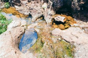
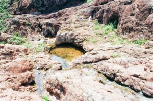
When we headed up the top of Port Island, we passed by the four potholes along the stream of fresh water, the flow of which eventually went down to the small waterfall at Lau Shui Hang.
Besides the highest point of Port Island, if you head south, expect to see the Lost City of Red Desert and Dog’s Head.
At around lunch hour, the group gathered to have lunch under our tent. We then spent the rest of the afternoon in Lau Shui Hang, as the sandy shore really did show when the tides have receded. And finally, the trash on the coastal waters ended up in this sandy shore. As a result, the water really cleared up for bathing.
Photos: Views at the beach at Lau Shui Hang at low tide
Around dusk time, we saw fishing boats approaching the coast. Some fishermen speaking a kind of Chinese dialect came up on shore and took fresh water from the mini waterfall. We figured that they were the Hok Lo fishermen, perhaps from China.
When we returned to civilization, it started raining down on us again. What a perfect day.
Reminders
The Port Island is an uninhabited island, and therefore there is zero facility there. Be prepared for no bathroom break for as long as you stay there. Bring plenty of water with you, particularly during the summer. Food is also a must. My friends who went down to the Chek Chau Cave came back exhausted and hungry.
In terms of hiking, you should wear proper hiking shoes, especially if you want to climb the coastal rocks. Significant dangers are present, however, therefore do not do it alone.
I felt the onset of a heat stroke after the return from the short hike. There are very few shaded spots on the island, therefore some kind of tent would be ideal. I hid under a big rock for a while to deep breathe and drank lots of water to get out of the heat stroke.
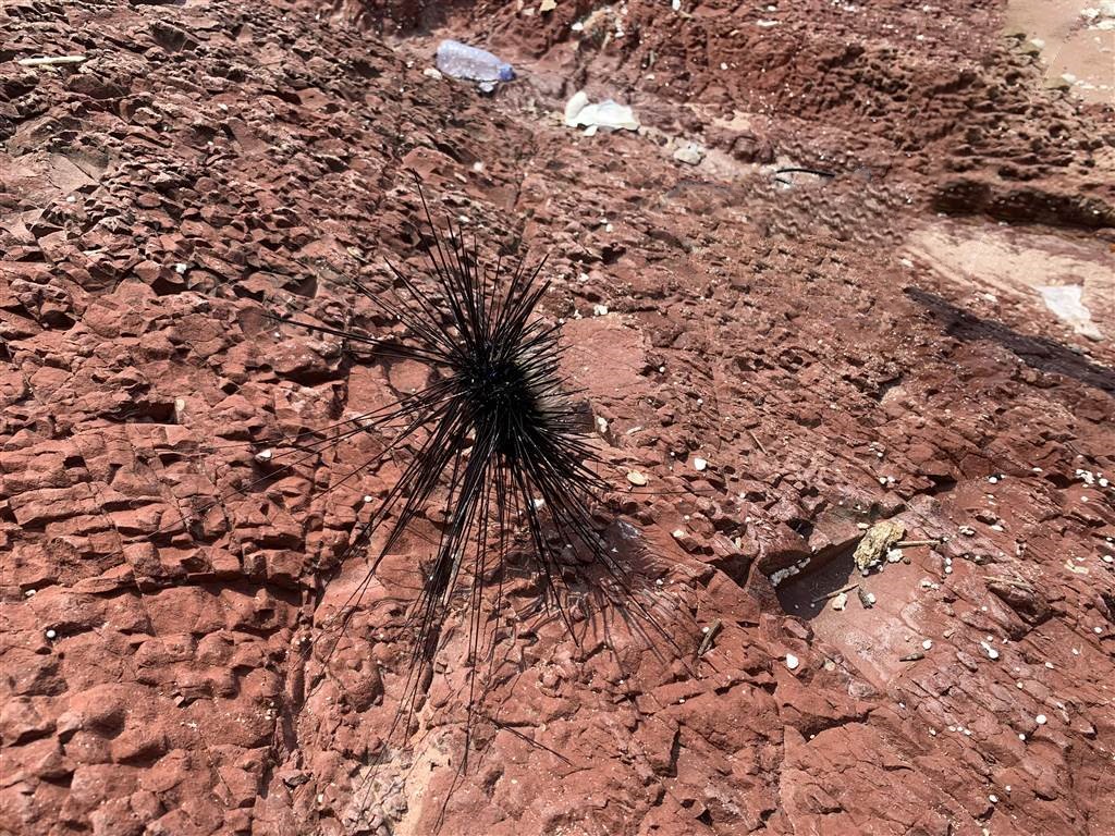
Finally, consider some protection for the beach, sunblock is a must, of course, but certainly shoes appropriate for the feet in water. Some of the group members were stung by the creatures in the sea. Beware and do not touch the sea-urchin looking organisms (they are not actually sea urchins but they look alike).
How To Get There
We had a group of 12 people so we could do a private hire of a boat for about $120 per head. There is otherwise no public transport option to get to Port Island.
Sources
Hong Kong National Geopark, Agriculture, Fisheries and Conservation Department, Civil Engineering and Development Department (2011).
Bernie Owen & Raynor Shaw, Hong Kong Geopark All in One (2011).
A Journey of Rocks, Mingpao Ed (Chin. 2009) at 26.