The Lion Rock
The Lion Rock is a very popular trail in Hong Kong, but I have never had the opportunity to walk it. On this wonderful winter day I joined a group hike and had a wonderful time seeing 360 views in this somewhat midway point of Hong Kong.
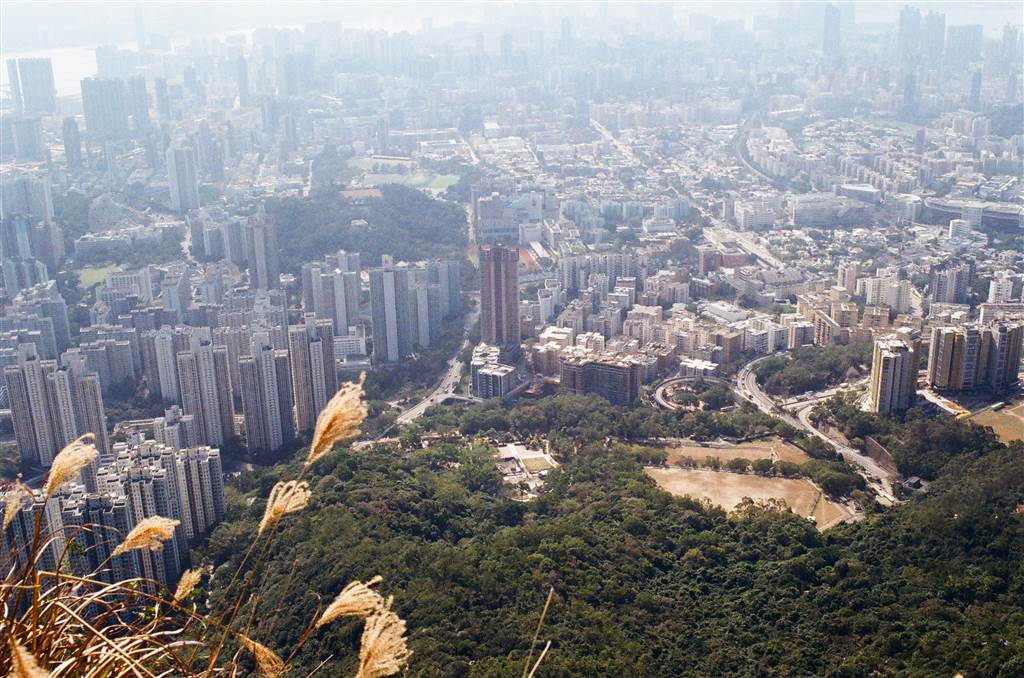
The aerial views were certainly excellent, but the Lion Rock also stands for the Lion Rock Spirit, an important cultural reference that has long represented a shared spirit of community and hope for the people of Hong Kong.


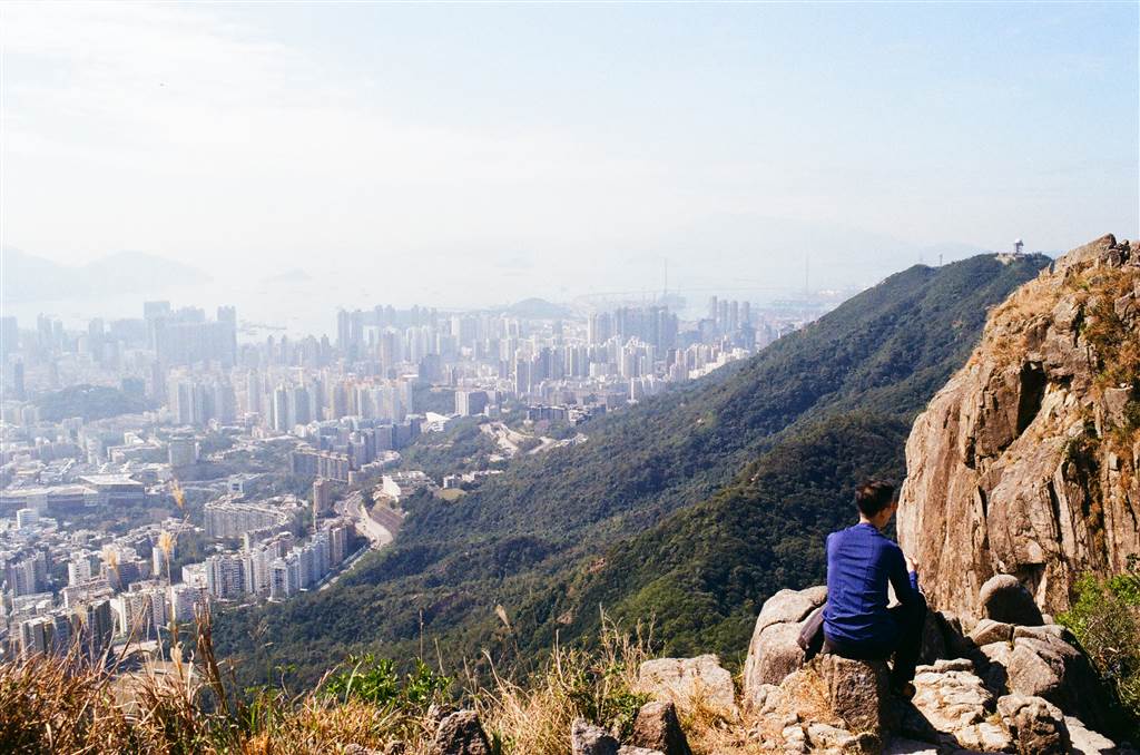
Photos: A Panorama of the View of Kowloon and Hong Kong at the Lion Rock
The Hike
We would be starting our hike at the Fat Chong Temple of Temple Hill. This is also the beginning point for a hike up the 488-meter high Temple Hill, about which we have previously written. At Fat Chong Temple, we headed up the Shatin Pass Road. Climb on a slightly steep incline for about five minutes, and keep watching on your left.
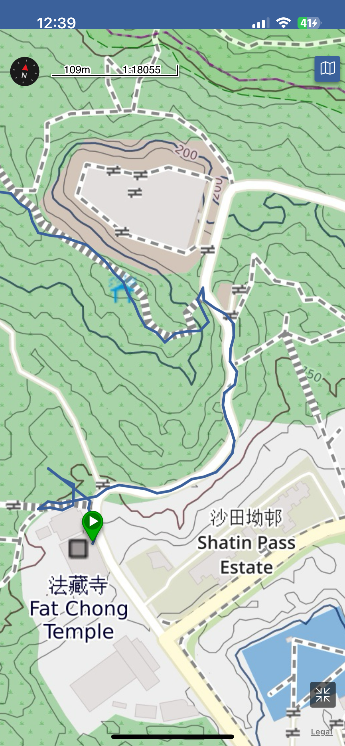
The entrance to the trail is on your left, with stairs and rail. This entrance will come up before you reach the Fung Wong Fresh Water Service Reservoir.
The Trail
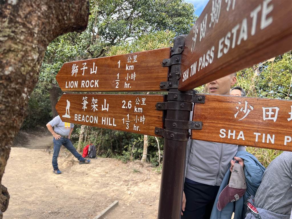
The climbing up this trail is relatively easy, as the paths are either paved or well trodded. Just keep on going on this trail and you will see signs at the crossroads indicating the way to the Lion Rock. It is very straight forward.
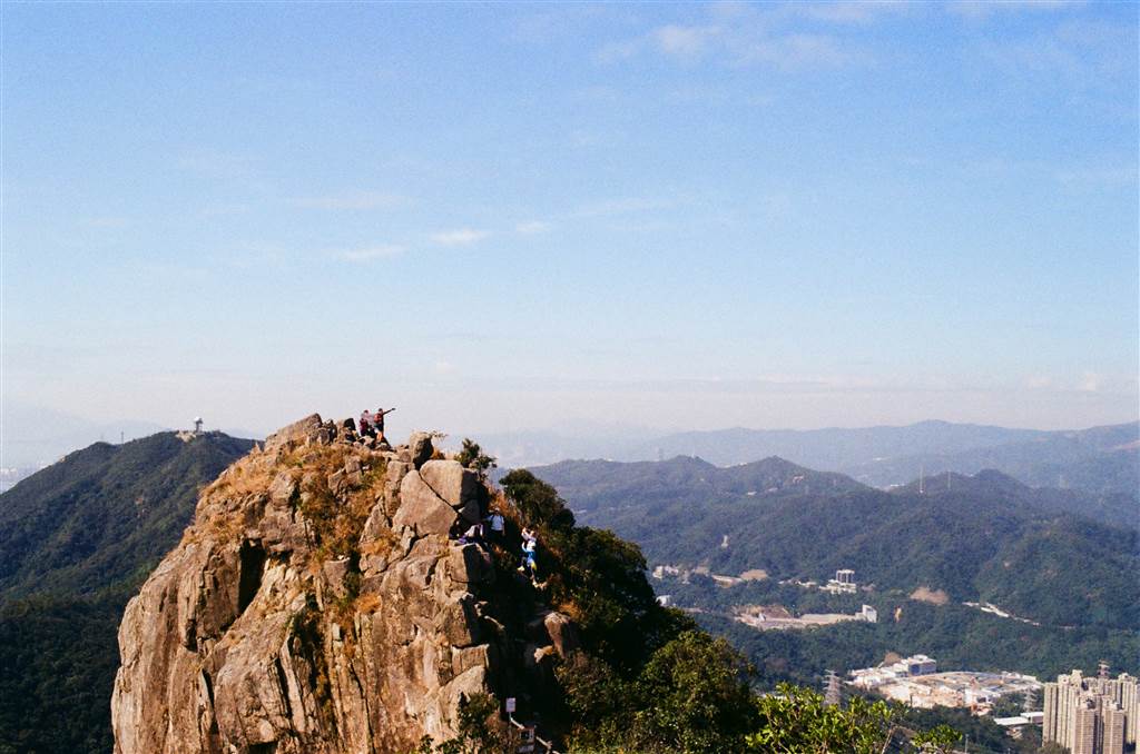
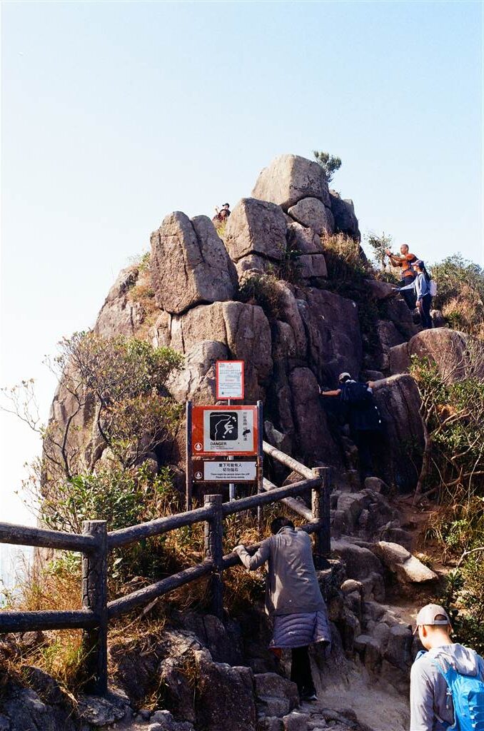
I highly recommend that you also see the Lion Head, where you will be able to climb up (engaging all fours) the famous rocky outcrop that makes the Lion Head.
After climbing the Lion Head, you will descend toward the Wang Tau Hom direction, or Tin Ma Court if you use hiking apps or Google Map.
A point of some importance is the existence of military structures on this trail. There are signs along the trail indicating where these facilities are, and I do plan on visiting them on my own when I do have the opportunity to do so. There will be an entry on this under the WWII category.
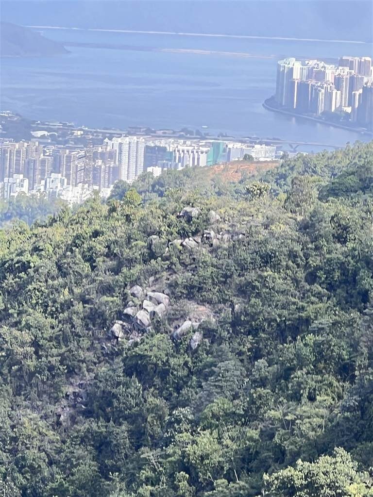
Photo: British-built Pillboxes Afar
Including time for photos, allow for about three hours to complete this hike.
The Lion Head
There are two viewing points at the summit of the Lion Rock. I suggest taking all your pano pictures at the Lion Rock, which is a large area with safe vantage points for photographs. The Lion head is comparatively dangerous, but it is perhaps worth climbing as well. The views are the same at both locations, and both at are the altitude of 495 meters.
Looking north, you will see unobstructed views of Tai Wai and Shatin.

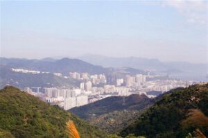
Lying on the northwest is Tai Mo Shan.
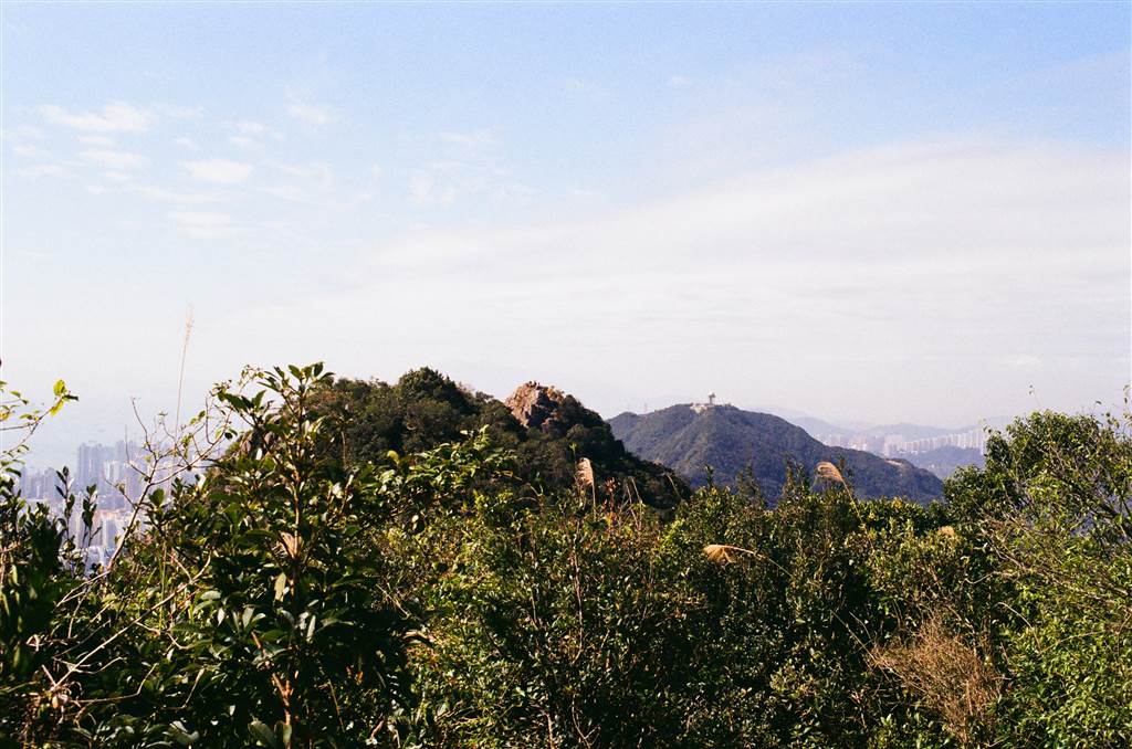
And then, of course, looking south you will see all of Kowloon and Hong Kong island.
The Lion Rock Spirit
The Lion Rock acquired its name because the Lion Head resembles the stately appearance of a lion. In terms of geography, it is also very significant because it is the mountain range that wedges between Kowloon and the New Territories.
Before vehicular access was opened by the two other Shatin tunnels, Tates Cairn and Eagle’s Nest, the Lion Rock Tunnel was the only speedy access between Kowloon and Shatin. For a very long time, the people living in the New Territories used the Lion Rock tunnel daily in their commute to the urban areas.
Culturally speaking, the Lion Rock stands as the epitome of the Hong Kong spirit. For as long as I can remember, Hong Kong people have had this phrase “beneath the Lion Rock,” referring to a shared aspiration to strive for a good life by hard work, honesty, integrity, perseverance, innovation and social harmony. The phrase comes from a very well-known song by Roman Tam of the same name, speaking amply to the sentiments of Hong Kong life during the 1970s and 1980s.
As a native of Hong Kong growing up during the 1980s, this song always brings me to tears. It is representative of a spirit of togetherness that no longer exists in Hong Kong today. But it still strikes a chord with so many of us, even for those who grew up a lot later. It was this very spirit that has propelled Hong Kong’s exceptional economic and social development all the way till the 1990s.
How to Get There
From the Wong Tai Sin MTR Station, take Green Top Minibus 18M to the final stop at Sha Tin Pass Estate. Head up Shatin Pass Road, the Fat Chong Temple is on your left. Keep on going on Shatin Pass Road for about five minutes, and the entrance to the trail will be on your left.
For our hike that day, we took a taxi from the Lok Fu MTR station, and you may also consider taking a taxi at the Wong Tai Sin MTR Station.