Beautiful Sha Tau Kok – From the Lead Mine of Lin Ma Hang to Shan Tsui Tsuen Village
I have long yearned to visit the lead mine pits of Lin Ma Hang. Due to the trail being somewhat challenging, I shelved the plan for a year until I found some companions to go with. The opportunity finally came last week.
The Way to the Lead Mine Pits of Lin Ma Hang
It is a slightly complicated matter to get to Lin Ma Hang and to explain why. But let’s first go through how to get there.
First of all, it is not possible to find parking in the border area and therefore you must take public transportation. At the Sheung Shui minibus stop (outside of Sheung Shui MTR Station), take green top minibus Route 59K. The very last stop you can get off at is the No. 12 Police Post. Without a permit, you may not enter the Lin Ma Hang Village on this minibus. Do note that Minibus 59K comes only every half hour. We could not wait that day and instead we took a taxi to the area instead.
Once at the Police Post, expect to exchange a few words with the policeman guarding the area. Simply tell the policeman that you are here for hiking. He will make sure that you understand you cannot cross the gatepost at the border.
Walk on for about ten, fifteen minutes or so. You will arrive at the gatepost for the border. At that point you may not go forward without a permit. The trail up to Kong Shan (also Lin Ma Hang Village) is on your right. See the sign.
Photos: From Police Post No. 12, walk on to reach the gatepost at the restricted area (Photo Left). On the right side of the road, you will see the sign pointing to Kong Shan (Photo Right).
This section of the path is a circuitous route to the Lin Ma Hang Village. Lin Ma Hang Village once belonged to the frontier closed areas of Sha Tau Kok. The government has released its restricted area status in 2012. However, the paved motorway that leads one into Lin Ma Hang Village remains in the frontier closed area. Therefore to get into Lin Ma Hang Village, which is the only way to hike Kong Shan, will be this circuitous, mountainous path.
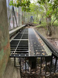
Photos: The circuitous path from the border gatepost to Lin Ma Hang Village (Photo Left). This part requires a hop onto the metal rail to cross a stream, be careful but it is doable (Photo right).
This path is relatively simple. Do follow both your hiking app and the hiking ribbons. There is one section that requires roping, and another section that requires a little hop to get past a stream. If you remain watchful, it presents little danger.
We reached Lin Ma Hang Village in a little more than half hour. There is a public toilet in the village. As soon as arriving at the village, look to your left to see a little green village home. The stairs next to this green village home is the way up the MacIntosh Cathedral of Kong Shan and also the way to the Lead Mine of Lin Ma Hang.
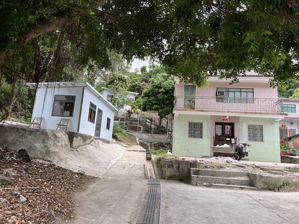
Photo: the stairs next to this green village home is the way up Kong Shan.
You will then climb 917 steps to reach the first interest point in this trail. The MacIntosh Cathedral of Kong Shan is one of the 7 such police posts established in the 1950s by then police chief Duncan William MacIntosh to stamp out illegal border crossing. I will discuss more on the MacIntosh Cathedrals in a separate entry.
Photos: 917 steps up to see the Kong Shan MacIntosh Cathedral (Photo Left). Photo right shows the view on the way up.
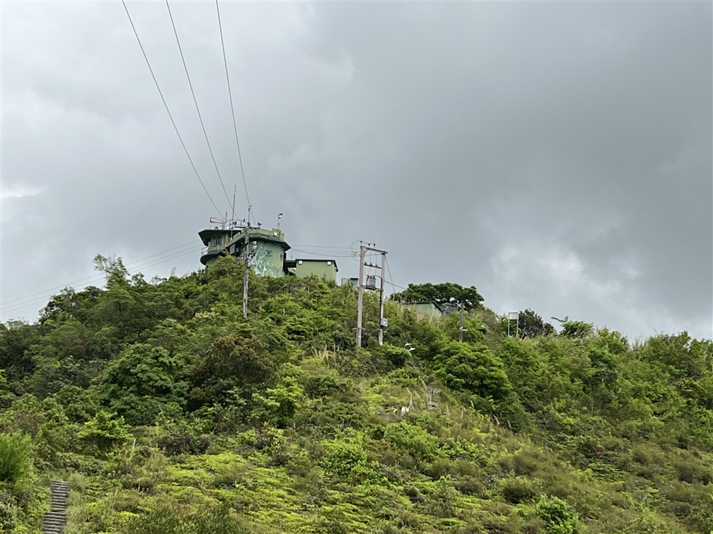
Photo: The Kong Shan MacIntosh Cathedral.
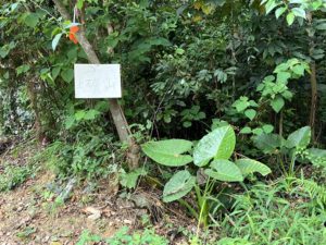
This spot requires just five minutes to take photographs, as it is fenced and you cannot go in. Then head onward to the path, and within a minute you will see this sign on your left. This is the way to the lead mine pits of Lin Ma Hang.
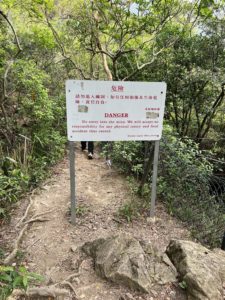
Photos: Going forward from the MacIntosh Cathedral, this pathway will show you the sign of the left (a warning sign) to the Lead Mine of Lin Ma Hang.
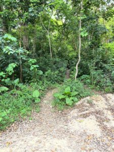
You will come across the No. 6 Pit (more below) in 10 to 15 minutes.

About Lin Ma Hang Village
Lin Ma Hang, as a village, has existed since the lifting of the Imperial Edict for Coastal Evacuation in the 8th year of Kangxi Reign (1668), for a few hundred years. Most of the villagers are of the Ip lineage, but there are also other surnames in the village. The area acquired the name “Lin Ma” because that is the native name for a type of citrus (Melodinus suaveolens) that once grew abundantly there.
The Hong Kong government closed the border with China since 1949. Until 2012, all of Lin Ma Hang Village belonged to the frontier closed area. This status has the unintended consequence of protecting the wildlife and heritage there. For the environment and the heritage have remained untouched for decades.
The Lead Mine of Lin Ma Hang
On the other hand, the Lead Mine of Lin Ma Hang was a booming industry before WWII. The residents of Hakka origin discovered this hill full of mineral treasure. The mines were in operation since the late 19th century. The first miners were Portugese. In 1915, Chinese miners discovered larger deposits in the area, thus ushering in the heyday of the lead mine industry in the early 20th century. Many mining companies obtained the rights to mine there. In 1938, the Hong Kong Mining Company hired 500 miners there, the trend continued to rise. In 1939, miners numbered as many as 2,000.
The main mineral mined there was lead, with also zinc, copper, silver and gold deposits as well. Because of these mining pits, this general mountainous area is also called Kong Shan, meaning “mineral mountain.”
A number of factors in WWII contributed to the eventual decline of the Lead Mine of Lin Ma Hang. In view of defence needs, the Hong Kong government called into service the two heavy mining equipment at the Lin Ma Hang Lead Mine. This has resulted in cessation of mining activities.
During the Japanese Occupation years, the Japanese took over this area and forced the villagers to work the mines. The mined materials were shipped back to Japan to make ammunition for the ongoing war. Resented villagers then joined forces with the Hong Kong Independent Battalion of the Dongjiang Column, an anti-Japanese guerilla force, to resist the Japanese. They attempted numerous times to destroy the production facilities at the mine. There were accounts of a huge fire at Kong Shan that flamed for a continuous 7 days and 8 nights. This effort did result in the cessation of mining at the Lin Ma Hang Lead Mine.
After the war, attempts to revive the mining industry at Lin Ma Hang did not succeed. There were a few reasons besides the destroyed facilities. Maps were also lost, causing low yield from the production. Furthermore, the Hong Kong government then included the area as frontier closed area at the border to stamp out smuggling activities. Along with labour strikes, typhoons and a drop in lead prices, the lead mining industry struggled. In June 1958, the Lead Mine of Lin Ma Hang officially closed its doors. The Hong Kong government finally revoked the mining license in 1962. Since then, the lead mine has remained in ruins.
There is currently no mining license in all of Hong Kong. The mining industry is a thing of the past.
The View at the Lead Mine Pits of Lin Ma Hang
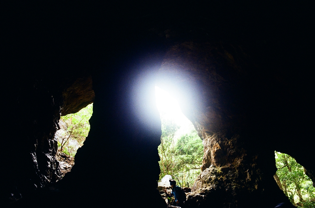
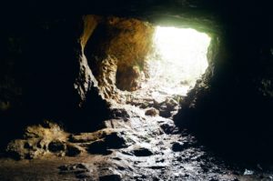
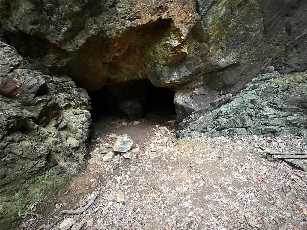
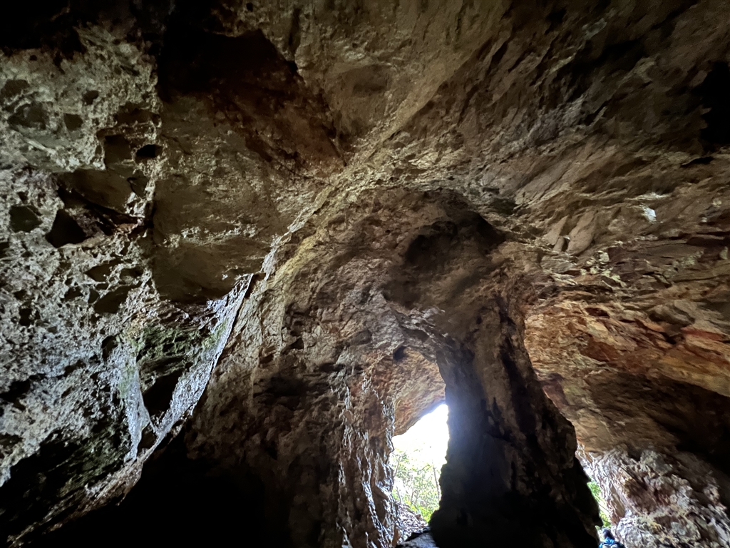
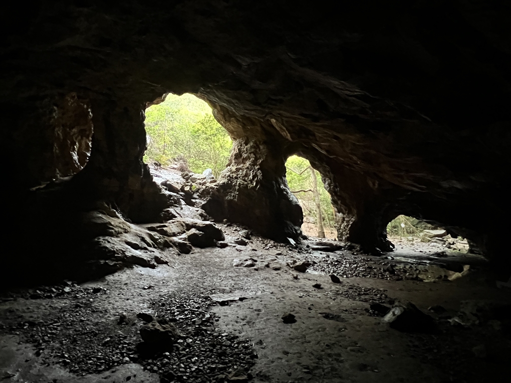
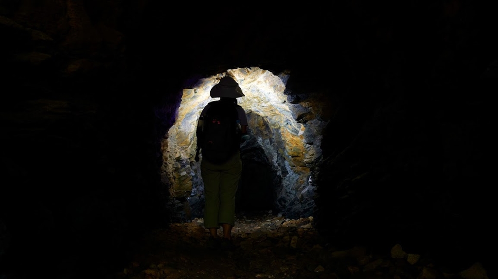
The main pit of Lin Ma Hang’s lead mine is called “the No. 6 pit.” The locals also like to call it the “No. 6 Living Room.” Before the government built rails around the smaller pits inside, there had been fatal accidents here. By now, however, with the rail the No. 6 pit is a safe place to visit.
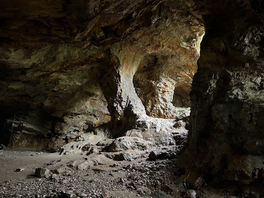
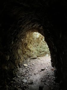
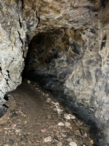
Facing the pit entrance, on the left of No. 6 Pit there is a small mining tunnel. I think the flash light on anyone’s phone will suffice in terms of lighting the way. But I did bring a proper flashlight for safety’s sake. It takes just one minute to walk through this tunnel, but it was a very cool one-minute walk.
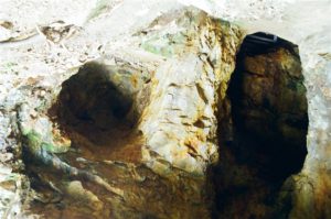
There are also Mining Pits No. 3 and No.5 for the more daring explorers. We have not visited those this time. My sources warned that, to reach these caves, it requires climbing on all fours. There is significant danger involved in exploring those caves. Do be careful. Better yet, find a guide who can lead you.
When we exited the tunnel, we came upon the next leg of the journey, and that is to hike back to civilization via Shan Tsui Tsuen Village.
The Way Back
We chose to head eastward to exit at the Shan Tsui Tsuen Village. I went with two young hikers and they were very experienced in directing the way. However, this path is certainly not for inexperienced hikers. Certainly do not go alone even for experienced hikers. Although there are ribbons and even signs all along the way, the pathways are not clear. There are many confusing turns and I am simply not able to properly document the way here.
Given that I do not advise inexperienced hikers to take this way, my suggested route to go back is to turn to the same route from the mining pits to reach Lin Ma Hang Village and the circuitous path that you took to reach the village from No. 12 Police Post.
On the other hand, for experienced hikers, this hike from the mining pits to Shan Tsui Tsuen Village is doable. In fact, many people will also hike up the almost-500-metre-high Robin’s Nest on the way for nice views. We did not do so, but even then our hike back to Shan Tsui Road took us some 3.5 hours. I also do not recommend this path because it is only good enough for exercise. In terms of views, there are few to offer on this route. Do note that even for experienced hikers this path will require navigation by a hiking app. Getting lost in this mountainous path is not fun.
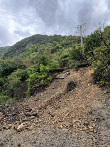
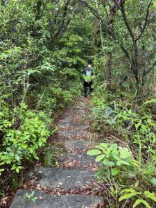
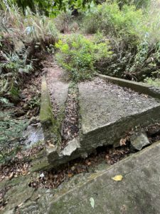
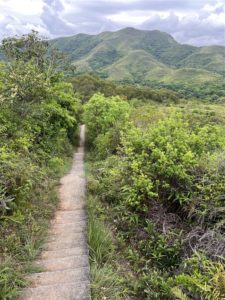
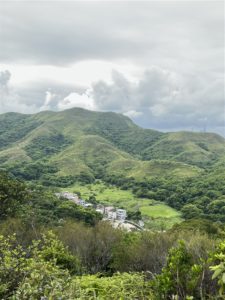
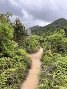
Some views of the way between the No.6 Mining Pit and the Shan Tsui Tsuen Village for exit.
Final Sites
The McIntosh Cathedral of Pak Kung Au is also on the way to Shan Tsui Tsuen Village. However, we missed the entrance. I will save that trip for another occasion.
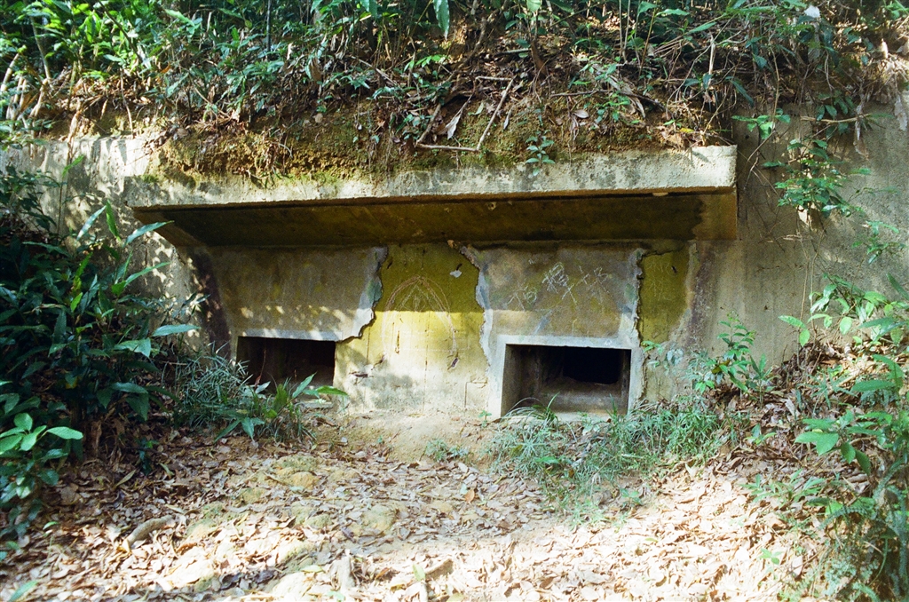
Very close to the exit at Shan Tsui Road lies a WWII ruins. This looks like a pillbox but it was built by the Japanese. There are a number of such ruins in Shan Tsui Tsuen Village, but again, I will save the exploration for another time.
Turn right on Shan Tsui Road (the section on the left is again a restricted area). Head out to the main roads and you will find the minibus stop for Route 55K. It will take you back to the Sheung Shui Station.
How to Get There
To get to No. 12 Police Post, take green top minibus Route 59K at the Sheung Shui minibus terminus. You may also take the green taxi at the taxi stand underneath Landmark North.
To return from Shan Tsui Tsuen Village, take green top minibus Route 55K to the Sheung Shui Station (final stop). 55K, unlike the 59K, runs frequently throughout the day.
Reminders
As discussed above, the way between Lin Ma Hang and Shan Tsui Tsuen Village is somewhat complicated. Please be sure to go with someone and also to search for the route info on a hiking app. Also be exceptionally watchful for the signs along the way.
There are also Mining Pits No. 3 and No.5 for the more daring explorers. We have not visited those this time. My sources warned that, to reach these caves, it requires climbing on all fours. There is significant danger involved in exploring those caves. Do be careful. Better yet, find a guide who can lead you.
Sources
Lau Lee Lam, A Guide to Hong Kong’s Ruins (Chin) (2013) at 127-131.
The Wikipedia on Lin Ma Hang (Chin).
Ngan Ming Fai, An Exploration of the Lin Ma Hang Mining Pit, Rugged Mountainous Paths Leads to Secluded Border Village (Chin), HK01.com, December 22, 2018.
Hong Kong Geology: A 400-million year journey, Minerals and Mining in Hong Kong, Civil Engineering and Development Department.