The Pristine Water of Tung Ping Chau
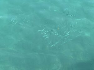
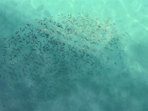
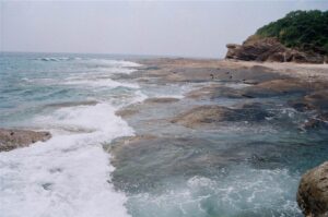
The pristine water of Tung Ping Chau made its first impression and I saw the amazing beauty of nature right away. Even as close to human presence as the pier is, the aquamarine colored water there is so clear that you can see the sea floor. There are also vibrant signs of life as schools of fish swim freely.
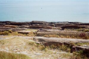
We headed on over to the island proper and we could already observe many people doing water activities at the beautiful beaches of Tung Ping Chau. As a geopark, Tung Ping Chau is blessed with a few natural endowments that make it special even amongst the many geopark wonders of Hong Kong.
A Brief Introduction of Tung Ping Chau
Tung Ping Chau is the northeastern-most island of Hong Kong in Mirs Bay. It lies very close to the Daya Bay of China. In fact, we saw some facilities afar that looked like electricity generators there, and wondered if that was the Daya Nuclear Plant.
According to the short introduction at the Tung Ping Chau Marine Park, the island formed from a lagoon that existed 50 million years ago. The forces of nature acted on the environment by deposition, compression and erosion. Plants, sand and mud eventually filled up the lagoon and formed layers of sediments. Due to compression of these layers, rocks slowly formed. Finally, millions of years later, it became the island we see today.
The highest point of Tung Ping Chau is at a mere 48 meters altitude in Hok Ngam Teng. The center part of the island is in a plateau. And this flatland gave the island its name, as “ping” in Cantonese means flat. Do note that in the southwestern waters of Hong Kong there is Peng Chau, although pronounced almost the same as Tung Ping Chau in Cantonese, it is a wholly different island.
Tung Ping Chau measures 1.1km2 and it is very walkable. I do suggest that you take the late ferry at 5:15pm to return to civilization (or even consider staying overnight, details below), so that you can fully appreciate all the wonders that the island offers.
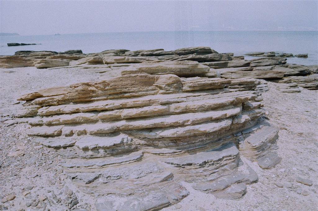
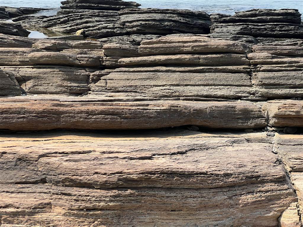
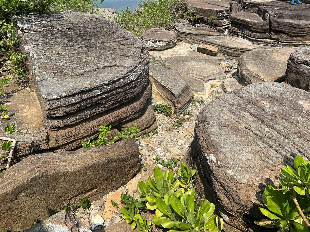
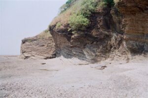
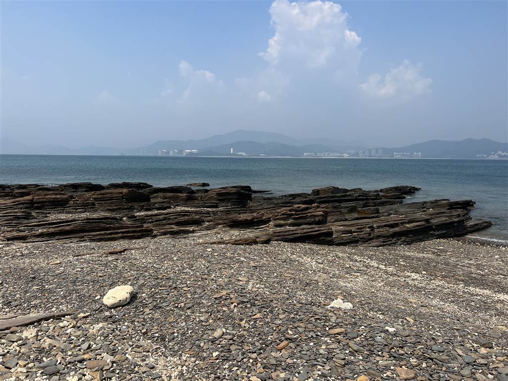
Tung Ping Chau offers plenty of geological lessons. I was amazed at its large-scale rock formations, which make exceptional scenic views throughout the island. According to Hong Kong Geopark All In One, Tung Ping Chau is “home to the youngest rocks in Hong Kong, ranging from 56 million to 32 million years old. Known as the Ping Chau Formation, these rocks consist of siltstone, mudstone and shale and are embedded with a great variety of fossils.” The youngest sedimentary rocks are formed all around Tung Ping Chau. They are exposed, and observable, only in Tung Ping Chau. The rest are covered by soft marine sediments under water.
Special Geological Features of Tung Ping Chau
Wong Ye Kok
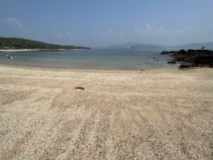
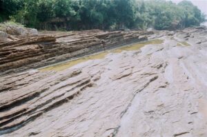
After getting off at the pier, we soon came upon Wong Ye Kok, the beach that lies on the shore north of the pier. You can’t miss the sedimentary rock formations there, especially with features of horizontal and cross bedding.
Bedding structure looks like a stack of book pages with different colors and thickness. Bedding forms when “lithological characters change vertically in mineral components, color, grains, and shape, arrangement or packing manners… with distinct dividing line between layers.” (Zhang Jianping at 28).
With a lot of rocks showing bedding strata, the scenery speaks volumes about the power of nature.

Another geological feature at the pier area and close to Wong Ye Kok is the bean-curd like join-developed rock. These are hard siltstones cut by joints in two different directions, and sea waves erode along the cracks at the shore. Further weathering enlarges the crack and form “bean curds.”
As with all other waterfronts in the island, Wong Ye Kok’s beach has see-through water. The beach has fine white sand on a long stretch.
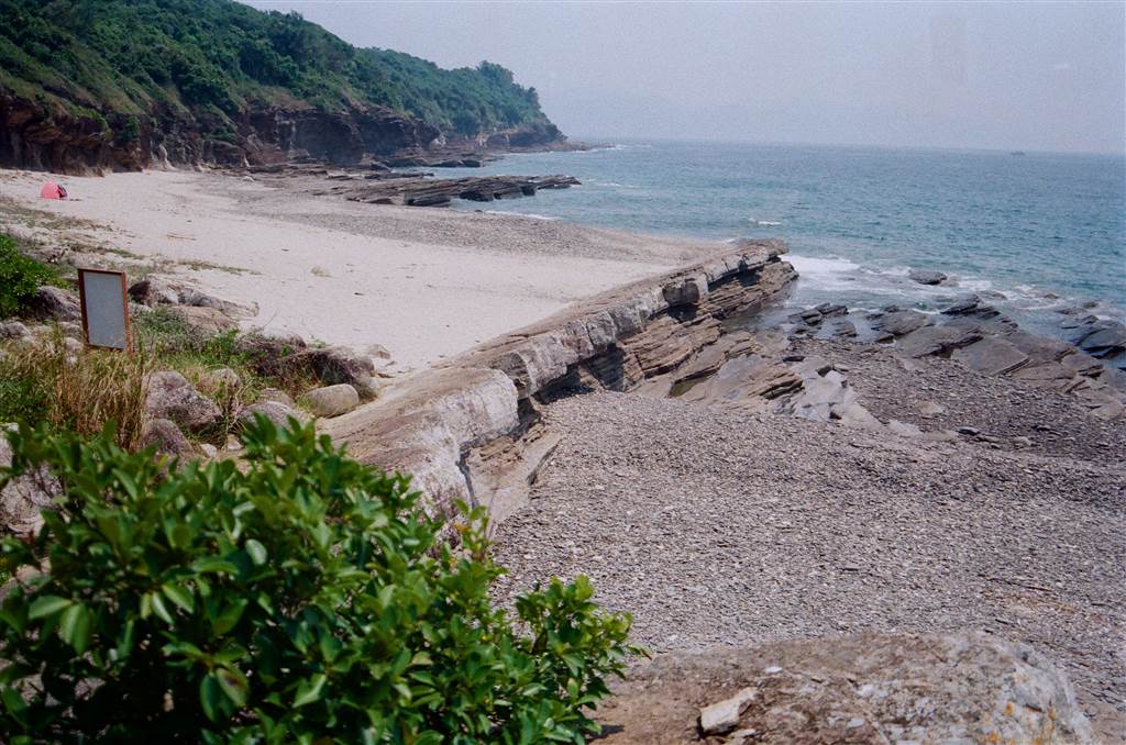
Cham Keng Chau
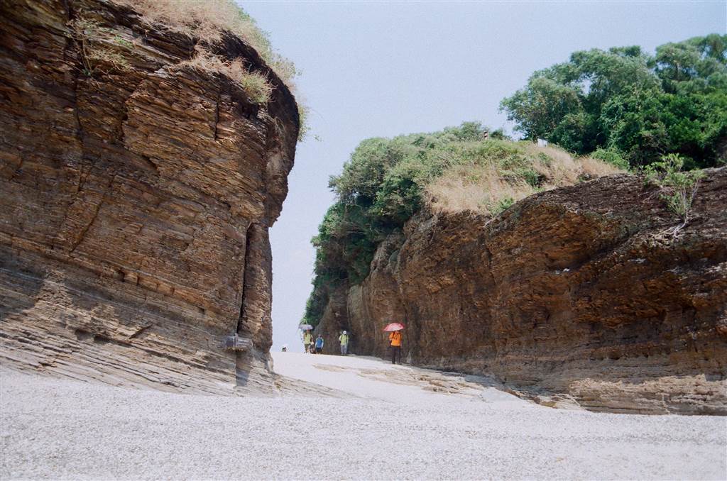
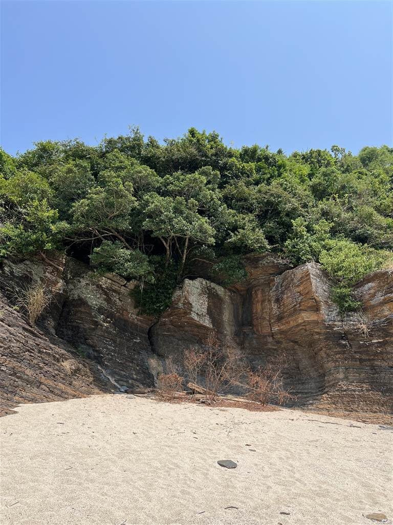
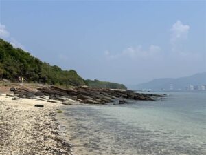
Cham Keng Chau lies on the western-most shore of Tung Ping Chau. At Cham Keng Chau, you will see a wonderful geological phenomenon of two cliffs that come with an abrasion canyon. Because the geology looks as if someone has chopped up the plateau, this area is aptly named Cham Keng Chau, meaning “neck-chopped islet.”

The abrasion canyon is 6-8 meters in width, 10 meters in height and about 20 meters in length. It shows near-vertical cliffs on its two sides. Over a very long period of time, the sea waves here eroded along the vertical joint crack. Its weak part gradually changed from an eroded cave to an eroded arch. Eventually, the canyon formed with the top of the arch completely eroded away. Both because of crust rise and water recession, the bottom land of the canyon that connects to Tung Ping Chau became exposed, thus making it possible for tourists to walk on as a canyon.

Photographs: other views at Cham Keng Chau
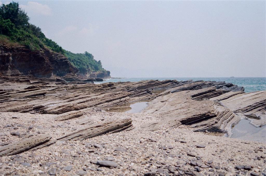
Lung Lok Shui
In Cantonese, the name of this spot conveys the imagery of a “dragon leaping into the sea.” You can see a ridge of a rock extending into the sea, and the name does justice to the view. In geological terms, the Lung Lok Shui is a cherty (quartz) bed 100 meters long and 60-80 cm thick. There are wonderful signs of erosion. After the softer rocks were denuded by sea water, the harder chert was preserved.
Close to Lung Lok Shui is the amazing wave-cut platform with gentle and uniformly inclined rock beds. The uniformity of its shapes suggests the inference that there has been no intensive structural deformation here (Zhang Jianping at 89).
Photos below: other views at Lung Lok Shui
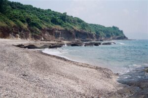

A Ma Wan
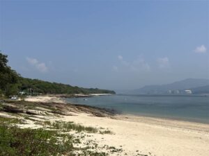
At A Ma Wan, I saw again a beautiful beach with interesting rock formations. It does differ significant from Wong Ye Kok in one respect. The “sand” of A Ma Wan are full of coral shards and shells.
Photos above and below: at A Ma Wan.


There are also exceptional views of geological features and views at Hok Ngam Teng, Keng Lau Shek and Lan Kwo Shui, however due to an injury sustained during the walk, I was not able to visit those.
Tai Tong Tsuen Village and the Food of Tung Ping Chau
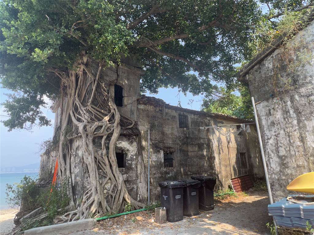
The island was once inhabited with a population of 2,000 in the early 20th century. The Tung Ping Chau islanders spoke a “Ping Chau Dialect,” and naturally they looked to the sea for livelihood. Some were also able to farm potatoes and peanuts on the island. However, due to its inconvenient location, and also with the lack of fresh water and electricity supply, most residents of Tung Ping Chau have moved to the urban areas of Hong Kong or settled down abroad.
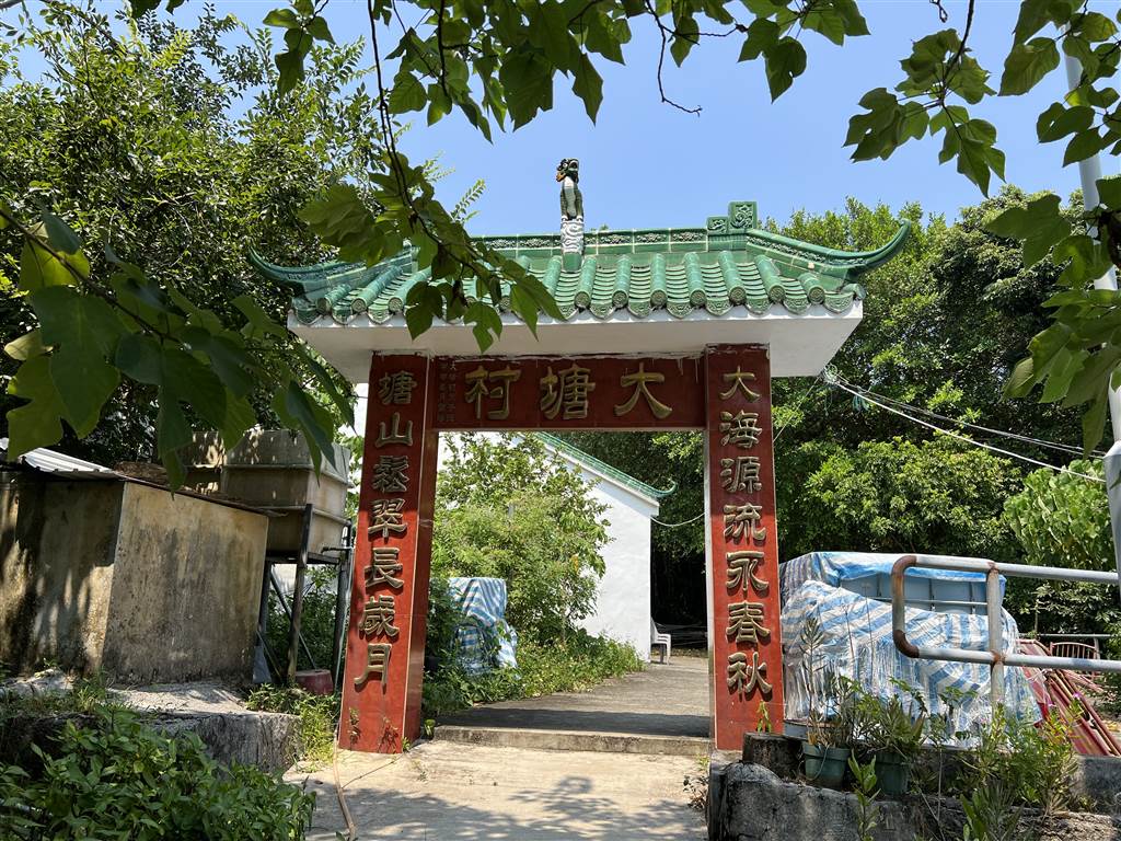
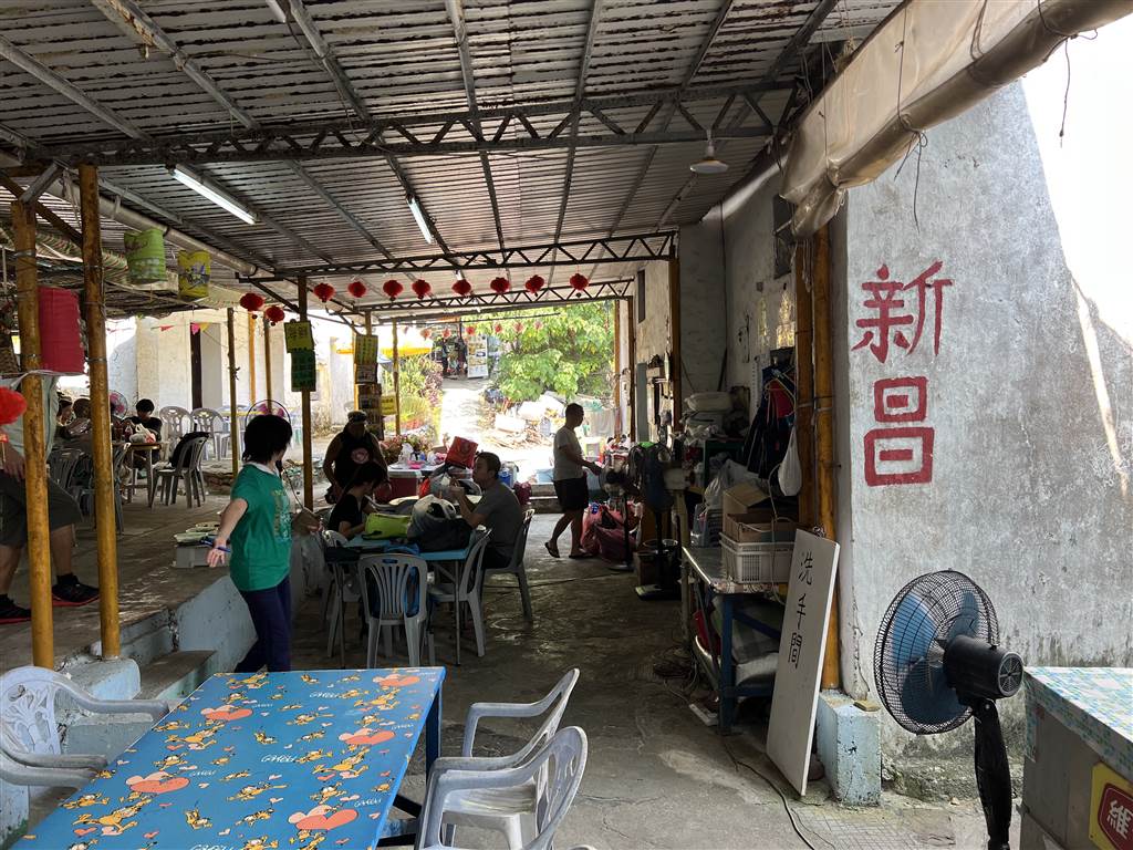
The main village is named Tai Tong Tsuen. Most of the stores that offer food and services are in the Tai Tong Tsuen area.
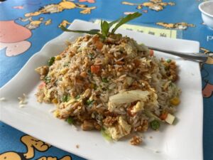
We sat down for a meal and of course the local seafood catch was the highlight. There are three things that the restaurant offers that are from the waters of Tung Ping Chau. First is sea urchin and they cook it in a yummy fried rice. The sea conch and clams are steamed and wok-fried respectively. As an 80% vegetarian, I must commend Sun Cheong Store for having a very good selection of vegetarian options.
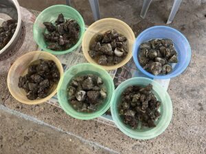
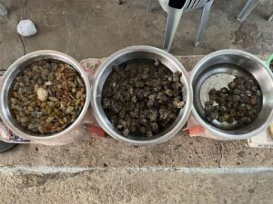
Finally, close to A Ma Wan lies the fishing village. It is characteristic of the fishing villages of Hong Kong’s inhabited islands. There are some ruins all along the way as well. When I was at A Ma Wan, I saw a worker there taking a whole bucket full of sea conches with him. Those were the sea-to-table catch that we had at the restaurant.
Religious Sites in Tung Ping Chau
The Tin Hau Temple
I came across two religious structures in my walk. The Tin Hau Temple lies close to A Ma Wan. For the islanders in Hong Kong, Tin Hau is the resident deity in their communities as the goddess of the sea. It is no different in Tung Ping Chau.
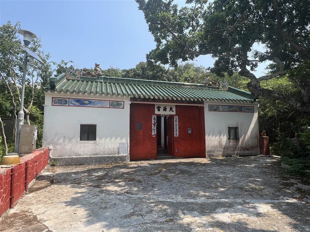
This Tin Hau Temple was built in the 30th year of the Qianlong Reign of the Qing Dynasty (1765).
The Tam Kong Temple
Tam Kong (Tam Tai Sin), on the other hand, is quite specific to the people of Tung Ping Chau. Tam Kung was a Cantonese man who was believed to have reached nirvana at the age of twelve. This temple is also well-restored, and it is about a hundred years old.

A Suggested Day Trip in Tung Ping Chau
The ferry ride to Tung Ping Chau begins at the Ma Liu Shui Pier. It takes one hour and forty minutes to get from pier to pier. The ferry only runs on Saturdays, Sundays and public holidays. Even on those limited days it goes only once or twice a day. If you miss the last ferry to return at 5:15pm, you would have to stay at the island for the night. Therefore be very watchful of time.
The “stores” at Tung Ping Chau (and there are quite a few) offer one-stop services for everything you need there, from room and board to life jackets. We asked the Sun Cheong Store about their rates.
For a one-day trip, they charge $450 and will provide four meals at their restaurant. At night, you may use their shower, and it comes with hot water. They will also host you in their rooms for sleeping. The provision is very basic, there is no air conditioning, but there is a fan and mosquito repellent. The bed is a nylon folding bed, perhaps really a thing of the past for Hong Kong people. If you take the later ferry (at 3:30) and arrive at the island on Saturday afternoon / early evening, they will charge you $370 for three meals at the restaurant instead.
For the ferry (kaito) schedule, please visit here.
Reminders
As with all hiking trip, especially in hot days, bring enough water with you. The walk at Tung Ping Chau is very easy, and in the villages you will have access to supplies, but once you head onto the trails you are on your own.
A lot of adventurists like to trek the coast and its rocks. I caution readers never to do coastal trekking alone. In Tung Ping Chau, there are standard trails inland that will provide the indication to access the special geological sites on the coasts. It is better to take these standard trails instead.
How to Get There
The Ma Liu Shui Pier is about a fifteen to twenty minute walk from the University Station. The ferry departs promptly for Tung Ping Chau at 9am on Saturdays and Sundays, but I do suggest that you get there to line up at least at 8:30am. There are easily hundreds of tourists going to Tung Ping Chau on a good weather day. On Saturdays, there is an additional return ferry scheduled at around 3:30pm. The last ferry leaves at 5:15pm on both Saturdays and Sunday. Please do watch out for time.
Sources
Descriptions On-Site at Tung Ping Chau
Bernie Owen & Raynor Shaw, Hong Kong Geopark All in One (2011) at 118-143.
Zhang Jianping et al., Tung Ping Chau Geopark Field Guide (2009).