I had a fabulous first trip to the Philippines. In fact, the experience was in the ranks of being miraculous, even as measured against my years of experience as a travel writer.
“Hey, do you want to join me in Manila?” My friend was attending a business trip in Manila and I jumped on the opportunity with a resounding yes to her invitation. Manila has been in my plans since last year, when I learned about the Intramuros from another friend that visited.
At the heart of my concern with traveling in the Philippines is the KK Park that runs the business of trafficking and scam. There have been Hong Kong tourists that were kidnapped in various countries in Southeast Asia and sent there. I almost never have travel companions, and so going to the Philippines alone for the first time was not a good idea.
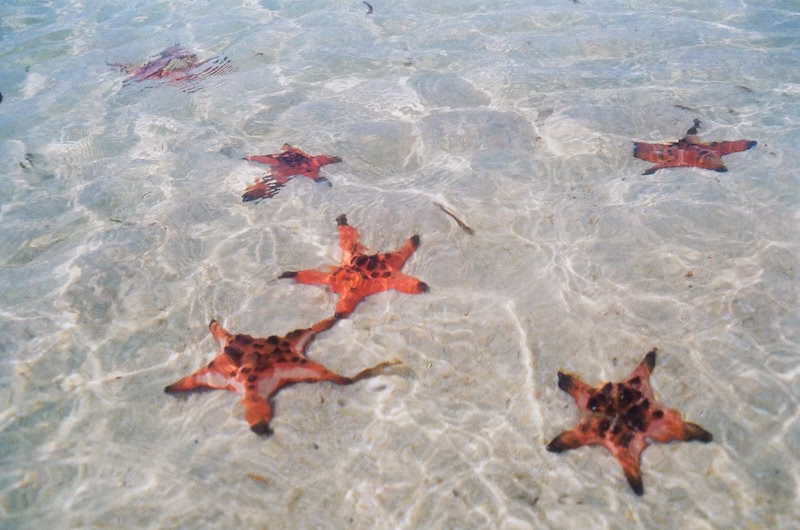
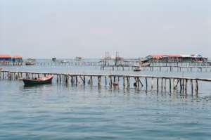
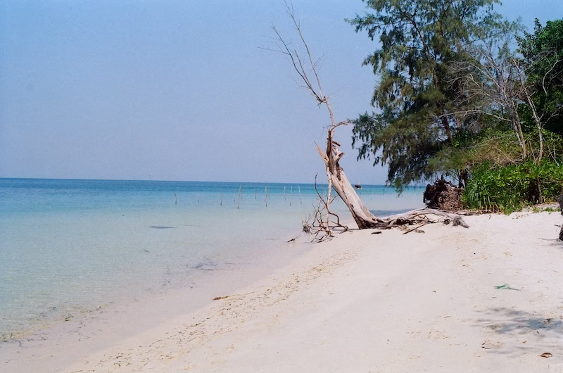
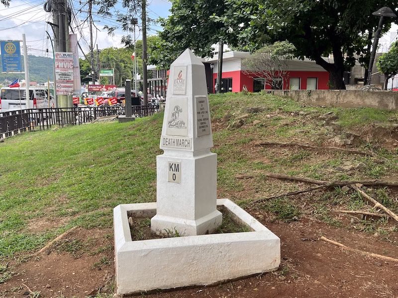
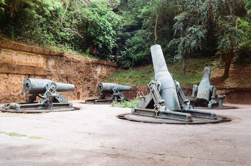
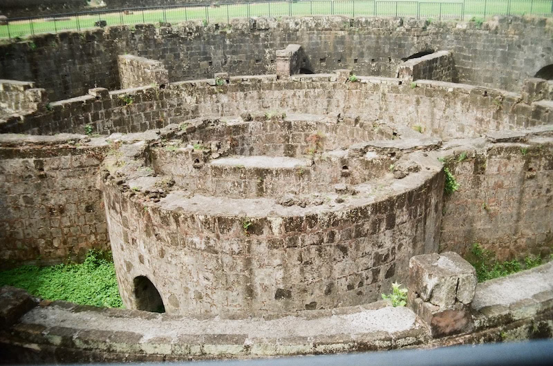
On my bucket list for this trip is a visit at the Corregidor Island (pronounced cor-RE-idor, the “g” is silent). And in a later entry I will discuss in greater detail the downlow on how to join that tour.
Flying from Hong Kong to Manila takes only a little more than one and a half hour. Both flights to and from Manila were pleasant with no delays. My friend and I arrived in Manila in the latter half of the afternoon. She took me through a flyover from the airport to the airport hotel hub before she called GRAB for a driver. The GRAB waiting area in the airport is somewhat chaotic.
Manila is the name of a plant that is native in the Philippines and in abundance in the Manila Bay.
Itinerary
In this five-day trip I would be visiting the Corregidor Island, the historical U.S. military base that played a critical role in the defense of the Philippines during the Pacific War. It is about three hours by drive from Manila. That tour alone, counting in the traveling time to and from Manila, already takes up two full days. I then really only had one and a half days more in Manila.
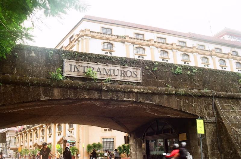
Due to some arrangement issues I visited the Intramuros three times in order to get through all the things I wanted to see there. The Intramuros is the only remaining historical site in Manila that was mostly built during the Spanish colonial rule. A whole lot of the original structures were destroyed during the Battle of Manila before the Pacific War ended. But the aged vibes are still there and it is definitely a must-visit site for visitors of all interests.
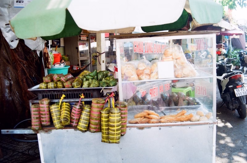
In the rest of the Manila tour, I went to the San Sebastian Basilica, the Escolta Street, then to the oldest Chinatown in the world. That was about it. I did not get to visit the BGC district (see below), which was a pity. For shopping, my friend recommended the Greenbelt by Ayala Malls, although I also did not have time to visit.
Currency
I always exchange currency upon arrival, before I exit the airport and get into the city. There was a currency exchange at the arrival hall. The rates were not too bad.
Connectivity
In the Philippines, connectivity comes with a couple options. You can purchase an eSIM from online vendors before you leave your home country, and activation is by a QR code that you scan on your phone upon arrival. This is simple enough, but there are two caveats. First, my iPhone is an iPhone 13 Pro, and the vendor did not list clearly on the website the technical specs required to activate the eSIM. An iPhone 13 Pro is too old to be able to do that. As a result, I requested a full refund for my eSIM purchase.
Second, an eSIM would not enable you to make regular calls with your phone, and sometimes it is necessary to call people to ask questions about arrangements. Therefore, a physical SIM does have its advantage.
Both eSIM and physical SIM are options that you can find at the arrival hall. The problem is, the options that were shown to me were very expensive. The vendor at the airport seemed to only offer 30-day plans (for 1,000 pesos). I was going to be there for only 5 days.
In the end, I inquired at the hotel and the staff told me to go to the Glorietta Mall, which is about 8 minutes by walk from the Peninsula Manila, to get a physical SIM set up at a proper mobile service operator. At the Glorietta, both SMART and GLOBE would be able to set that up for you. I ended up visiting GLOBE and it was quick, easy, and cheap. GLOBE does offer 7-day connectivity plans for about 160 pesos.
Accommodation
We stayed at the Peninsula Manila. Generally speaking, the Makati and the BGC (the Bonifacio Global City) are very tourist friendly districts. The Makati district is somewhat older, but the streets are pleasant, well maintained and safe. The BGC is new, and my friend told me that it is almost futuristic there, a cross between the Central and West Kowloon areas of Hong Kong. For first time visitors, these are my recommendation for accommodation. The hotels will be pricier there, but it is worth it.
Essentials
It is early summer and it was very humid and hot when I first landed in Manila. The summer weather in Manila comes with intermittent (but often heavy, stormy) rain and it serves to taper the heat significantly. Essential items for a trip to the Philippines are definitely sunglasses, sunscreen, hat and a handy umbrella that you should take with you wherever you go.
In terms of other personal items, you likely will find everything you need from the local drug stores or convenient stores.

VISA
Please check your country’s foreign affairs department for entry requirements to the Philippines. For U.S. passport holders, there is no VISA necessary for a stay up to 30 days in the Philippines. However, all visitors must get on the eTravel website to do a declaration. You will have to create an account with login information, and enter your flight and hotel details, in order to acquire a QR code for entry into the Philippines. The QR code will be sent to your email immediately upon approval (I don’t imagine them denying you the declaration).
Getting Around
Before you arrive in the Philippines, you should install the GRAB app on your phone and hook it up with your credit card. Certainly get that set up before you leave your home country, so that when you need the app you don’t have to mess with installation and payment issues. The GRAB app is very efficient. It shows you quickly where your driver is when they accept your order, you can choose amongst different comfort and seating options for different prices, and all along the route the map will show you where you are. It is the safest and most reliable transportation, even for the locals.
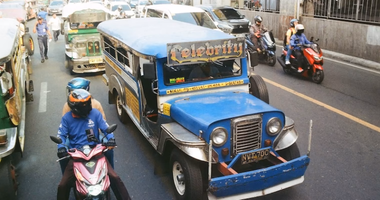
My friend did say that for a really local experience I should do the jeepney at least once, which is a distinctive feature of the Filipino urban life. I was in too much of a rush in this trip to learn the routes and so I did not get to try it. There is also a metro in Manila, but at the end of the day, GRAB is much more efficient, safe and foreigners can afford it any number of times within their trip.

In terms of getting around, Manila is notorious for its traffic jams. Very often, a mere 3km in distance can take up 20 minutes in the car. The GRAB app takes care of that. You are charged a set price before you get in the car, regardless of the actual conditions of the traffic (unlike a taxi). However, if you are going to the airport, be sure to allow for delay on the road due to traffic. The same leeway is advised for planning your itinerary within the city.
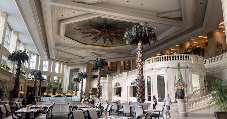
The Makati district is just about a half hour from the airport. We arrived into the luxury of the Peninsula Manila. The hotel itself has a storied past, and that is coming up next.